Showing posts with label Jake Of The Style. Show all posts

Friday, 28 February 2020

Romsey Ward Boundary: A walk for Terminalia

To mark the feast of Terminalia, Roman God of Boundaries, I decided to walk around, within and to various points on the boundary of the Ward of Romsey. Residing in the ward, it seemed sensible to do something close to home. This was for two reasons. Firstly, it would be good way of seeing things always in close proximity in a  different way. Psychogeography begins at home, or at least ought to more often, I thought. Secondly, I was too disorganised, busy with mundane things like work and in most cases too far away to get to any of the events people had organised for the Terminalia Festival of Psychogeography. I had left it too late to organise something involving other people. So this was a solitary Sunday morning excursion but one done in tandem with, or at least on the same day as, many others walking borders and boundaries.

Romsey Town, which is the epicentre of the Ward, is a place I have long associations with. My mum's family came from the area, helping to construct the Labour Club which I was taken to as a kid for Sunday Lunchtime Bingo. Later I used to pass through the area at night on my way home from gigs and  pubs in town as a teenager. About 12 years ago I gravitated to the area to live and am still here. Despite the more recent years of increasing gentrification that have happened despite my presence, the place still projects an atmosphere of 'Romseyness'. This is hard to describe but is something resulting from an amalgam of  the particular Victorian street patterns dating from the Railway Age and Little Russia and the buildings contained within. The houses themselves, the other buildings that interperse them including the Labour Club (now closed dilapidated but still standing), the ABC Barbecue Chip Shop, The Co-op and places like the flat roofed Bed Centre on the corner of Ross Street where a rare giant advertising  billboard stands, give off the same constant underlying atmosphere.  In addition, a number of familiar characters have always inhabited the area.  Some have been around for years, some are more recent. The sad departure of 'Nice Weather Lady' whose funeral was the other week marks the loss of Romsey's version of Disco Kenny. But others are still  here. Romsey Ward encompasses a wider area and I wasn't sure the atmosphere was really the same in the more peripheral zones along the boundary. Indeed, until I decided to do this walk, I'd been pretty much unaware of where the boundary was.

Terminalia takes place on the 23rd February, the last day of the Roman year so marking a temporal boundary, but concerned with boundaries and borders of all types. Terminus is said to protect all within his bounds and help focus on priorities and release problems over which you have no control.

I considered that ward boundaries were things that most people were not that interested in and had little control over anyway, other than to respond to obscure local authority consultations about any propsed changes. So as well as convienient, the Romsey Ward Boundary seemed appropriate. Unlike most people, who have already let go of  any thoughts of understanding or caring about the vagueries of local authority boundaries or more likely probably never bothered to pick them up in the first place, I had got stuck in a loop of fruitless internet searching. This brought nothing but frustration at the lack of comparitive temporal ward maps to be found.  I had vague recollections of talk of ward boundary changes to Romsey a few years back, so had doubts about the accuracy of the Council website version of the map which, although sanctioned by Ordnance Survey, was dated 2012. In the end it appeared that, as far as I could work out, the changes made were County Council ones to electoral districts, which are not to be confused with City Council wards. I let go of any thoughts of confirming this beyond all doubt and settled for the 2012 map.

I started on a footpath that bisects an enclosed patch of green space off Rustat Road. Corrie Road Guides Hut sits fenced off at the end of this enclosure and straddles the ward boundary, this path takes a right turn more or less at the border with the next ward, Coleridge. The hut sits directly on the boundary and the lamp post more or less marks the boundary line in front of it. The green space, too small to be featured on google maps and, as far as I know, nameless, had been spruced up a bit. Grafitti was almost absent and strangely two Chrstmas trees had been planted along with more traditional daffodils.

Terminalia, Psychogegraphy, Guides Hut, Romsey, Cambridge

I headed out of the green space onto Rustat Road and to the cycle bridge that crosses the railway line, the first border point I visited on the Romsey/Petersfield boundary.  The railway line splits the two Wards and also the two sides of Mill Road. The difference between sides of the road is much less marked since the days of Red Romsey. With both sides of the bridge now almost equally gentrified, the old social boundary has been removed to the archive of folk memory.

The view from the cycle bridge down the track to Mill Road Bridge, the next border point on my route, was as ever obscured by the moss and black mold that forms around about eye level on the perspex covering.

Mill Road, Psychogegraphy, Coleridge, Romsey, Terminalia

I doubled back to reach Mill Road Bridge via Argyle Street, past the Housing Co-op that backs onto the Railway Line, a place as near to the boundary as it's possible to live. The familiar mural on the bridge was accompanied by several laminated notices from the 'Stop the Train Wash' campaign. The giant train wash was, apparently, one of the main reasons for the works on the bridge back in the summer.  I don't recall any mention of it anywhere during the 'Mill Road Summer' of the bridge closure. The campaign literature features a photoshopped impression of what the facility will look like. The image shows a giant nine meter tall dark grey monolith, stretching along and looming over the gardens of the houses on Great Eastern Street that back onto the railway. It brought to mind The Black Tower'. I could see how it might bring about similar levels of mental decline in the residents of Great Eastern Street to that experienced by the protagonist in the 1980s Channel 4 TV short. The structure will, if it happens, be sited in the railway owned no-mans land on the border between wards and operational mostly overnight, giving it a 24 hour presence even when it's too dark to see.

Mill Road, Mill Road Bridge, Cambridge, Terminalia, Psychogeography

On top of the Bridge is a memorial bench commemorating Suzy Oakes, 'Champion of Mill Road'. This sits in the middle of the Bridge on the border between the two Wards, symbolic of the bringing together both sides of Mill Road across the divide through events like Mill Road Winter Fair.


I headed down the steps into the car park at the end of Great Eastern Street. Near the bottom a new pathway presumably marks the forthcoming 'Chisholm Trail' cyclepath, which will follow the boundary along the railway until crossing into Abbey in Coldhams Common and onwards to Chesterton and Cambridge North, where it will pick up the Busway path beyond to cross countless other borders and boundaries as far as St Ives (Cambs).


Stink Pipe, Psychogeography, Terminalia, Cambridge, Mill Road, Train wash, Great Eastern Street

At the end of Great Eastern Street, a no through road, a wall marks the boundary with the railway land behind. A majestic old stink pipe rises up it front of it.

I doubled back and took the parallel Cavendish Road. At the end I went as far as I could to the left where a road/track joins the railway land, until the point where I became an unauthorized person.


Looming up beyond the gate was an object resembling a watchtower, reminicent of something from the Berlin Wall. I probably had spent too long looking at a book called 'Cold War East Anglia' in Waterstones the day before.


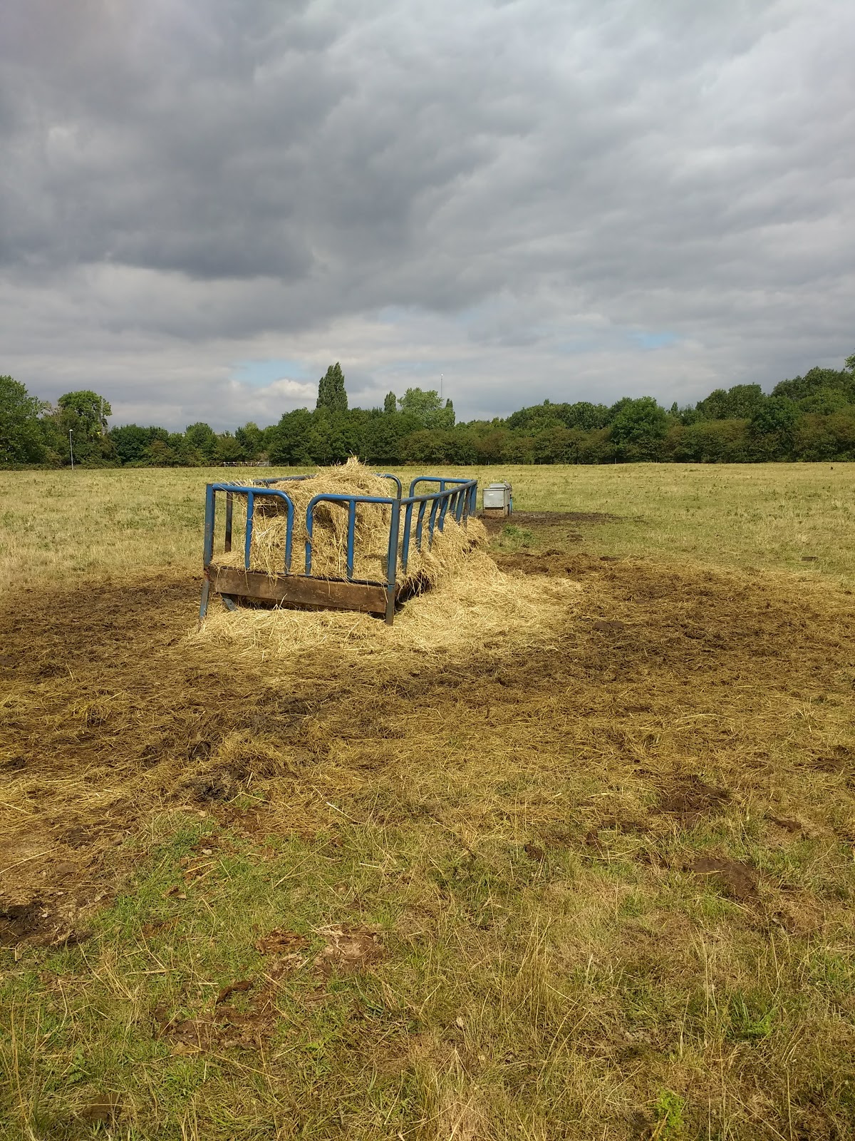
Along Cromwell Road, backing onto the railway, is Winstanley Court, a recent(ish) development of flats. Presumably and oddly named after Gerald Winstanley, who lead the Diggers in opposing the enforced boundaries brought by the enclosures. While laudable, the more local Jake of The Style, who is said to have lead an uprising that prevented nearby Coldhams Common being enclosed, is not remembered in any of the new development along this stretch. I attempted to walk through, thinking I could emerge somewhere back on Cromwell Road nearer to Coldhams Lane. But it appeared there were three separate developments, cut off from each other by walls and fences. The individual estates had been enclosed, each a labyrinth of dead ends. It appeared each was owned by a different developer, all three keen to prevent wandering between their plots.


I ascended Coldhams Lane Bridge, the third point along the rail border. The tower of a chinmey or extraction shute of some kind rose up from an old brown buidling used by the railway. I recalled British Telecom having an operation here when I was small. This was during the days of Buzby, an orange cartoon bird who encouraged people to 'make someone happy with a cheap rate phone call'. The campaign was a big success at the time, there was even a Buzby Fan Club for kids. The orange bird must, therefore, take a significant amount of blame for the current prediciment of mobile phone induced always-on-ness that we find ourselves in today.

I had wafted back from late 1970s TV ad nostalgia by the time I reached the pinnacle of the Bridge from where I observed the railwway border once more. This was the only point I strayed across the border from Romsey. I followed the Bridge down along the other side on the boundary between Petersfield and Abbey, and crossed the other side into Abbey briefly before going back up and into Romsey again. It's not possible to cross at the apex and I didn't want to retreace my steps.


British Telecom, Cambridge, Coldhams Lane Bridge, Terminalia, Romsey, Psychogeography

On the way down I noticed a poster for a past event at the Centre for Computing History. The strange blue androi- like womans face was slightly unearving. I had heard a story on the radio earlier about a human like robot being produced in Japan that could wince at 'pain', the most lifelike yet. This was a far cry from the days of the ZX81 and of Clive Sinclair and his ilk, members of which I assumed the monochrome faces on the poster belonged to. According to the radio story, the boundaries between artificial and real intellegence, human and robot, were becoming ever increasingly blurred.


At the bottom of the bridge I turned into Coldhams Road, the main artery of the light industrial estate starting underneath the arches. This was a somewhere too old school to be considered a business park, with a place that looked like a mini-scrapyard next to a tile outlet and several MOT garages. Coldhams Road hugged the railway line on one side and a series of mostly single story flat roofed premises behind spikey metal fences on the other. I had expected little sign of life and noted the absence of the bacon roll van normally seen during the week. But I was not alone. Several cars passed me and further on I saw people getting out to enter a brown flat roofed premise that would not have looked out of place in 1970s Dr Who. It turned out the building is now used by a church of some kind.

Cambridge, Romsey, Terminalia, Psychogeography, Coldhams Road, Insustrial Estate

Just beyond was a bizarre and incredible old house (well, maybe 1930s) called Orchard Cottage. I had never seen it before, this being virgin territory for me. Net and bedroom curtains were up, making it look inhabited. It's the only house on this stretch of the boundary, and possibly the most unusual feature I'd seen so far. It wouldn't have looked so weird surrounded by an Orchard next to Coldhams Common, which given it's name I suspected it was in an earlier period.

Just past this another building was being used as church, I couldnt see anyone but could hear a pastor sermonising in a manner more suited to the Southern United States than a deserted light industrial estate on the Romsey boundary.

A spikey locked blue gate festooned on each side with notices signified I'd come as far as I was permitted along Coldhams Road. Just beyond this somewhere is Hilary's wholesalers, the same firm who have a green grocer in the Romsey end of Mill Road. The wholesale operation is located in Abbey. I took the gate to be roughly at the boundary of Romsey's extention along this unusual track.


I retraced my steps, pausing briefly at the locked gate that separated the industrial estate from the railway land beneath the bridge.


On Coldhams Common I made my way to the 'Bridge of Moad', which carries the railway over the short graffitied tunnel that passes beneath. Another  boundary point between Romsey and Abbey.

Railway Bridge, Romsey, Coldhams Common, Cambridge, Terminalia, Psychogeography

I entered the tunnel and observed, among the most recent street art offerings, a green faced apparition that at first struck me as something that belonged on the cover of an album by The Meteors. A bit further away it looked like a hand held device clutching, aggressive and anthropomorphized mobile phone decorated with pound and dollar signs. A Buzby for a new generation.


I followed the line of the railway along the common until the next border point. I've written about the Black Bridge (no longer black) before.   I climbed up to view the railway line and observed recent grafitti referring to someone or something called 'Futhead'. More impressive was the lichen at the top of the bridge which grew in the shapes of small countries and continents, sparking visions of self contained micro-worlds where, although unobservable, things were happening.


I lurked under the bridge for a while, looking through the boundary 'window' where the airs of Romsey and Abbey mixed and counteracted each other in the neutral space between each side.


I followed the common, as far as possible  staying adjacent to the railway. Eventually the way was blocked by a fence and small thicket of sparsely fly-tipped bushes and trees. Somewhere behind these are Stourbridge Grove allotments which hug the railway line for a while. I followed the semi-circle of grass back along the line of back gardens belonging to houses on Coldhams Lane, then back onto Coldhams Lane itself  to head to the next boundary point.


This short part of the journey was relatively uneventful, other than an encounter with a distressed antique looking telephony box in someone's front garden that bore similarly vintage 'Nigel' tag.


At the roundabout, I passed the brown single storey buildings of what used to be the Adult Education Centre, a small complex that radiated 1960s municipality and Dr Who vibes. On the other side of the road it was impossble not to notice the much more recent and oversized C3 Church building. This manifestation of the Australian franchise megachurch projected something that felt more akin to 'V' than Dr Who and more akin to big business than municipality.


I followed the fence around the brown building just onto the end of Barnwell Road. Just before I reached the next boundary point I noticed what appeared to be the ghost site of an old electricity facility.  No equipment or danger of death signs but the concrete base along with a telecoms box were still there, enclosed by a square fence topped with barbed wire.


The railway bridge nearby marked the border, crossed beneath by the road that heads out to East Barnwell.


I followed Coldhams Lane under another railway bridge, this time just within the boundary. The other side, a left turn brought me into Nuttings Road./Upware Road. This residential corner is cut off on all sides and sits almost forgotten. But it is contained in the Romsey boundary, which diverges from the railway in order to take in these streets before aligning with it again. This small area of post war housing, which surrounds a municipal green area, has the peripheral feel of a border outpost settlement.


I headed around the green and through a passage on Upware Road that lead into the East Barnwell Nature Reserve, via a gate allowed me to cross the boundary where it stretches behind the houses. I walked the pathway behind the gardens and saw that the last house had an outbuilding of some kind at the end of the Garden, just within the Romsey Boundary. I couldn't tell what the square concrete looking structure was used for. It may have been a laundry room or maybe Romseys most far flung Air BnB. Whatever, the structure resembled an outpost bunker, suited to being on the border.

Emerging out of Nuttings Road, I crossed back under the Bridge and over the road. I paused outside the entrance to the Army Reserves complex next to Sainsbury's, built on the old Saxon cement works site. This facility prevented me following the boundary along the railway line. Unsurprisingly it was securely gated and there was no through path for the public  The low level paranoia emanating from the site brought Cold War East Anglia back to the fore momentarily.

I travelled parallel to the site along the brook behind Sainsbury's. A footpath follows it behind some back gardens until it emerges in Brookfields.

Cherry Hinton Brook, Coldhams Brook, Cambridge, Psychogeography, Terminalia

I turned into The Tins, one of the Pathways to Cherry Hinton from Brookfields and Burnside. This part of the Tins runs just inside the boundary with Coleridge Ward. On the Romsey side is the Army Reserves/Saxon Works site. Beyond the trees, as indicated by the 'Danger Deep Water' sign, is a lake created from an old pit. On the Coleridge side there are two more lakes, this time created out of pits of The Norman Works. These were fairly recently the subject of a campaign to open up 'The Romsey Lakes' and create a 'Romsey Beach', which seems a bit cheeky on Romsey's part. They have also been called 'the Cherry Hinton Lakes'. But never 'the Coleridge Lakes'.


I reached the footbridge taking the path across the railway border. The bridge marks a three way confluence of boundaries of Romsey, Coleridge and Cherry Hinton. At this extremity of it's border, there was little tangible feeling of Coleridge present within the cast iron structure. It crosses exclusively between the realms of Romsey and Cherry Hinton like a miniature edgelandic bi-frost.


Romsey, The Tins, Cherry Hinton, Terminalia, Psychogeography, Cambridge

I headed back to Brookfields. According to the Council Map the boundary put Burnside, which runs to the left when emerging from The Tins, as just inside Coleridge, the boundary running through the houses and placing the road firmly on the other side of Romsey. I suspect this was inaccurate and the boundary line had been overlain slightly off kilter with the street map. Otherwise, the residents would be Romsey/Coleridge hybrids for voting purposes. Truly people of the border!

This meant I had to double back and head along Perne Road to get to Budleigh Close. At the end is another boundary point with Coleridge where the close converges with Burnside, The Snakey Path, the Allotments and one of the 'Romsey Lakes'.


Back along Budleigh Close I saw a faded blank noticeboard attached to somebodys garden fence. Mosses and lichens had colonised it, taking advantage of prolonged inactivity by human hands. The houses behind date from the 1980s but the notice board seemed to belong to a previous age of 1950s council housing that made up a large swathe of Coleridge. My grandparents lived in such a house, not very far from this spot. The board acted as a portal, triggering flashbacks to the Coleridgian atmosphere I associated with the area of post war housing stretching from Cherry Hinton Hall through to the area around Coleridge Rec. My mind had briefly passed through the ward boundary, temporally as well as spacially. I was momentarily back in a vague time of side passages, garages, recs, and white dog poo ridden grass verges near where ice cream vans parked and where it was permenently Saturday or Sunday.

Further, a Banksy-esque piece of street art that proclaimed 'life is beautiful'  decorated a wall. Cars had parked in a rare display of consideration to leave a gap enabling passers by to observe it. The mysterious 'M' had claimed responsibility, his or her mark placed within the floating heart/balloon.


The passage next to the scout hut across Perne Road was more or less on the boundary border but was a dead end.

Scout Hut, Cambridge, Terminalia, Psychogeography, Romsey

Instead, I diverted until I was back on the boundary running along the back fence of Coleridge School field. The fence gave a solid feel of division between the two wards.


The fence ran out as I emerged into Mamora Road but there was a clear difference in feel between  each side of the road. A distinct 'Romseyness' on one side and a 'Coleridgeness' on the other. The map showed all of Mamora Road as being in Romsey. But it felt like the boundary existed right along the middle of the street.

I crossed into Coleridge briefly for the final stretch, to Corrie Road and back through the passage that met the boundary at the Guides Hut. The nameless green space was both ward boundary confluence and terminal point, a fitting realm for Termimus. I lingered a while and considered the variation in atmosphere in Romsey. The outer edges of the ward were different, yet often similar, with the feel of neighbouring wards often seeping and mixing in to create hybrid zones at the borders. The Coldhams Road industrial estate stood out as somewhere with its own microclimate, the only place that seemed totalky separate. Nuttings Road too seemed to have a certain independence, and was somewhere that could easily defect to Abbey with which it shared a more similar atmosphere. These thoughts drifted away and I departed the realm of Terminus, leaving behind no offering of wine or suckling pig (the Co-op wasn't open yet), just the walk itself, which felt more than sufficient.


Sunday, 26 August 2018

Coldhams Common: Liminal Greenspace

I went for a wander in the direction of Coldhams Lane Bridge, considering drifting into the small industrial estate next to the railway line, behind what used to be the Greyhound Pub. On route along Cromwell Road, outside the small parade of shops, I noticed Yin/Yang symbol in the pavement. On closer inspection it was a fish curving around the sea. The fish had a brown leaf covering it's eye, though Autumn was not due for a few weeks yet. At this point I changed my mind and decided to go to Coldham's Common. Maybe I'd be able to access the Industrial Estate from the other end, through a secluded path through the woods.


I arrived at the Coldhams Lane entrance to the Common, not far from the bottom of the bridge and Industrial Estate. Cattle were grazing each side of the footpath I took across the expanse of rough grass, as they often are, in close proximity to light industry and MOT garages that were hidden from view the other side of some trees.

I read that The Common avoided enclosure in 1594 when someobody called Jake of The Style led locals in revolt against an attempted land grab, and so we can thank him that the space is still there for the use of the common people. The linked website is the only reference to Jake of The Style that I can find. Whether he really exited or was made up for educational purposes I'm not sure. 


Just beyond the grazing cattle, I went under the railway line, through the low black underpass. Often a magnet for both graffiti and cowshit, less so today. The legend 'MOAD' sprayed over the entrance. An unlikely location for either the Museum of African Diasphora or the Mother of All Databases. Maybe here the acronym had a different meaning, marking the lair of something or someone malignant.  Unknown to the Greater Anglia passengers passing over the bridge in their ingorance of the underneath, as they move along  the track that bifurcates the common and stretches off in the direction of Ipswich.

It was around here I think, that in my pre school years, I was sped across the green on a bike by my mum, while we were chased by a horse. She was petrified of the beast and glad to get the other side of the bridge. I can't remember a thing about it but my imagined version of the scene came into my head. I don't think they put horses here these days. Probably for the best.


Through the other side and into another area of The Common. The border of trees to the left continued to bar the way into the industrial estate with the assistance of a pointy grey metal fence. I gave up on the idea that a backway might exist and was soon distracted by a series of two raised concrete yellow painted manhole covers with accompanying posts. Almost fluorescent against the grey sky, presumably marking the drifting of liquid, sludge or sewage under the surface of The Common.


I crossed the bridge over Coldham's Brook. Beyond this is another area of The Common, which leads up to Newmarket Road. On the right another grey pointy fence, this time marking the boundary of The Abbey Stadium, where Cambridge United play football.  On match days the away supporters are herded into the area reserved for them. Habbin South sounds like one of the Glasgow street gangs shown on the map in James Patrick's book 'A Glasgow Gang Observered'. But the stand is named after Harry Habbin, who was an enthusiastic supporter of the U's and not as far as I know had no Scottish street gang connections.

Unlike Harry, I've never been much of a football enthusiast. When my Dad took me along when I was small, normally to a midweek evening match, I went grudgingly. Time seemed to expand within the realms of the football ground. An hour and a half seemed like an eternity. It was usually dark, often raining. Half time offered the highlight for me, some chips or a pie. I had a brief spell of liking football when I was about nine years old, and for some reason became a supporter of Ipswich Town. I sometimes went to see them with a friend and his dad, on the train passing through the Common unaware of the lair of MOAB as the passengers are today.

Ipswich were a division above Cambridge. So when the two teams clashed in the prestigious Willhire Cup, an East Anglian football tournament sponsored by a local van hire company, I went with my Dad to the Abbey to watch the U's get mercilessly thrashed. My pleasure was short lived as Tom Finney scored the only goal in the match, winning it for Cambridge. This marked the end of my short lived support for Ipswich and football in general.

My Dad continued to go 'up the football',  often on Saturday afternoons when he used to bunk off work. He would meet up with fellow local Co-op managers who had slipped out for a couple of hours. One bloke was clocked on the TV at a match by his boss. A bright red jumper and big cigar not helping him to blend into the crowd.

It must have been around this time that football hooliganism was rife. Cambridge was not immune to this. The leader of the local 'firm', The Cambridge Casuals', was known as the General and infamously orchestrated the violent ambush of some Chelsea fans on the way to a match. This resulted in tabloid panic and prison sentences for the General and his cronies. Not so long ago I read that they, along with other 'veteren' football hooligans, were back at it, in their 60s. Like aging rock stars trying to re-live their heydey. Maybe they are hoping to get put back inside to avoid the financial worries of retirement.


These thoughts drifted through my head while I stood gazing at the the pylon-like structures of the floodlights, sinister against the grey clouds. It being a Tuesday morning the football ground was devoid of any sign of human life and eerily silent. It resembled an industrial estate, electricity sub-station or prison camp more that a place of frenetic sporting activity.

The liminal atmosphere here was not just down to the lack of people, grey skies and industrial like structures of the football ground. The semi-edgeland location of The Common is another factor. Physically, it's not right out on the edge of the city. But it's far enough out of the centre to feel beyond the grip of the University and to make it outside the scope for most tourists. Being surrounded  by light industry, retail parks, a postwar (ex) council estate, a couple of main roads and the airport, it is buffered to an extent from casual penetration.

The University Golf Club did appropriate part the Common as a golf course in the late 1800s. This was fairly short lived, and it was described as the world's worst golf course. The rough ground, stinking ditches and presence of hooligans made it less than ideal. As did the proximity of a rifle range at the far side of The Common. These days there is football (including the American and Gaelic varieties) and the inevitable park run. There is no apparent University presence, sporting or otherwise.


I wandered back across the brook and turned left to follow it down the narrow path hugging it's course. For a short while I could have been anywhere in the middle of nowhere. Brambles, no people, not a lot of sound. The illusion was lifted as I arrived at a footbridge leading to a children's playground and the entrance to the swimming pool. The bridge was decorated by the ubiquitous Cambridge Heron.


Another bridge a bit further along featured more artwork. This time more official and featuring opposite footballers. The one with the green background looked like a thin Hulk or maybe a Green Lantern. The white one a Silver Surfer.


More superhero-esque characters appeared at the outdoor gym. One raising both blank face and fist at the men dangling from the climbing frame and awarding a one star rating.  The other wandering off in the opposite direction, less than impressed.


A short wander from here I came to the entrance to the BMX park, signified by a defaced council notice. I wandered into it and followed the course for a bit.


Like the gym, it was deserted. It felt like it had been for years, abandoned with bits of board left to shore up the impossibly steep slopes, as if to preserve them from weathering in an off season lull which had extended from the 80s, when BMXing was something that had it's own programme on Channel 4. I knew though that the track dated from a more recent time, a later BMX revival.

 In the 80s, an earlier track known as 'Sandy Banks' existed in another part of town, across the river. It had, according to local legend at the time, been built unofficially by the kids who used it. This explained the entrance being fenced off suddenly one day, barring access to the site.  The closure seemed to follow somebody throwing something at a rower from the track resulting in an argument. The fence was swiftly bashed down to regain access. But blocked again and later the area was developed.


I don't know where the name Sandy Banks came from. It was on the river bank but not very sandy. The Coldhams Common track looked like soil of some indeterminate type had been deposited to create it but despite the protective boards, has drifted away in places,  the chalk underneath exposed like teeth with the enamel scraped off.


The track resembled a minature disused quarry, or alien planet from a low budget British sci-fi TV programme. A pile of detritus appeared to have been flytipped in front of what looked like a sealed metal horizontal door.  An entrance to tunnels or caves under the ramps perhaps. Home of a 'stig of the dump' type character or several of them. Or a Moonbase Alpha. The door offering protection from gangs of ruffians and whatever dwelt in the lair of MOAD.


I left the minature world of the apparently abandoned BMX track and wandered across the field which contained a couple of sports pitches. The American football and rugby posts resembled dead anntena, no longer broadcasting or receiving. No low level hum to be heard. I still saw nobody, as I crossed the field. The lack of people not ominous, on the contrary having such a large open area to myself felt almost cheeky. The peaceful physical space seemed to create a parallel space in my head, one with plenty of room, decluttered from the everyday.


The other side of the field I reached the bridge crossing the railway. The mark of 'M'  freshly daubed each side of the stairway. I've seen this moniker before but much less often than the 'Nigel' tag, which was conspicuous by its absence in The Common. 'M'  a more discerning graffiti artist maybe.


The bridge had been freshly painted blue. Normally a spot for graffiti artists, it is a sort of focal point. In my mind's eye it was always painted black and was a mysterious object, something that at one stage I wasn't sure actually existed apart from in a dream I'd had. This is no doubt due to the lack of frequency of visits to The Common over the years mixed with vague childhood memories dredged up from my subconscious. When I approached the bridge, it still had the air of something distant in my memory or imagining, just out of reach of my grasp. A physical manifestation of a time and place I can't be sure really happened.


From the top of the bridge I looked through one of the metal diamond shaped spaces of the railing in the direction of Ipswich. Attached to the bridge was a leftover notice from 'Cambridge'Live' about the imminent use of The Common as an overspill campsite for the Cambridge Folk Festival, which takes place at Cherry Hinton Hall a mile or so away. This was now a few weeks ago and the notice hung upside down. The Folk Festival has been running since the 60s and  at least these days is what you might call a respectable mainstream festival. Until recently it was sponsored by Radio 2 and has glamping as well as the widespread use of fold-up chairs by the audience.

In 1969 and 1970, there was apparently a different festival actually on The Common. The Cambridge Free Festival, according to the UK rock festivals website, was a real thing. The line up looks too good to be true. King Crimson, Terry Reid, David Bowie, Edgar Broughton, Incredible String Band and a plethora of other bands regarded as legendary these days as well as ones faded into obscurity.  Henry Cow were based at the University so more believable. The organisers appear to have been involved with people from the Cambridge Arts Lab, which may explain the presence of David Bowie. It also seems the same people were involved in starting the still going Strawberry Fair on Midsummer Common ( a place more central and compact than Coldhams), and that the Coldhams Common festivals were a sort of precursor to the Fair. That said, elsewhere the internet is silent on the events, and some of the accounts on the UK Rock Festival site may be less than reliable. No doubt memories of the time are somewhat hazy.


On the railway another reminder of the past. I haven't seen a milk crate for years. The Unigate and Coop dairies used to compete for business along with a couple of also-rans. They came in the morning, in parallel to the Ice Cream vans which arrived the other end if if the day. Mr Whippy and Mr Rosso in similar competition, heated arguments in Italian with lots of hand gestures if they showed up at the same time.  The red milk crate I associated with Unigate, who had better shaped bottles. Another ghost from the recent-ish past.


Back into the field I'd started at, the emergency cattle feed had been put out early due to the hot spell. The sight briefly made the area seem remotely rural when looking away from the road ahead.

The meeting of urban and rural was concisely symbolised by a discarded Ofo Bike mudguard next to a cowpat, just before the exit into Coldhams Lane.


I exited The Common leaving behind a world of vague memories and liminal imaginings. I wondered why  I had visited so infrequently what is probably Cambridge's best green space within the City boundaries.

Immediately on exit I was almost diverted into the industrial estate and into another  recent past by the brown sign pointing to the Computer Museum. I had no idea it was there. I decided to save a visit for another day, and wandered off with a vision of old Sinclair and BBC computers in exhibition cases displaying Horace Goes Skiing and Football Manager on loop, while at the same time the noise of a tape recorder loading games across the room provided a sound equivelent of a low level but persistent migraine.