Thursday 28 December 2023

The Illusory Gas Holder of North London

I had seen it, several times out of the window as the train passed through the Northern outskirts of London. Somewhere near New Southgate, or so I thought. Its not easy to read the station signs in the run up to Finsbury Park. The distances between the stations at train speed is short. A less than rigorous internet search mentioned the last gas holder in New Southgate as if it was a thing of the past. New flats had been approved, according to the Enfield Independent in December 2021. But soon after reading that, on another trip to London I saw the gasholder again looming up briefly as the train sped past. 

I made a subsequent trip to see if I could find the gas holder. I didn't see it from the train window on the way towards London. I got distracted whilst in the vicinity and forgot to look. The search for the gasholder was the catapult (or excuse) for a wander around an area I used to pass through a lot and live not far from when I was a student. When viewed through the lens of hindsight mixed with a weird sort of nostalgia for the places I'd never been, I saw the area as somewhere I hadn't explored nearly as much as I should have at the time. There was, thirty odd years later, still much uncharted territory to traverse and get lost in. The plan, such as it was, involved finding the gasholder and then meandering to The Fishmongers Arms near Wood Green, a former pub which was still open when I was a student.  Like many of the streets in the surrounding area, the pub was never visited by me at the time. There is no explanation I can think of as to why. But we mainly slept in Wood Green and rarely went out in it, instead heading further South for beer and entertainment. The Fishmongers Arms must have been the nearest pub to Arcadian Gardens, which was where  I shared a house at the time. Just off the High Road, which is what Green Lanes briefly turns into along that stretch. 

After emerging at Bounds Green and taking a reasonable breakfast at the Sunrise Cafe nearby, I headed towards New Southgate Station across 'The Green', an elongated green corridor sandwiched between the houses of Tewkesbury Terrace and The Bounds Green Road. This threw me out the other end near the junction with the North Circular Road. The junction was immediately disorientating. I could remember coming across it on the bus from North Finchley, another place I lived as a student. I had taken the bus journey most days for about a year in order to catch the tube at Bounds Green down to Finsbury Park. But my memories of the place from that time were so vague and distorted that they were counterproductive. Having decided that I wanted to walk free of google maps, and only refer to the paper A-Z if absolutely necessary, I turned right onto the North Circular in the mistaken belief I was on the road to New Southgate Station. I followed the road to my right and an  unidentified water course to my left flowing through an inaccessible vegetated area. Away from the vortex of the junction, my sense of direction partially returned. I turned off at the first opportunity into a a series of streets named after poets; Chaucer Close, Milton Grove and Shakespeare Avenue. The last of these flung me into a passage which emerged onto a main road, featuring Arnos Grove Tube station. When I lived in Wood Green, I had imagined Arnos Grove as somewhere far more distant from Bounds Green. This only added to my current sense of disorientation and promoted a sense of freeness from the constraints of set routes, phone checking and worrying about destination. I began to think if I didn't get to New Southgate (the place I'd planned to properly start drifting) anytime soon, or indeed at all, then it wouldn't really matter. But Charles Holden's iconic tube station design design resembled, in my current obsessed state, a gas ring. An optimistic sign that I was on the right track.

Psychogeography, Charles Holden, Arnos Grove

After following the main road for a bit, I veered off left and after wandering through a small and detritus infested park opposite a church, I found myself among the passages of a small housing estate behind some shops. I soon emerged onto the main road opposite New Southgate Station, the road I thought I was on about 20 minutes before.

I crossed the bridge over the railway tracks and emerged into a zone between the station and a wall that was clearly the remnants of a previous age. The wall had become colonised with street art and graffiti. The message on the wall directly in front of me was 'rest in peace'. My immediate thought was that this was a lament for the gas holder and I really was too late. Maybe the vision from the train window had been a mirage all along.

The wall stretched onwards but these days was an ineffective barrier between the station and what sits other side. Previously behind the wall had been large Victorian lunatic asylum, The Friern  Hospital. But the vast site has since been turned to residential use. I walked through the archway where a door would have once blocked my way and onto the fringe of the still new(ish) looking housing development.

I followed a path along the other side of the wall which turned into a park. When presented with a junction, I took the path to the left which led to a green space with a circle of bushes and vegetation surrounding a dip in the ground, presumably an old pit of some type. There was no-one around. But evidence of people being here in the form of a discarded crisp, chocolate and coke picnic in one corner and a housing estate on the other side, demonstrated the area was far from a secret. But it  felt off the beaten track despite the proximity of housing. I decide to walk around the circle, but as I got a quarter of a way around I saw what I first thought was someone's dog staring at me. But no person emerged and I realised it was a fox. Quite a big one. The creature stood still for what seemed a long time staring at me before turning and running off into the undergrowth. I decided to abandon my circuit and leave the fox in peace. Its sudden appearance had been slightly unnerving and the atmosphere of the space was somewhat off-kilter, in a 70s public information film sort of way.

I went back to the right hand path and soon emerged alongside a retail park. I decide to stop for some light refreshment, more due to the need to a wee than being thirsty. The best of very few options  available was Costa Coffee where I sat outside and took in the view. I was glad I had taken breakfast at the Sunrise Cafe earlier since there appeared to be no decent breakfast options in the retail park, which I suppose is typical of these sorts of places.

I left the retail park and after crossing a bridge over a small lake, I emerged onto Atlas Road, which ran parallel to the North Circular. The road appeared deserted. It was only the sound of the traffic hidden by the trees to the left that reminded me I was in London, but otherwise I could have been walking through farflung peripheral region. The road's purpose had presumably become largely redundant once the North Circular had been built, other than to get to the retail park. But there was no sign of any retail park traffic, which presumably preferred Orion Road, on the other side of the North Circular. The names of the two roads brought about images of the titanic and galactic, but Atlas Road at least was the antithesis of those things. It did though have a strange and eerie feel to it.

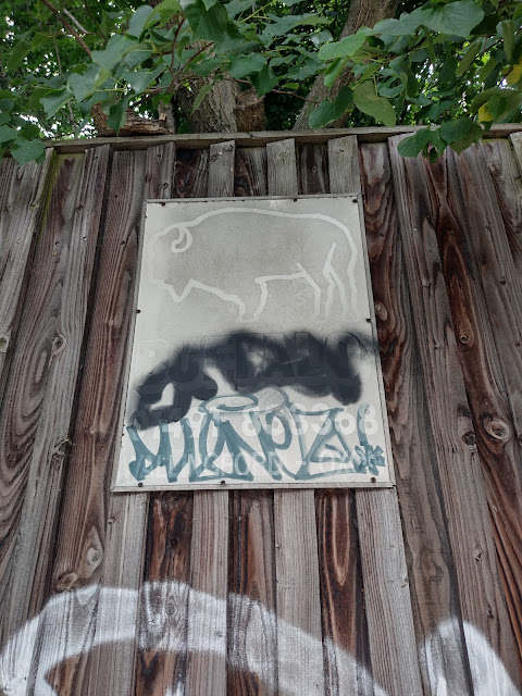
A sign featured an image of a spectral bison, hinting that the fauna to be found behind the fence was probably something to beware of.

Bison on Atlas Road

Similarly spectral was the advertising board. I wondered how long it was since anyone was tempted to advertise there. I reckoned I was the first person to see the board that morning judging by the number of people or cars I had seen along the road (none).

After a walk that was beginning to seem endless, I turned back to investigate an opening in the vegetation. This lead to a footpath that followed the Bounds Green brook. The path was as deserted as Atlas Road. Although netting supporting the banks of the brook from collapse showed that the watercourse was one not left to its own devices and carefully managed.

The path turned off into a residential area, the brook going its own way, impossible to follow. The residential area was non-descript and soon led to a main road. This road, for once, was not the North Circular or any of the other roads emanating from the vortex of the earlier junction. After crossing over and following the road beyond the large Tesco Extra to my left, I discovered I was on Colney Hatch Road.  

The name Colney Hatch was both familiar and meaningless. I had no conception of it as a place. I was curious enough to break the rules and check the ordinance survey app. The name Colney Hatch appeared over an area not too far away, until I zoomed in a bit then it disappeared. Colney Hatch was both on and off the map. Wikipedia calls it 'loosely defined'. Further along the road, after crossing the North Circular, I encountered the crumbling edifice of Colney Food and Wine. The building seemed to me to be the most defined manifestation of the place 'Colney Hatch' I would find. The previously mentioned Friern Hospital asylum grounds extended to and was associated with Colney Hatch, the place name being  used as an abusive term for madness as a result.  The food and wine building looked like it might be one of the few surviving along this stretch contemporary to the asylum. 

Colney Hatch is a place on the border of Haringey and Barnet.  I had already traversed between the two boroughs, a fact only really noticeable by the local authority symbols on road signs. This part of Barnet was far removed from the Northern area where it merges with Hertfordshire. Here instead, it blends in with Haringey and Enfield to form an almost amorphous and extensive part of outer North London.

I turned down Albion Avenue. Although the battered street sign appeared at odds with any Arthurian or Blakean connections the name might have suggested, there was a definite change in atmosphere as soon as I entered the street. It had been another dry day and getting hotter. But as I passed the sign a very welcome light rain shower suddenly started. Attached to a wall on one of the houses was a brown terracotta sun, its alchemaic expression ambiguous.

At the end of the Avenue, which was not a long distance, was Halliwick Recreation Ground. I sat on one of the benches surrounding the grassy expanse. I looked at the A-Z to recalibrate and get my bearings. I soon realised that I would be going completely the wrong way if I carried on out the other side of the rec, in relation to the suspected site of the Gas Holder around New Southgate Station. I'd come way off course.  I retracted my steps and instead followed the road down the side of Colney Food and Wine.

I passed through a residential area with a mix of housing types and at least two MOT garages. This eventually led me to an opening to a park or green space of some kind. Somehow I then ended up back on the North Circular. A complex pedestrian footbridge led over to the other side and I decided to cross. From the bridge I could see the towering adverts from the retail park I had sat in earlier. The realisation that I had walked in essentially a large semi-circle, when the journey had felt far more erratic, was discombobulating.


Walking along the path alongside the North Circular felt odd. Although the path existed, it didn't appear to be very well used. Probably not surprising given the volume of traffic which seemed relentless. I approached a bridge, which featured the mark of the mysterious 'Ouch' emblazoned in black paint. The two crows circling overhead, vulture like, adding to the ominous atmosphere. Once under the bridge I was suddenly engulfed in a concentration of exhaust fumes and pigeon shit. The pigeon detritus and  vehicle pollution had coalesced into a noxious tar-like murky film on top of the asphalt. This 'enhanced' the  stench in the air and made walking feel like a significantly less than healthy activity for the duration of the underpass. 


I was not sorry to emerge the other side, where I realised I was back at the junction that had confused me earlier. I stopped to take stock and noticed on the A-Z that not far from where I stood there was a large circle depicted which was presumably a site of gasholder. The A-Z I had was not current. No Gas Holder loomed over the fence, only an ariel mast. It was clear, however, that I stood on the other side of the wall from the former site of one of the New Southgate Gas Holders and knew that the one I had seen out of the train window was not sited here.

Around the corner was the road leading back to New Southgate Station. Across the road the new development included a Premier Inn and other buildings that looked almost identical to it but were probably flats. I speculated that they stood on the site where other gas holders had stood.

I crossed the road, and found myself as confused by the junction as I was the first time. I had assumed the road ahead lead to Bounds Green but soon realised I was wrong. The traffic was a relentless jam in all directions. An old lady was begging at the traffic lights of one of the junctions. It was an effective but dangerous looking strategy. The cars could go nowhere once the lights turned red and she approached them. I'd seen a younger woman doing the same earlier at another part of the junction. I somehow got sucked into the vortex of the junction again, and managed to find myself on the exact opposite side from where I realised I wanted to be. It took some time to get back to the right place, where I managed to orientate myself again on the road towards New Southgate Station and the newly developed area, which was presumably the one where flats had replaced gasholders.


Just before that I can remember the scene below which I think was across the road from the new development, on the still semi-industrial side where the large gasholder shown on the A-Z had been. But I couldn't swear to it.

But I recall with much more clarity seeing the enormous blue edifice of builderdepot.co.uk a little further along. The giant blue wall didn't look quite real, as if it had been superimposed by a computer graphic. It was hiding the railway line behind.  I couldn't quite fathom the enormity of it.

I crossed the road and made towards the new development, which had been called Montgomery Park. An online search after the walk revealed nothing of the origins of this name, only that the place was a 'new chapter of city living'.

I followed what looked like the obvious route into the site, despite the 'no entry' sign on the floor. There was still development going on but some of the blocks appeared finished and occupied. These blocks were non-descript typical 21st Century. A sign told me 'City Living and a vibrant Community are right on your doorstep'. I can't say I noticed anything particularly vibrant, nor much living going on. But maybe I'd arrived too soon.

I emerged out the other side of Montgomery Park into a road belonging to an earlier era. I passed an older block, from a time when such places were called  flats rather than 'apartments'. The car park/waste ground behind the fence was a much larger open space than any I'd noticed in the new development and looked like a prime place for football games and other 'vibrant' but possibly more dangerous social activities.


Less social was what would have been the only place to stop for a sit down near Arnos Grove Tube station, were it not for the potentially arse injuring spikes. The small corner, with it's no parking sign,  was resolutely anti-social.


I had emerged back at Arnos Grove by accident and it was getting warmer. The unwelcoming 'seat', combined with the equally unwelcome increasingly intense sun, helped convinced me that the nearby Arnos Arms might provide a much needed respite.

Feeling replenished after a sit in the darkest corner of the pub I could find and a couple of refreshing weak rhubarb beers, I braved the heat of the sun again. It was even depicted on an electricity utilities box, it's intensity represented by size and its effect on a being standing below. A Ludwig/Mr Potato Head hybrid with a demented sunstroke grin hovered above grass that was too pointy to stand on and probably about to catch fire. 


I found myself in Arnos Park and being offered a choice of destinations. I was not heading to any of the places on offer but took the left turn.


The park offered shade alongside the course of the Pymmes Brook, which I followed as closely as possible.  Across the brook was a cut off and private area containing what looked like allotments and an area used by park maintenance people.  Drifting through the green corridor of the park afforded a pause from suburban housing, arterial roads and intense heat and sunlight. It was over all too soon, and I was thrust back out into streets of houses and the blazing sun, a week too early for the 6th Enfield Gin and Rum festival.

Not too much later I escaped from the streets again into another park.  Broomfield Park was much busier than Arnos and there was more going on. Or at least evidence that there once had been. A boarded up kiosk has been closed long enough for graffiti to develop.


Not very far away a much larger dilapidated building was being slowly renovated. Broomfield House was surrounded by boards design to both keep out intruders and to inform visitors about it's history.  As well as some history of the building I learned that progress with the repairs was likely to be slow due to lack of funding.
 
Beyond the house a large concrete plain expanded across the park. This was also dilapidated, and had been colonised by grassy tufts wherever there was a crack in the surface. I imagined it must have had fountains dotted around in the past. But now resembled a bit of abandoned World War 2 airfield.


From Broomfield park I emerged into Palmer's Green. I remembered this as being the next place up from Wood Green along Green Lanes, the other side of the North Circular. I had only passed through it on a bus once when I lived in Wood Green when I'd forgotten to get off. Another time I got off train at Palmers Green station in the dark. So had little knowledge or memory of it. 

Once I reached Green Lanes, I found myself in a place sort of parallel to the part of the road South of Turnpike Lane, but much less intense and with a more suburban range of shops. But there was a very similar atmosphere. A building with a large ghost sign above a nail bar provided an image which perhaps captured this best.


I headed North beyond where the shops gave way to the between space leading to Winchmore Hill. The most notable sight in this zone was the Parish  Church of St John The Evangelist. The building featured unusual green topped twin turrets each side of the large arched window at the front.


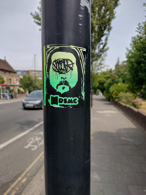
A little further along a green beared face confronted me from a lamppost. In place of eyes some sort of  incomprehensible symbol or hieroglyph stared at me from the face. The visage was of a similar green hue to that of the turrets of the church. I wondered if it was a depiction of the head of St John the Evangelist in a hip mode, notifying passers by that they walked in his parish.

 
Not long after this encounter, an ornate brown and white curved and bay windowed facade above a parade of shops marked my arrival at Winchmore Hill. The impressive sight was only slightly marred by a massive Paddy Power logo


Beyond this a stretch similar to, but shorter than, the Palmers Green bit of Green Lanes gave way to a turn in the road, near the point where a Waitrose now occupied the former Green Dragon pub. The pub had closed in 2015. But a bit further along, at the start of a parade of shops was the Little Dragon, a micropub named in tribute that opened in 2017. I had noted earlier the heraldic symbol of Enfield Borough Council on the street signs of Green Lanes which I mistook for a Red Dragon, but in fact is a Red Enfield, a mythical beast that is an amalgam of fox, lion, eagle, wolf and greyhound. The creature is used in the heraldry of Enfield Borough as well as the emblem of some local schools, football clubs and other organisations. The Enfield is associated with the mythology of the O'Kelly family in Ireland but its not clear what the connection is between the beast and Enfield Borough. The Green Dragon, as a pub symbol, is associated with loyalty to the Earl of Pembroke, so connected to Wales. So although Winchmore Hill was physically heading towards and contained a slight whiff of Hertfordshire about it, there appeared to be a hidden Celtic connection somewhere below the surface.

 
By this point, I was hot and in need of refreshment. I bought water and ice cream from a shop on the parade and sat on the bench near to the sign which told me I was patronising Masons Corner Shopping Centre. The row of five of six shops curved around the corner and felt like somewhere on the periphery, a small haven slightly removed from the rest of Winchmore Hill. The sign felt defiant, these shops existed in their own right and were their own centre. Feeling a bit refreshed but too exposed to the Sun I decided ot would be sensible to pop into the Little Dragon for a swift half and some shade. The beer was good  and I felt ready to head back out into the Sun after half an hour of respite. 

I had reached the Northern peak of my journey. I decided to head back towards the North Circular and beyond to Bowes Park following the New River.  At the end of the parade of shops a short road, which turned out to be a dead end, featured  'Gasoline Alley' which I'm guessing is (or was) a secondhand car car dealer but there was no sign of life or any cars for sale. The double glazing, painted 'vintage' woman and sign all looked like they post-dated the rest of the white flakey painted building by some years, but despite that were sympathetic additions that enhanced rather than ruined the building. I left before I could be accosted by the proprietor, should they be inside doing some bookwork while waiting for prospective customers. I wasn't up to any kind of sales pitch, particularly from a skilled used car salesperson.


The next turn led me into a residential street that was heading back towards Winchmore Hill. The New River cross under the street about halfway along and I entered the gate to the footpath. The gate featured a Thames Water logo and stated that the path was a 'non-public right of way'.  While of course I knew what it meant, even in my by now sun-addled state having walked quite a few miles, I thought it was an odd way of saying it. It did have me wondering initially who exactly were the 'non-public' who had the right of way. I did know I wasn't one of them.  It went on to say that the owner allows the public to use the path at their own risk  'for the time being'. I set of along the path hoping that 'the time being' would be a sufficient period for me to reach the other end. It was unclear what would happen to me if not. The path and river  stretched in front of me, devoid of people or activity. The notice, and its public information film tone had unnerved me slightly. I wondered what or who I could expect to encounter ahead.


Soon I was provided with some 'New River Path Safety Precautions'  courtesy of an unmissable notice. The small print at the bottom pointed out that the New River brings fresh water from Hertfordshire into London and requested that people do not litter or let their dogs shit on the path. 

 
It wasn't long before I found myself leaving the path onto another street, as access under the bridge was not possible. Across the street, I could not rejoin the path. This was the first in a series of temporary departures from the path where parts of it were inaccessible.  I found myself at Stanbridge Place, marked by a round blue placque bearing its name. There was little of note, other than a Chinese takeaway that looked like it might have been frozen in time in the 1980s. It featured a faded plastic 'vintage' Pepsi sign attached at right angles to the contrasting grey concrete of the building.


I got back on and off the New River a few times, and the memory of which bit was which has become muddled in my miod since the walk. At some point I emerged back onto Green Lanes where the path separated the road from the river. Here a couple of engraved stones helpfully reminded passers by that the New River is neither new, nor a river. It was new once, when it was first opened but it was a choice of name that seems odd now. A bit like Sonic Youth. Although I  suppose Sonic Youth probably didn't think they would still be a concern in their 40s, but presumably the New River was supposed to last a lot longer. And it has.


Various streets seemed to bear names related to the river, including River Avenue which ked me back on to a stretch of the New River featuring a few floating footballs. This part of the route seemed particularly vibrant. I still had encountered no other people on the path but here the ominous public information film element had completely disappeared. The greenery was particularly fresh here and there was no hint of the industrialised nature of the watercourse found elsewhere along the path.

 
This was short lived. No much further along a discarded childs blow up horse lay in the path. There was something both melancholic and apocalyptic about the sight of the abandoned equine toy.

 
Here the River had also taken a turn for the worse, presumably due to the fallen tree laying across it. The tree appeared to be responsible for what looked like a midden of static sludge that had replaced the flowing water. There was an unpleasant whiff coming from the direction of the sludge. I couldn't be sure that it was silt due to the flow of water being restricted by the tree or the result of discharge into the river from an undisclosed source. Possibly dropped litter and dogshit were  a contributory factor.  Whatever the cause, the atmosphere was somewhat sinister and brought forth depressing thoughts of wider environmental degradation.

 
Attached to a nearby tree was what appeared to be a small spent plastic bottle that would have contained cleaning product of some sort. The sight seemed symbolic of a futile attempt to clear up the mess. The contents of the container was nowhere sufficient enough to combat the sludge in the New River. And it was made out of plastic itself so would become part of the problem itself. It seemed to be a metaphor for the apparent inability of humanity to do anything effective to prevent much of the world slipping into a similarly degraded state as this part of the river. A little further along I witnessed a cormorant display its distain at this state of affairs as it pointed its arse in my direction and let out a stream of liquid birdshit. It was too far away to do me any damage but the message conveyed seemed quite clear. 


I was forced to leave the path again for a short detour due to a 'danger keep out' sign and grey pointed metal fence prohibiting access to the next part of the New River. Eventually I rejoined it and walked alongside an extensive grey and graffitied warehouse of some kind. Again, there was no sign of any other human life. But the grim geeling brought on by the sludge had dissipated. I was enjoying the New River and its all but uninhabited low key mixture of greenery and low key defunct industrial structures.


I exited the New River path for the last time next to the building that fronted the long warehouse I had followed. The square brown premises of Chris & Sons Ltd did not look abandoned and although the shutters were down (it was Saturday) it appeared to be a going concern. A cursory glance at google while writing this confirms that it is, but what I hadn't realised was  the road I stood on to take the picture was Green Lanes. I had stuck to my not using the map rule. This and the combination of heat and the slightly off kilter state resulting from having now walked some miles had contributed to my sense of orientation being more vague than normal. Still good enough for me to know I was heading in the right direction, just not exactly how.

 
I headed down a road opposite and followed it to its conclusion, where I was spat out onto a main road. This time I knew I was back on the North Circular and that I needed to get across. 

 
A set of traffic lights futher up allowed easy passage over the North Circular and into a residential street that was heading (according to my wonky orientation) parallel to the New River and towards Bowes Park. I didn't check the map to find out but I was more or less on the right track. I soon found myself on Myddleton Road, having past Bowes Park Station and an entrance to the New river path, which I had hoped to have emerged from had I not lost the thread of the river at Chris And Sons Ltd.
 
I had hoped to engineer the walk to take in Myddleton Road for two reasons. One was that I had seen a YouTube video posted on a thread connected  with the Mill Road Bridge closure plans in Cambridge. The video featured a local trader voicing concerns about the imposition of a Low Traffic Neighbourhood (LTN) on Myddleton Road where she had a shop. The concerns were the same ones Mill Road Traders had about reduced business and to some extent gentrification. The second and more pressing reason was that after having seen the video, I remembered walking down street of shops somewhere between Wood Green High Road and the back of Bounds Green Tube when I was at University. I only remember going their once and buying some chips. I couldn't recall how or why I had gone there and why it was only the once. The place had remained dormant half remembered in my mind ever since to the point where I thought I'd probably imagined or dreamt it. I was convinced it must have been Myddleton Road having seen the video.

I walked the length of Myddleton Road and although vaguely familiar it wasn't how I remembered the street I had bought my chips in. Maybe  the 'chip shop' street was a figment of my imagination, and I'd been here at some other point, possibly when a friend of mine briefly lived near Bounds Green. I cannot be certain.  Inevitably the street would have changed to some extent in thirty years, but I didn't recognise it at all.

What was certain was that the LTN had been implemented and judging by the posters stuck on the planters there was some resistance to the idea. Meanwhile, the official wording painted onto the planters is 'Haringey Streets for People'. The wording similar to the name of the pressure group 'Mill Road for People' who are on the side of closing Mill Road Bridge and creating an LTN as a result. Walking through the planters it was clear that the arguments and divisions the issue has caused here are exactly the same as in Cambridge and no doubt elsewhere. The video I had seen and a number of others can be found on YouTube and several threads on a local internet forum are like reruns of the 'discussions' found on 'Nextdoor' about Mill Road. 

 
It was apparent that Myddleton Road was undergoing a process of transition towards something more gentrified. Some newer cafes and vintage type shops were evident. But there were just as many empty or at least apparently empty shops. The process was slow and didn't seem guaranteed. The name of the street incorporated into the facades was an original relic from the past rather than a contrived attempt at authenticity.  


The same feel could be found in many of the other shop fronts, particularly the empty ones. The Lyons Cafe stood out in particular. The windows were covered in brown paper, but the signage did not look overly dilapidated, so much so that I wondered if it was in the process of being tarted up to be re-opened. After the walk, I found a Geograph post from 2015 showing a picture pretty much identical to the one I took below, 8 years later. Nothing had changed. A blog post I found called 'A Street in London' from 2018 by Cecily McNamara talks about Myddleton Road and the state of the street in the context of the predicament of high streets in general. Wood Green Shopping Centre, which opened in 1978, had a detrimental effect on Myddelton Road in the same way large shopping centres, in or out of town, have had on high streets across the UK. The papered up windows of some of the closed shops masked ongoing business still operating from within, just not the sort that relies on passing trade. Workshops  and recording studios operated hidden away. I don't know if Lyons concealed any ongoing operations behind its brown paper but it appears to have been closed as a cafe for some time. How long I haven't been able to find out.


Lyons Cafe, Myddleton Road, Harringey, Psychogeography, Gentrification


I past a definitely opened and busy  cafe called New Salami FC. New Salami FC are a local football side, and the cafe caters to their supporters. Similar cafes/clubs exist along Green Lanes beyond Wood Green Shopping City dedicated to different FCs, linked to the Greek Cypriot community. New Salami FC currently play in something called the Isthmian League North, along with some other London based clubs as well as ones as far flung as Gorelston and Lowestoft.  New Salamis FC in Bowes Park is associated with a parent club,  New Salamis Famagusta FC which based Larnaca in Southern Cyprus. The parent club is a refugee club, forced to move South away from Famagusta following the Turkish occupation of Northern Cyprus in 1974. The club had originally been established in 1948 by left leaning athletes. At this time the Greek civil war between Leftists and Rightists determined the organisation of football in Cyprus with left leaning clubs forming a separate league. The wiki article about the history club is well worth a look, even for those like me who have little interest in the actual game of football.

I left Myddleton Road, still unsure as to whether it was the street I remembered buying chips in 30 years ago. I wondered how it will fair over the next thirty years and if the LTN will have much of a positive or negative effect either way. I followed the 'hidden river path' under which the New River flowed.


I had assumed it was flowing East in roughly the direction of the Fishmongers Arms which was going to be my final destination. The heat had not abated much and I was getting to the point where I was getting weary. I'd been walking since about 9am with only a couple of short stops and now it was probably about 3.30pm, maybe later. Unfortunately the river path was not a direct route and I ended up meandering somehow back onto a main road to Wood Green Station, so my imagined 'as the crow flies' route was not to be.

I followed the High Road which although a road I walked up countless times years ago, felt a lot less familiar than I thought it should have done. In particular, I was amazed that I had no recollection whatsoever of the Civic Centre, the headquarters of Haringey Borough Council. The building looked contemporary to 60s/70s postwar Newtown Architecture. It is listed and due for a revamp according to the information board that extended along the front.

Harringey, Civic Centre, Wood Green, Psychogeography

I was too weary to appreciate the rest of the stretch up to the Fishmongers Arms and decided a return trip in the near future was needed to do the area justice. I was glad when the now closed pub emerged into view.  The pub had closed sometime in the 2000s and turned into flats. The building was not how i remembered it and had it not had the words 'Fishmongers Arms' still painted on it I would not have recognised it. I recalled it having a metal looking statue of John Lennon standing above the front door and I had no recollection of the wall and hedge separating the pub from the High Road. 

The Fishmongers Arms, Wood Green, Psychogeography, Perambulatory Ramblings

The pub was noted for hosting the Wood Green jazz club in the 50s. In the 60s the emphasis shifted to rock. There were early appearances by Graham Bond, Julie Driscoll, Fleetwood Max and Pink Floyd among others. I don't know if any music was still going on in the 90s but I can't recall anything being advertised at the time.  The John Lennon Statue was apparently sold off by the owner. Before that it had been moved to another pub he owned called 'Legends' further up Green Lanes near the North Circular. 


I stood briefly in front of the Grade II listed cattle trough and drinking fountain that stands in front of the building on the High Road. This was constructed in 1901 for the Metropolitan Drinking Fountain and Cattle Trough Association. The bowl under the tap appeared to have been converted into an ashtray. I didn't try the tap, although I was thirsty, put off by the fag butts and assumed  that the drinking fountain was probably defunct in any case.

I headed for the tube, tired but glad I had reached the Fishmongers Arms and brought the walk to a proper conclusion. On the train home my thoughts returned to the gasholder. This time I made sure I kept an eye out. I saw the back view of the giant blue board of Builderdepot.co.uk. Then a bit further North, further than I had walked today, I saw it. The gasholder was there. Just not in New Southgate. A bit of googling revealed it is located in New Barnet, decommissioned but still standing in the site of the New Barnet Gas Works. Quite a bit further North on foot but a fleeting few seconds by non stopping train from New Southgate. I would have to make a return journey at some point. I part cursed myself for not bothering to find this out in advance but mostly congratulated myself. The expedition had been well worth it. That I did not find the gasholder was not really the point. It was the idea of it that had led me on a perambulation that otherwise would not have been. One afforded not by tiresome hours of screen time and  internet 'research', but  based on a whim following fleeting views of a random object out of a train window. 


Friday 22 September 2023

The Closed Shops of Mill Road


Mill Road, Cambridge, Psychogeography

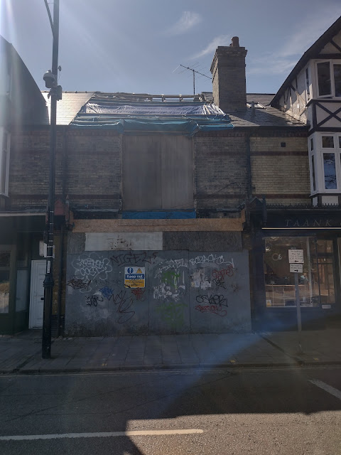
I'd noticed scaffolding had gone up in front of the building formerly inhabited by a Tesco. It had been empty for a while, the supermarket oligarch having finally given up the ghost in Mill Road. For many this was a welcome departure. A few years ago, the No Mill Road Tesco campaign was well organised and culminated in a large demonstration. The Tesco opened anyway. But with no alcohol licence and with limited local support, a few short years down the line its not that surprising that it has gone. It had failed  to compete with the long standing and more popular Mill Road Co-op. As a 'product' of the Co-op and so having inherited a possibly irrational semi-loyalty to it, I can't say I was sorry to see the back of Tesco. The building had potential. I had hoped that maybe in a street constantly bigging up its community credentials, somebody with more imagination, ingenuity and access to funds  than me might come up with a great plan. Maybe some sort of cultural venue, library, community repair shop or centre where people could go and interact without feeling like they have to buy an expensive coffee to pay for their seat. 

Of course, nothing of the sort has been proposed. Instead there is currently a planning application for a private MRI scanning facility. I hadn't been that optimistic that what would replace Tesco would be anything to get too excited about. But I had not foreseen something quite as far removed from what- might-have-been as the provision of a private health care facility. This seemed to me something wholly contrary to everything I regarded Mill Road as having once stood for, in particular on the Romsey side of the Bridge.

A bit of cursory investigation revealed the planning application was made by Moor Park Capital Next Gen Ltd.  Companies House records show the company is directed by somebody of Australian nationality who is resident in Thailand. The company is owned by Hamersley Private Limited of the British Virgin Islands. Who is behind the BVI company of course is not (and does not have to be) disclosed.

There have already been a few objections lodged against the plans on grounds of noise, traffic and because the proposed development is out of character with the conservation area. The current building can hardly be said to be of architectural merit, but does have essence of Mill Road about it. What the Council's decision will be is anyone's guess. The developers appear to have already started work regardless.

I took a stroll to observe other recent developments. Or more accurately in most cases lack of development. A number of shops that closed have remained dormant for some time, most since before or during the pandemic. They are frozen in time, creating interim liminal points in between the places that have remained active or in some cases been reactivated. These 'closed shops' are left behind in time and have become temporary relics of the 'before times'.


Mill road, Cambridge, Psychogeography

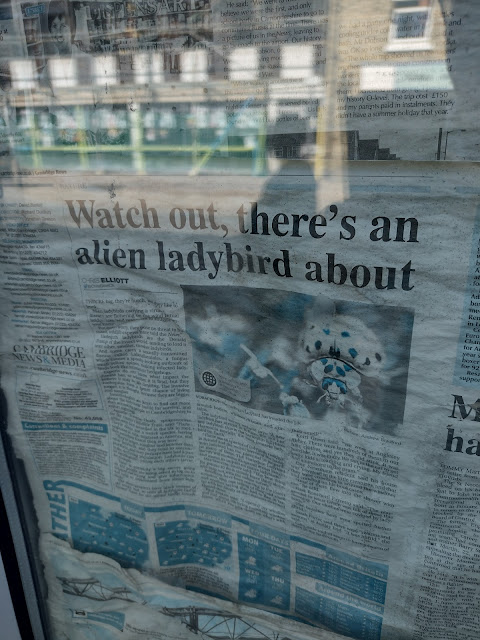
Opposite the former Tesco is a shop unit which has its windows completely covered in newspaper from the inside. It is not possible to see into the interior and no shop sign remains from its previous incarnation. The newspaper, the Cambridge News, dates from 29 October 2016. I have no memory of what type of business occupied the premises before that which was a realisation that I found quite disturbing.  Eight years is  quite a long time for a shop on a  thriving street to be closed which was something  not so much disturbing as plain odd. The static window display of old news reminded me how quickly places can disappear from memory. Even those previously celebrated are often soon forgotten after abandonment or replacement.

I was interrupted while perusing the archive  headlines by a man asking if I would mind helping with his sons A-Level geography fieldwork. I was happy to oblige, although was slightly perplexed that the Dad was doing all the talking. The son said nothing while I answered his Dad's questions. The questions were concerned mainly with access to state education in Cambridge with a view to University. I was disappointed not to have been asked about current issues around gentrification, active travel, traffic congestion and more specifically given what I was up to, the changing retail environment. I have no children so my knowledge about access to the best local schools is limited, but no doubt money, pushy parents and being in the right catchment area are still factors that have a significant impact on a kid's chances of getting into the best state schools, which is more or less what I told him was my perception.  

After he'd gone, I resumed reading the headlines.  The one that stood out the most was the imminent invasion of 'alien ladybirds'. It was the close up shot that exaggerated the alien-like features of one of these creatures that caught my eye. I don't recall any subsequent emergency involving ladybirds in 2016 or since, and hoped the current flap about African Hornets would turn out to be equally as non-eventful. Another headline concerned the council's determination to push ahead with the Dutch roundabout at the 'accident blackspot' where Fendon Road meets Queen Edith's way. That did go ahead and the reception has been mixed. Having traversed it a few times by foot, car and bike I'm not sure I noticed that much difference in terms of feeling more safe, but initially was considerably more confused about what I was supposed to be doing. Like flat pack furniture, it didn't come with very good instructions, but was easy enough to work out. The roundabout is still often argued about on local social media. The ladybirds on the other hand, are never spoken of.


Mill road, Cambridge, Takeaway, Psychogeography

A little further along, the Chicken Rush takeaway has seemingly been closed for much longer than it was opened.  It was an active concern for an even shorter period than the curry house that preceded it. I managed to visit both only once each, such was their limited tenure.  Prior to the curry house it had been a newsagent-cum-general store that was very useful and now is something lacking from Mill Road. The shutters of Chicken Rush were unusually open one side, suggesting some sign of life inside. But when I passed a couple of hours later to get my tea from the Co-op they were back down. Whether goings on behind the shutters signify an imminent resumption of some front of house activity remains a mystery.

Mill Road, Cambridge, Psychogeography

I wandered down to the area of Romsey beyond Coleridge Road. The former Chick-King takeaway has been closed for several years as mentioned in a previous post. Since I last took any notice of it the takeaway signs had disappeared and some graffiti had appeared. The open windows indicated the building is still occupied as residential premises. I've heard nothing anywhere of plans for any new outlet of any sort here. 

I didn't go beyond 'Chick King' and headed back up the road.


Mill Road, Cambridge, Labour Club, Psychogeography

I passed the former Romsey Town Labour Club with a mixture of nostalgia and sorrow. It remains (for now) a symbol of a more community spirited and cohesive Mill Road. The crumbling building appeared broken and resigned to its future development into short term 'apart hotel' type accomodation. Last year the City Council's Planning Committee refused an updated application for 43 serviced apartments on the site and said  the previously approved plan for 36 plus a gym and cafe could still go ahead.  But no development whatsoever has started to date and the building, including the facade which I think is supposed to be retained, is getting ever more dilapidated. Some remains of fly-posters pointing out what a great community space the building would make were still hanging on.  Nigel had added his stamp of support to that sentiment more recently on the boarded up front door, appropriately in red. 

Despite searching I can't find any recent update. A post by The Cambridge Town Owl 'Can we save Romsey Labour Club?'  back in April explains the lack of Council funding and powers mean that the building has little chance of a return to its former glory as a community asset. So  the answer to the question is almost certainly 'no'. The post also contains a bit of the history of the current planning application, as well a couple of random links to videos shot inside the club. One of these features a live set from 2012 by 'The Doozer', who was a local musician with connections to the 'Weird Folk' scene of the mid 2000s. He was behind Harvest Time promotions who put on several events in Cambridge featuring some of the leading lights of the 'New Weird America' wave of bands and others of similar ilk. This peaked with the Palimpsest Festivals at All Saints Church that ran annually from 2005 til 2007 (possibly beyond but I only remember three). Harvest time and the Doozer have since faded into the collective memory, having ceased operations some time back as far as I know. The random video was a reminder of what has been lost with the dissapearance of the Labour Club as a space to host arts and entertainment, as well as cheap beer, cheap cheese and onion sandwiches and conversation.

Mill Road, Dutch's Corner, Cambridge, Psychogeography

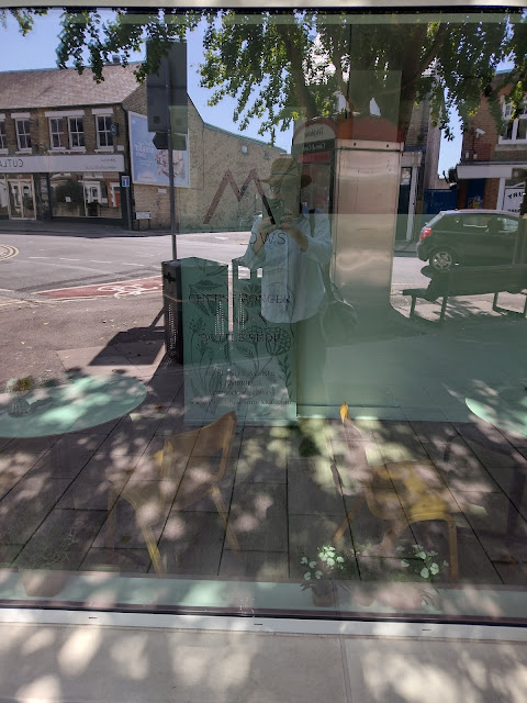
I crossed the road and walked up to Dutch's Corner. It was hard for some reason to get a good photo of the new development that recently replaced the Cambridge Bed Centre in its entirety. Before the Bed Centre, Frank 'Dutch' Holland's petrol station and prior to that Holland's bakery had occupied the site, hence the name 'Dutch's Corner'. The view above is a reflection from one of the windows of the shop/cafe that sits on the ground floor. Reflected from across the street is the shop recently vacated by Cutlacks, a hardware, kitchen and garden shop which had been a staple on Mill Road for years. I heard vague things about a planning application flats but have seen nothing substantial. The owner wanted to downsize and concentrate on his other shop in Ely. But he also cited the planned Mill Road Bridge closure and congestion charge as 'the last straw' and things which hastened his decision.

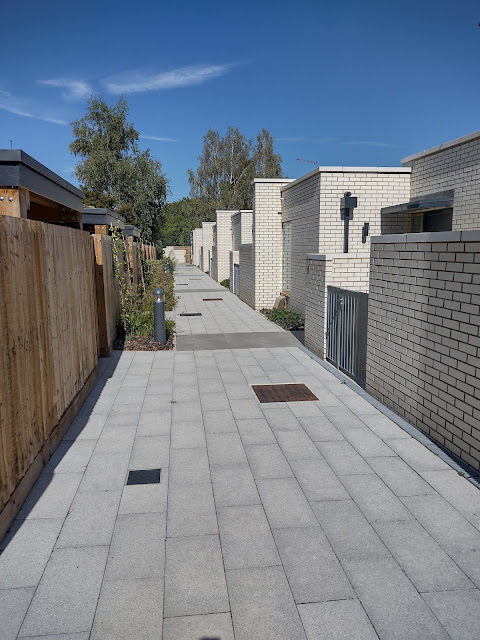
The shop/cafe at Dutches Corner sits beneath the flats that make up the bulk of the building. The block is unusually more reminiscent of decent 60s municipal housing than the usual sort of spreadsheet architecture we have come to expect from new developments. It was brown, not beige and of a proportionate size (although still too big for me to photograph without crossing the road, which I didn't bother to do). Around the back is a small development called 'Holland Row' that is owned by 'City Stay' and available for short let via Booking.com. The light coloured small flat roofed brick buildings were utilitarian looking but at the same time eliminated a kind of seaside/Mediterranean feel. Fitting perhaps for short term/holiday lets and symptomatic of the increasing 'destinisation' of Mill road. Two or three normal looking houses have been built on Ross Street, the backs gardens facing the serviced apartment buildings. These houses sit a bit awkwardly, not quite blending in with the existing Victorian stock. But overtime, this newness will probably fade into line with the rest of the street. The houses looked more like they would (or at least could) be occupied by people needing somewhere permanent to live, which is a good thing. The new Dutch's Corner Development is, as signified by a notice stuck onto one of the walls, owned and managed by HTS Estates Ltd, a long standing locally owned company rather than one with owners in tax haven. Also a good thing.

Dutch's Corner, Cambridge, Mill road, Psychogeography

Back around the front I had a closer look at the shop/cafe. It didn't open on Mondays but I could see the menu. Sandwiches at £8.95, even with the addition of a BeefHeart tomato, seemed a bit extortionate for my wallet. I could get a BeefHeart CD for less than that in Fopp. It did have a cheese counter though so I may be tempted to make a return visit.

Sea Tree, ABC Barbecue, Mill Road

I carried on up the road to the Broadway. Here was another premises that had fairly recently become inert. The Sea Tree had been a more upmarket fish and chip shop, which opened a few years ago right next door to the existing ABC barbecue chip shop/kebab joint. The Sea Tree had a fire a few months ago that it has not recovered from. Rumours of inadequate insurance have been cited as the reason it hasn't been able to reopen. There has been no sign of any movement for several months.

The ABC Barbecue, while outlasting it's next door neighbour by a matter of weeks, has finally closed having changed hands. It is still operational as a kebab joint I think, so the use hasn't changed significantly, but the chicken spit in the window has finally gone along with the nostalgic ambience and the fish and chips. The old Kebab Leg sign though is still there, for the time being at least. No sign signifying the replacement name for ABC has gone up, giving an ominous air of temporariness about the new incarnation.

The Sea Tree was the final place in a state of limbo I encountered on the Romsey side of the Bridge. I crossed over into Petersfield.

Mill road, Cambridge, Library, Psychogeography


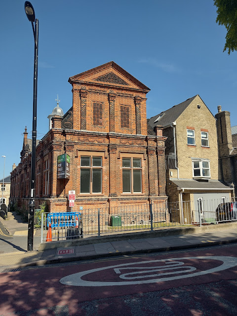
At the bottom of the bridge, the old Mill Road Free Library building is still standing and still has the for sale notice on display. Some months back Centre 33, a charity working with young people, was shortlisted as the preferred bidder. But nothing seems to have happened yet and the building still appears in a limbo state. Prior to its closure it had been used by the Hindi community as the Bharat Bhavan Temple. Earlier this month, 'The Gateway To India'  was was officially opened up the road in Ditchburn Place Gardens. The structure had previously been part of the Bharat Bhavan temple, but following the end of the lease, it was saved from destruction by the efforts  of a local trader. What the future holds for building that once housed the 'Gateway' is less clear.

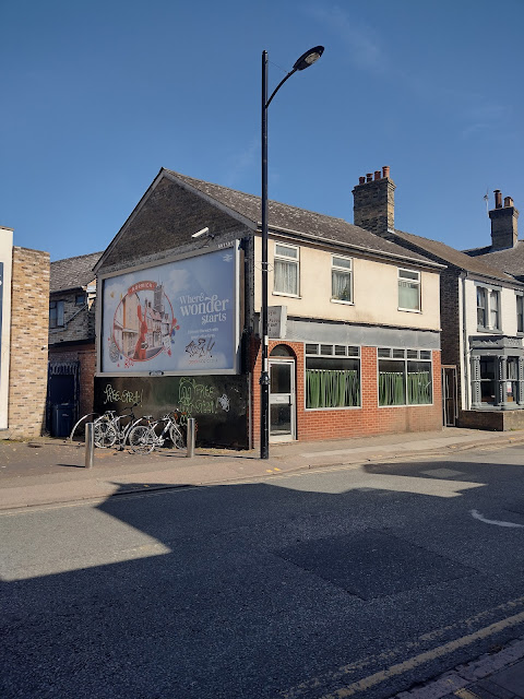
Over the road on the corner of Devonshire Road is another building in an in-between state. The second and third floors still appeared to be occupied and presumably are in residential use. But the ground floor, which I think was previously a reprographics business of some kind, has been empty a while. I couldn't remember how long for and when it was opened I barely noticed what was inside, which was strange given its prominent position on the corner. Now the ground floor at least has an air of abandonment. There is a pile of unopened post on the mat and what appears to be a collection of unwanted personal belongings inside. Graffiti has started to colonise the windows. I have seen no mention of any plans for the building anywhere. 

Across the street, just next to the butchers, are some fairly recently built short stay flats, again bearing the logo 'City Stay'. There has been talk of development of the Travis Perkins site next door for a while.  I had noticed that the Railway Cottages that sit between Travis Perkins and Mill Road Bridge, behind the butchers had their windows boarded up. The cottages provide accomodation for young people and one of the houses is used to house homeless people. Or at least did before the boards went up. The planned development, called 'Devonshire Gardens', shows the railway cottages remaining, but dwarfed by the modern architecture of the proposed new flats. The site is due to start development in 'Q4 2023' after Travis Perkins have left for pastures new and to be completed 2 years later. 

Mickey Flynn's, Cambridge, Mill road, Psychogeography

Mill road, Cambridge, Quality Fish Bar

I carried on, passing two long standing limbo buildings that have stood dormant next to each other for several years now. Mickey Flynn's pool hall was active more recently than the former Quality fish Bar next door, but its been closed for several years. An attempt to open a Sainsburys supermarket on the site was thwarted when planning permission was refused following 4,500 objections. Ironically, soon after a Sainsburys, albeit one on a smaller scale, opened in the former Mace shop further up the road. Amended plans to turn Mickey Flynn's into a restaurant and flats were, as I recall, approved. But nothing has ever happened since so I might have misremembered. A cursory google search brings up nothing and the building remains stubbornly in stasis.

The former Quality Fish Bar next door is the Petersfield version of the Chick-King across the bridge. The building is apparently occupied as residential accomodation but that isn't immediately obvious and the place resembles an abandoned takeaway/restaurant. It last operated with added kebab, but I can only recall going in when it was an old school fish and chip shop of the sort that are rarely found in Cambridge now. The Chick-King had also been an old school chip shop called The Belgrave around the same time. Both I think had the same owner, which probably accounts for the similar current use as ghost chip shop accomodation.


H Gee, Nigel, Mill road, Psychogeography
 

Meanwhile, opposite the now ghostly and precarious burnt out remains of H Gee is hidden behind the boarded up facade. I noticed I had been preceded once again by 'Nigel', who I assumed must have been carrying out his own survey of the liminal sites of Mill Road. The former Roll On Blank Tapes, down Gwydir Street just opposite, had recently been boarded up. It had been said that Mr Gee had lived there. I don't know if that was true or if he still does. I wondered if the boarding up of Roll On Blank Tapes signified something ominous. The loss of the H Gee emporium of electrical gadgetry meanwhile was a significant change and seemed to herald a new era on Mill Road and not necessarily a better one.


On the corner of Tenison Road two dormant premised face each other. The former premises of Culinaris Deli (not photographed) has been closed for a relatively short time and the business has moved up the road to bigger premises previously occupied by Lloyds Bank, on the corner of St. Barnabas Road. I didn't think this warranted inclusion as the business still exists and the site has not been dormant for long (maybe a year?). But while I stood on the corner, memories came back of the long standing Chinese Takeaway that once occupied the building. The Rice Boat was its last incarnation and while this was still an old school chinese takeaway, complete with a large formica encased television permanently on in the corner, it was  its predecessor The Jade that appeared in my mind. The Jade was a seemingly timeless presence while I was growing up and well into the 1990s. It had a small restaurant at the back, which I think was where my first ever sit-in Chinese meal happened. I remember being a bit shocked  at the relatively extortionate eat in price  compared to  the (same) food available for takeaway. The Jade had some connection to The Times, another established Chinese Takeaway on Cherry Hinton Road. One of my friends nannas had a calender in her kitchen featuring  the names of both establishments, which she had obviously obtained from one of them. They presumably shared ownership. The Times was the first place I ever had a Chinese Takeaway from, so theres another connection between the two. Mill Road now has no now old school Chinese Takeaways of the formica TV variety, having hosted several over the years. But it does have The Spring, which although no TV, has almost certainly better quality food. But memories of the Jade and the Lotus House, and a lesser extent the Taipei, live on.  A friend of mine found a quantity of old menus when clearing his mums house featuring some of Cambridge's finest lost Chinese Takeaways and Indian Restaurants. Judging by the prices, they mostly dated from the 1980s, which is the era I first encountered takeaway food and which was one where Cambridge had a prolific array of such places.

Shaking myself out of an unhealthy moment of nostalgia and the craving for a Times chicken fillet curry that came with it, I focused my attention on the opposite dormant premises. This had been Music And Digital Village,  more recently known as  'DV 247'. The shop had sold musical instruments and associated equipment. Apparently it was part of a chain which suffered during the financial crises. As with many of the other places mentioned already, I can't recall exactly when it closed nor know what plans (if any) there are for the future of the shop.


Beyond the former DV 247, on the townward stretch, I saw no more 'closed shops' until I got to the site of Fagitos. This has been closed since the pandemic and had a sign saying it was 'opening soon' as a Greek restaurant for so long that I'd assumed that it was never going to happen. But it seems it is. The people behind it are apparently the same family. 'Mr Fagito' as we thought of him has I imagine has retired and passed on the business. On the 'Fagitos Albania' Facebook page, he is also referred to as Mr Fagito. The last communication from 27 April 2020  ended with: To celebrate the launch of the schedule, I will be giving away an all inclusive trip for two to Parkside Pools. All you need to do is comment 'Mr Fagito you're so ripped' on this post. Good luck! The page is almost certainly does not feature messages from the real 'Mr Fagito' despite its superficial appearance as the official means of communication of the previous takeaway incarnation.

The frontage is now unrecognisable. I wasn't sure if the undercoat had still yet to be painted over or if there had been a localised outbreak of Grey Plague. It looked likely that the new Fagitos was going to a different proposition to the infamous late night Takeaway that almost certainly invented Spicy Potatoes and remains Mill road's most celebrated outlet of its type (with the possible exception of Carlos). The new Fagitos will, I guess, need to cater for the demands of the new Mill Road and so no doubt will be different. But the name will live on. And with a bit of luck the spicy potatoes.

The final site I checked out was the building that was once well known for being the Ann Pettengel Bureau. At least it was well known to Cambridge cinema goers during the 1980s, when it featured in the reel of adverts for local businesses.  My main recollection  was the representation of the building itself in a graphic, almost cartoon form, with the businesses logo above. I think I was too young to realise that a recruitment agency was a gateway to office toil and all that entailed. Instead, I recall at the time that the representation of the building had a slightly magical quality about it but I can't remember exactly why. Ann Pettengel left Mill Road some years ago and now operates from Cowley road business park on the Northern periphery of Cambridge.  Recently the Mill Road site was used as offices for for an insurance company, but at the time of the walk was almost ready to reopen after a short gap as offices for Home Instead, a social care franchise operation.

It stuck me as a bit of an odd place and an unnecessarily large building for offices of a social care company.  Also locating where rents are I imagine  unfavourable for a business which could easily be located on a cheaper site seemed an odd move. At first I had assumed it was going to be an actual care home which would have made more sense. The only explanation I could think of that it would only serve local people within walking distance or cycling distance and its carers would  not have to dive anywhere-even to get to work. That seemed unlikely. But I'm not a business person, so what do I know. I was glad though to see the building still the same shape as in the one in  old cinema adverts and was also glad it has been occupied by something that will bring some social benefit, unlike its counterpart over the bridge at the former Tesco should the MRI scanner plan come to fruition.


I finished my amble back at the former Tesco site, noticing that only one of the four cars that had been parked up before was still there. Activity was at a standstill.  

Shops, restaurants, takeaways, pubs and other businesses have come and gone over the years along the road. Some have been fleeting, barely noticed or remembered. Others have been well established and long serving and when gone remain in faded form in the collective memory. Several of the 'closed shops' seen today though seemed to belong to a different phenomena to the normal ebb and flow of businesses closing and opening. The duration many have been in limbo seems counter to all the talk of the street as a thriving  'destination'. Maybe they are biding their time, pending decisions on the bridge closure and congestion charge before deciding what to turn into. Maybe difficulties with planning permission or lack of funds are the causes of stasis. Maybe they are the victim of the general change in the retail environment due to increasing automation and online buying, coupled with the cost of living crises reducing the viability of retail, even in well off places. 

Whatever the reasons, the 'closed shops' seemed to me symbolic of the current division of opinion about the bridge closure and more widely congestion charge. At the time of writing, the Fiends of Mill Road Bridge have launched a legal challenge against the decision to close the Bridge that has delayed the closure.  Last week a woman was reported in the Cambridge Independent as saying she would 'self identify as a bus' if fined for driving over the bridge. Meanwhile,  pressure groups on the other side of the debate are citing statistics gleaned from the recent Greater Cambridge Partnership consultation to back up their arguments. 72% of just under 2,000 respondents said they were in favour of restricting traffic over the bridge. Whether that figure, based as it is on only a fraction of the number of people living in Romsey and Petersfield, is representative of the true feeling of the majority of the population or if it should be regarded as the result of just another 'non-sultation', is anyone's guess. But until things move on for good or ill, the more long standing of the 'closed shops' of Mill Road will probably remain in limbo.