The Kite
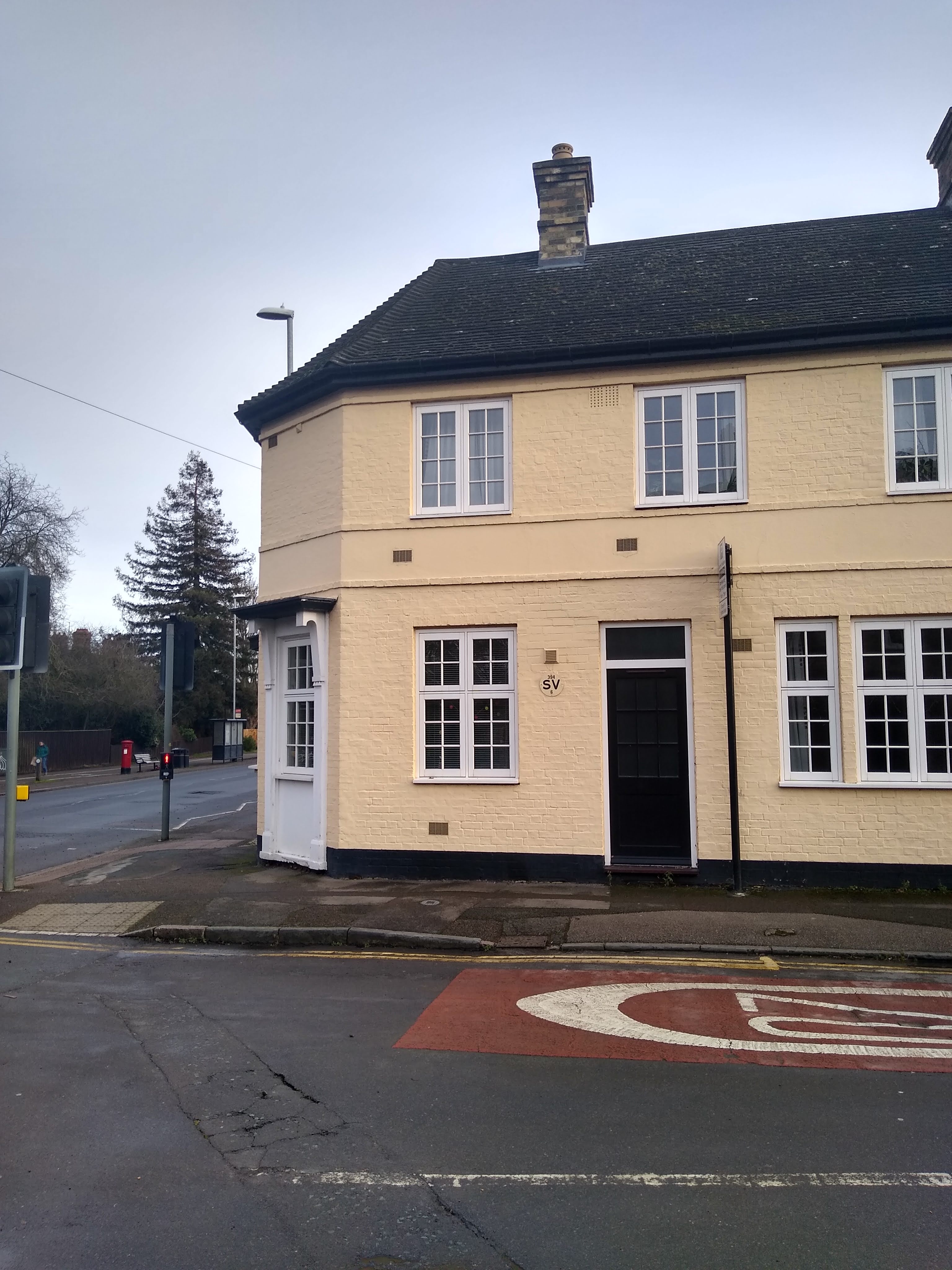
The Kite is an area on the edge of central Cambridge. It's shape, as defined by the four stretches of road that contain it, is easily visible on any contemporary map of the City. Since about 1983 the area has been dominated by 'The Grafton' shopping centre. Plans for a shopping centre in Cambridge were first muted in the 50s with the Kite a favoured location. In the end the Lion Yard was built first, arriving in the town centre in the early 1970s. Despite this, plans to develop the Kite were still being pushed (and fought against) for the rest of the decade and into the early 80s. The Kite's main thoroughfares of Fitzroy Street and Burleigh Street had long provided a decent range of shops, including the Cambridge Co-op's flagship department store, Laurie and McConnell (another department store) and an array of smaller independent outlets. But the authorities wanted the Kite to become a major retail destination to complement (rival?) the main town centre and Lion Yard just ten minutes walk away.
The University and Colleges were, unsurprisingly, a significant influence on the decision to demolish the streets once part of an area once known as 'Barnwell', in order to make way for The Grafton Centre. Barnwell in Victorian times was poor and had a notorious reputation, a place very much 'town' rather than 'gown'. It contained a number of brothels which were the main loci of the limited visits 'gown' made to the area. These visits was illicit and unapproved. The area remained one where working class 'town' people lived and worked for years after until they were displaced by 'The Grafton Centre', an occurrence long after the name 'Barnwell' had migrated East to the areas adjacent to Cambridge Airport and The Abbey Stadium.
The apparent purposeful dilapidation of the houses, until they and the people who lived in them could be removed, was part of a trend that has continued at pace in Cambridge. 'Ordinary' 'town' people were being pushed further to the less pleasant edges of the city or out to the villages and satellite towns. But were still welcome, even expected, to travel back for work, leisure and shopping at great inconvenience and expense. Upon it's arrival the Grafton Centre became a major locus for both work and shopping, and to a lesser extent, leisure (shopping is not leisure in my book).
There was vigorous opposition to the development. I can recall as a child seeing 'Save The Kite' written on walls and protests on local news programmes. I have memories of a World In Action documentary being shown on ITV about the campaign, but since no record of this seems to exist on line and nobody I have spoken to remembers it, this may be a false memory.
By the time the Grafton Centre opened in about 1983 I had probably not even started secondary school. My recollections of the Kite before it arrived are very vague and mostly limited to the main Fitzroy/Burleigh Street axis and the Co-op Club located on James Street, all streets that survived. I've little memory of anything definite that stood before on the footprint of the Grafton Centre. My Dad often took me to the Co-op club on evenings when my Mum worked. He parked up in the streets nearby, some of which later have gave way to the development. The dilapidated looking houses featured bright graffiti and murals. The only one I clearly remember depicted a giant green face with long hair. At the time I associated it with The Incredible Hulk which would have been on TV around that time, but it was more likely connected with those occupying the buildings in protest against the impending demolition. I never saw the Little Kettle Cafe or the original Grapvine Bookshop, the loci of opposition at the time and located on the section of Fitzroy Street the Grafton Centre was eventually built over.
I have clearer memories of the earliest incarnation of the Grafton Centre. The 'glass' lifts that led up to the car park could have been from a bad science fiction TV show from a few years earlier. Below these was a fountain into which people were encouraged to throw coins. What they were spent on I never found out. Towards the back end was a small supermarket called Prestos from which the stench of fish constantly wafted into the surrounding area. Security men delighted in finding reasons to throw their weight around, often by tannoy from room hidden away somewhere. Taking a bike through, loitering or, later, smoking, would result in an authoritarian announcement of rebuke.
The Grafton Centre was my first experience of a self-contained shopping area with it's own rules and private security guards instead of proper police. A totally separate environment from that outside, and one that felt a bit more sinister. By contrast, Lion Yard, although covered, felt more like a continuation of what was around it and more human. More like a poor quality arcade rather than the sort of American style self contained 'mall' which the Grafton Centre aspired to be. The Lion Yard also had the advantage of containing the Central Library, the Red Lion Statue and the Golden Egg cafe. The Grafton has never contained anything of such significance or interest, although the Lion Yard in recent years has veered more in the direction of the Grafton Centre,with the removal of the Red Lion, addition of the Grand Arcade (a posh extension) and a series of 'no' signs at its entrances which are now closed at night.
Recently the Grafon Centre has been subject to the latest in a series of revamps. I deduced from the advertising stories that the 'centre' suffix that had officially been dropped from the name a few years back was not being reinstated, reflecting perhaps the short attention span/information overload environment that currently engulfs everything. The current revamp is part of the local plan for Cambridge and an 'SPD' document was published on the council's website a couple of years ago covering the Grafton, Fitzroy and Burleigh Streets as well as some peripheral areas. This zone has been identified as an 'area of major change'. I decided to make a rare visit to the Grafton to see what was going on.
Periphery of the Kite
Before entering The Grafton, I felt it necessary to carry out a preparatory walk around the border of The Kite, along the four roads that contain the area. An orbit of the Grafton would afford the chance to both fortify me with real fresh(ish) air before my immersion into it's closed environment and also to re-explore it's surroundings and any remnants of what had existed before.
I began at New Square, next to the pedestrian crossing which is at the centre of the transition zone between the Town Centre and the Kite and where the seemingly endless stream of shoppers go back and forth between the two. Nearby the post below is a marker of this zone.
I headed along Short Street, as it is known beyond the signpost. Prior to that it's called Emmanuel Road. I'm not quite sure why the need for the dual road name exists. There is another example of this around the corner where the outline of the Kite continues along Maids Causeway which at some point before James Street and the ex-Zebra Pub becomes Newmarket Road.
One of the large Georgian houses that make up the stretch of Maids Causeway features a peculiar looking gate. The white painted symbols at the centre brought to mind the creature from the children television programme 'Vision On', but rather than being a 1970s creation by Wilf Lunn or Tony Hart, the gate was 21st century and bar coded. The bar code provided
a link to information about the design. It represents a famous (at least in the field of quantum mechanics) experiment by Greenberger, Horne and Zellinger, hence the name GHZ-gate. The experiment apparently demonstrated 'non-locality'. This involves the existence of 'spooky' correlations in the quantum measurements of things at different locations caused by 'collaborations' between particles vast distances from each other. Or something.
The phrase 'non-locality' brought to mind The Grafton Centre and similar shopping 'malls'. Maybe spooky collaborations are taking place between the particles of all shopping centres across the UK (and probably the world). This might explain the high degree of homogeneity and blandness that they all seem to share. Their quality of anywhereness and disconnect from the places they are imposed on seem to fit the term 'non-locality' quite well.

At the corner of Fair Street I noticed what appeared to be date stamps on the wall. I'm not sure of any specific significance of 1878 in the history of the Kite. But by this time most of the development of streets and houses that replaced 'The Garden Of Eden', a market garden which covered a large part of the Kite, would have been complete. The gap between the two dates on the wall appeared symbolic of a period sandwiched between two eras of significant change. The Grafton and surrounding pedestrianisation of Burleigh and Fitzroy Streets was largely complete by 1984. Meanwhile, an old fashioned black Victorian lamppost stands across the road from this wall, a surviving artifact from the interregnum between deveopments.

I stopped next outside the 'remains' of the Zebra pub. The building still stands unchanged but with an air of early stage deriliction. The two zebra heads on the front of the pub have been having the same conversation since the pub closed. It's the same resigned conversation that recurs among the populace of Cambridge each time a new development is proposed or gets the go ahead from the Council.


I couldn't work out if the building was currently being used as 'student accomodation'. Not so long ago an estate agents sign appeared to be advertising it as such but this had since disappeared. There was no sign of anyone inside or any significant changes or 'improvments' to the building since the pub had closed. A window pane had been broken exposing a flappy Venetian blind. Ivy and other plant life associated with liminal spaces had taken root in several areas giving the air of abandonment. But it's not impossible students or other residents are living inside, given the dire shortage of reasonably priced living space in Cambridge and the enthusiasm of some landlords and estate agents to take full advantage of the situation.
Prior to it's closure the Zebra had become a sort of overspill/rival for the King Street Run pub a few hundred yards away, frequented by punks and other 'alternative' types and occasionally hosting live music. I lived out of town and never really visited the pub during this period. I'm not sure what Green King's excuse for closing it was.
Across the street, the Burleigh Arms is still open. It was a significant establishment on the local 'alternative' music circuit in the 1980s when it hosted live bands in a sweaty side room. I was a frequent visitor. But around 1989 the music was stopped and the walls ceased sweating after complaints from neighbours and unsuccessful experiments to compromise using a sound limiting device. I haven't visited the pub in its current incarnation and I rarely hear it mentioned by anyone I know. It's somewhere that slipped of my radar 20 years ago, noticed only in ghost form from the corner of the eye when passing. Maybe a visit is in order. But not today.

I reached Christ Church and the street running up it's side bearing it's name. The Church turrets are reminiscent of those on the neo-byzantine Cathedral of Westminster (but much smaller) and unusual in Cambridge. I took a diversion down Christ Church Street along the side of the building. Something was going on inside which put me off wandering into the small grounds. Instead I lurked a while behind a side building which stood next to an electricity substation and with it's back wall facing the Grafton Centre, as if in a stand off. The plant life growing up the building furthest from the substation had withered on one side and turned brown, exposing two flint layers resembling geological substrata. It was as if the building bore the marks of the struggle to 'save the kite' and was now being sustained by the electricity from it's neighbour. It had survived but whatever used to stand in front of it had disappeared nearly 40 years ago.

The vista now opposite the church outbuilding was a microcosm of 1980s bland architecture, with the added bonus of a rebuking 'no' notice attached to an intermediate wall. I only noticed the large print 'NO IDLING' command initially and decided, just to be awkward, that I would loiter around a bit. But then I realised it referred to turning off car engines. A reasonable demand I suppose even if stated in an authoritarian and patronising manner. When it comes awareness raising of wider environmental issues, a large section of the population either switch off from or get irate at what they perceive as the pronouncements of patronising 'do-gooders'. Consequently they become determined to do the exact opposite. So I wondered about the effectiveness of this notice
The building behind the wall is one side of the Grafton Centre, containing residential flats as well as 'tradesmens entrances' to the shops. Their are flats hidden along both sides of the Grafton and it's easy to forget they are there. I've never met anybody who lives in one or knows anybody who lives in one, and as such they seem peripheral and remote. I wondered if the view from the other side of the flats is actually into the shopping centre or if there are just no windows at the rear. I didn't ever recall seeing any from inside the shopping centre.

I walked along the 'street' alongside the flats and trades entrances. All was 1980s except a short stretch of wall the opposite side from the Grafton. Somehow I'd never noticed it before. As I loitered I saw established vegetation growing from the cracks and crevices in top of the wall and that the brickwork was clearly Victorian. A plaque in the wall confirmed this: 'This wall and the ground on which it stands belongs wholly to the Cambridge refuge, July 1941. This stone was replaced 1881'. The plaque apparently refers to a refuge established for prostitutes (or probably in many cases women falsely convicted of prostitution by the University court) where they stayed for rehabilitation prior to being given jobs in domestic service.
After the second world war, the building was used again as a refuge for displaced families from overseas, after which it fell empty and had a last phase of use of by local children for playing and making dens before being finally demolished. I gleaned this information from the excellent
Capturing Cambridge website after my walk but have found little else about the site anywhere else.

The section of wall had survived and stands like the church outbuilding in defiance of what sits opposite. Viewed from the angle below it resembles a barrier between new and old, but behind it sits Stanton House, a complex of old peoples flats far more recent than the wall, although I think (only just) pre-Grafton Centre. I vaguely recall visiting my Great Grandad when he lived there but so vaguely that I can't remember the immediate surroundings. But the wall remains, an opposing projection from another time in an angry face off. The bollards appeared to have been put there to hold it back, lest it contaminate the sterility opposite.

Beyond the end of the wall is Napier Street, which runs from a rear exit of the Grafton Centre back down towards the other side of Christ Church. The building that houses the former Ancient Druids Pub now houses a Chinese restaurant. The second 'lost pub' in the space of a 10 minute walk, the 1980s single story not-flat roofed-flat roof pub-style building soon replaced an earlier
Ancient Druids on Fitzroy Street that was lost to the Grafton Centre development in 1982. In my younger (underage) drinking days we sometimes used the second incarnation of the Ancient Druids. It used to have an on-site brewery so served some of its own beer and thus may have been 20 years ahead of its time, but I can't remember if the beer was any good. Other than that, it largely resembled a modern estate pub with a confusing split level floor. I quite liked it but perhaps it was the unfortunate rear of the Grafton location and Cambridge not being ready to embrace and nurture the micro-brewery beer it brewed (possibly it
wasn't any good) that were the main factors it's demise.

Other than Stanton House and Christ Church, the main feature on Napier Street is Cobble Yard. I say main feature, it's largely a forgotten corner of Cambridge with a small number of businesses, most notably a post office along with a changing cast of other outlets, currently a hairdressers, printers, financial advice company, osteopath and an 'ethical' residential lettings company.
In the mid 2000's there was a slight return to the sordid Barnwell of old on the site when the Talk of The Town lap dancing establishment took over the Cellar Bar, a subterranean venue below the yard. It lasted for quite a while considering the controversy it seemed to generate, including the leaving of an advertising trailer in a layby on Barnwell Road. (an act connecting both 'Barnwells', intentional or not). The layby was not far from a school, causing some outrage. But this sort of debauchery couldn't last in Cambridge, despite being sited in an area that 100 years before was reputed for sordid and ribald behaviour. Modern progressive Cambridge just wouldn't stand for it and the club closed its doors in 2011.
The premises had previously been a series of nightclubs/music venues but each was short lived, partly due to the proximity of houses and associated noise problems but also due to the weird location. I don't think many people knew it was there. The passage leading to the entrance is now gated over and apparently, according to a discrete plaque on the wall, the premises is now run by something called Citystay Corporate Accommodation. Serviced accommodation is as favoured as student accommodation, if not more so, by developers and property owners in Cambridge these days, so while this use of the premises appeared to lack imagination it was no surprise.
I think it was in one of the offices (former houses) back on Newmarket Road that for a period was an outstation of Anglia Television News. Occasionally their reporters could be seen standing outside talking into the microphone as they presented an item for one of their programmes. Just across the road was the HQ of the Cambridge Evening News. Thus the area was a hub of local news media temporarily. But at some point Anglia News retreated back to its Norwich HQ and the Cambridge Evening News relocated to a business park in Milton, just outside the City. Not long after the 'Evening' bit of its name was dropped, and while this had become increasingly ludicrous given that the paper was available from at least midday, it heralded the start of it's decline towards reliance on advertising click-bait rather than quality local journalism.
The next notable feature is the building housing the Cambridge Buddhist Centre. I nearly walked past, it's an easy building to miss, but was glad to see it was still there and still untouched by any recent development. I knew it had once been 'The Festival Theatre' long before my time, but realised I knew next to nothing about it. A quick Internet check revealed it had originally been built as 'The Barnwell Theatre'. Later local businessman, Robert Sayle, purchased the building and turned it into an evangelical mission.
Robert Sayle had established a successful drapery business on St Andrews Street, which grew into a department store and was later acquired by The John Lewis Partnership. The store was known as Robert Sayle (or Sayle's for short) for years after. It managed to maintain the atmosphere of 'Are You Being Served' until the Robert Sayle name was dropped upon the store's temporarily relocation to Burleigh Street in the former Co-op department store building. The temporary move was to facilitate the building of the Grand Arcade on the St Andrews Street Site, where the store would eventually return to a permanent home incorporated into the new shopping centre. The Robert Sayle name was lost forever along with the old school department store atmosphere and the renovated store was indistinguishable from any other John Lewis. Maybe this was a consequence of a 'spooky' collaboration between the Grafton Centre and the new Grand Arcade to ensure 'non-locality' was established. Anyway, the Festival Theatre had been dormant since 1946 after a brief revival during the war and used as a storage space for the Arts Theatre, until opening as the Buddhist Centre in 1999, long after the development around the Grafton centre just behind it.
Just beyond a subsidiary road (more of a layby) called Sun Street runs along some 1980s/90s officey looking buildings known collectively as Duke Court. I think Sun Street was in the past more significant but it's difficult to find much about it with a cursory google search since the top hits are all for serviced apartments which exist hidden somewhere within Duke Court. The most prominent occupiers are an estate agent and something called Elite Education,which according to it's website provides 'elite' education to people from/in Bangladesh by partnering with various Universities. The location in Cambridge presumably adds prestige and is probably the main reason it is based here, like so many other international educational establishments. Dukes Court is a site that is easily ignored or unseen by the casual passer by. It replaced a row of buildings that included or were adjacent to the Carioca Club, a place mentioned in a
previous post. and which also always seemed somewhere off the beaten track despite being in town. Back in the Barnwell days, it seems there was a pub along this stretch called 'The Gallant Tar' but web references to this are limited to one unmaintained 'potentially unsafe' website as far as I can tell and possibly unreliable.

At the end of Dukes Court is a gap where something has been demolished in recent months. I can't recall what stood there before at all, which is a bit weird but I suppose not that surprising given the out of the way and unassuming nature of this stretch. At the back of the buddleia festooned site is a white light-industrial building which looks of John Pertwee era Dr Who vintage and very much of the old Kite. The legend 'Deja Vu' brightly painted on it's facade, partly obscured by vegetation, seems fitting. Although I had no real recollection of what stood on the cleared site previously, there was something familiar about the space. I then considered that the phrase 'Deja Vu' could well have referred to the new development behind the white building, looming up and looking very similar to most other recent developments.

Beyond this a few metres is the corner of Newmarket at East Road, dominated by the Elizabeth Way roundabout. The roundabout is very much of the early 70s with its underpasses and concrete that replaced the tip of the Kite and rendered part of what had been Barnwell beyond recognition. I recall hearing talk in the past of modernising the roundabout, particularly the underpasses, which would be a shame. It is a unique site in Cambridge, a city lacking it's fair share new town brutalist concrete. On this corner of the roundabout is a large brown 1980s building called Compass House, formerly offices and now part of Anglia Ruskin University. Unlike the roundabout and it's underpasses, this building is a structure devoid of notability or interest, which may well have been the intention.
-
Just beyond the building into East Road the back end of The Grafton Centre becomes visible. The area extending immediately out from it to where I stood is a mess of road, car park and bus lanes with a scattering of buildings. I turned into this zone and soon found myself within a small area of disused light industrial buildings, one of which was recently reported as being used for a crack den. This led me into Severn Place, a road I had previously been unaware of. Along one side were a couple of boarded up and fenced off 1930s houses, looking like relics of a pre-Grafton centre Kite. I'd evidently caught them in limbo, pre-demolition. I didn't know how long they had been in that state. I wondered how I'd managed to remain oblivious of the existence of Severn Place.

An A4 laminated notice, faded to and located in obscurity, was attached to the building across road. It contained information of how the development for the street had been intended to pan out. The notice dated from 2014 meaning work had been either paused for some time or
abandoned completely by the original developer. Two new apartment blocks had been built prior to this break in activity. Evidently both are at least partly used for yet more serviced accommodation. The plan had originally been to join Severn Place up with Newmarket Road and form a link with East Road. Only the white
'deja vu' building is physically preventing this so it's surely it's only a matter
of time until this comes to pass.
Meanwhile, the road is in a state of paused transition,
with luxury flats on one side and a defunct, brown and vegetation infused light
industrial premises on the other. A Pre and Post Grafton Centre face
off in a place used as an unofficial overspill car park and one
where men in grey hooded tops get out of battered Vauxhall Astras, loiter
about on their phones and smoke fags.

I crossed back over the area of road heading towards the main Grafton car park back onto East Road where I encountered The Cambridge Working Men's Club. This is housed in a building resembling a small offshoot of the Grafton Centre with a sort of futuristic mock-Tudor front entrance. All other aspects of the building give little away about what it is. I noted that guests are welcome to use the club. Possibly a sign of the times, social clubs like pubs are suffering declining attendance. But it was good to see traditional social club activities like bingo, pool, snooker and live music are all on offer. There are still a few places like this in Cambridge but they have reduced in number as the population that uses them has been thinned out. It's unlikely that the temporary residents of serviced accommodation are frequent visitors.

Just beyond the working men's club I passed the part of the Grafton Centre occupied by the Vue Cinema. The imposing turret-like structure gives the appearance of a sort of cardboard and glass fortress. This was added in the second phase of the Grafton's development as part of an extension that also featured numerous food outlets and more shops that included British Home Stores. The latter was seen as an additional 'flagship store' for the Grafton but about three years ago it disappeared when BHS when bust, just after the company and it's large pension fund deficit were sold to new owners for £1 by Philip Green.

I carried on, keeping to East Road. I soon came to a small row of two or three older buildings, original Kite vintage houses now used as businesses: a barbers and a tattoo shop. At the end of this row is the building that until recently housed 'The Snug', a sort of cocktail bar. A noticed proclaimed 'watch this space', bore the legend 'Not Snug' and prophetically indicated the next incarnation of the building would be revealed on 11.10.19. And like most prophetic announcements nothing has happened and the site remains inactive.
The building is most notable in recent times for being 'The Boat Race' which, in it's later years, was a much revered music venue. It hosted up and coming bands that became well known, many more who didn't and a Sunday Blues Jam with free roast potatoes on the bar. The earlier incarnation of the Boat Race occasionally hosted local blues bands but was more of a pub. The small front bar was frequented by bikers and a pool table. The bigger back bar catered to a younger cider and blackcurrant drinking crowd of heavy metal and goth types. I recall that interactions between the two halves of the pub while not altogether unknown, were fairly limited.
Previous to being called the Boat Race the pub was known as the Falcon. Apparently my Great Nana lived nearby and used to visit the 'bottle and jug' to buy stout and yak to her friends. Even earlier, the pub went by the name Waggon and Horses. On first opening in 1827 the area was pretty much rural with the Garden of Eden still in existence where much of the now demolished Kite had not yet built. What the next incarnation of the building will be remains to be seen.

I passed the end of Burleigh Street and the corner where Blockbuster Video once stood, now a musical instrument shop. Just up from this on Burleigh Street is the entrance to WTs Snooker and Sporting club which is housed above the shops fronting onto East Road and named after it's owner, the former snooker player Willie Thorne. The club is inconspicuous other than for a constant gathering of people standing at the entrance smoking. I wouldn't be surprised to find out that Willie Thorne has never visited Cambridge, let alone the club.
Opposite this corner, the other side of East Road, is locally remembered for a far less inconspicuous gathering (or maybe series of gatherings). Here once stood the long demolished building that had housed Thakes Bike shop, where I once bought a number plate for my Raleigh Burner during the first wave of BMX enthusiasm in the early 1980s. After the shop closed down the building was squatted and on at least one occasion hosted a party which resulted in police confrontation. This was circa 1985 and I was too young to be involved, probably only having recently having disposed of the Raleigh Burner and still at school. But I was there to witness a large crowd of young people lining each side of East Road outside the 'venue' shouting at the police and anyone else who would listen. I was in the back of my uncle's car having spent a family evening in the smoky confines of the Cambridge United Supporters Club and we were on route to Chan's Super Kitchen for a takeaway. We had no idea what was going on at the time but emerged from the maelstrom with our house special curry untouched. The event turned out to be a significant one. It highlighted the lack of decent venues for young people and resulted in the Council building the Cambridge Junction music and arts venue.
As well as Chan's Super Kitchen, which is long gone, Kentucky Fried Chicken was an often frequented establishment at such family gatherings. The Cambridge branch is still located where the thick of the action was taking place that night all those years before. These days 'KFC' as it's now known is not a place I ever think about visiting. But when I was about 11 years old it ranked as one of the few spots I recommended when the Cambridge Evening News came to my school and selected pieces we had written about Cambridge in an English class. Mine was inexplicably among those chosen for publication. Most of the other pieces were nauseatingly reverential about the Backs of the Colleges, churches and museums. I enthused about Andy's Records, Cambridge's abundance of fine Indian Restaurants and Kentucky Fried Chicken. It was good to see the 'News, then a quality publication, was prepared to feature some 'low culture' other than football. But perhaps not coincidentally, this was the only time anything I've written was ever published for public consumption in a widely read organ (or at all).
Now the temptation to visit either the KFC or the Duke of Cambridge pub next door was not great. The pub is another establishment I never really notice these days and haven't frequented for a long time. But contemporarily with the Boat Race I went there a lot. A few of us started going in and we seemed to be the only customers. The old couple that ran it put up with us, presumably for this reason. Whispers of 'it's that lot from the Boat Race' from her to him were heard the first time we arrived. Later someone else took over and I carried on using it for a pie and pint at lunchtimes while at Anglia Higher Education College. Much later it had a brief spell as something called 'The Noble Art', a terrible concept bar with a boxing theme, metal furniture and cocktails. I never went in. I think after this the name changed to The Bakers Yard. The atmosphere had been lost for me and I had also developed an aversion to Greene King beer by this time so used it very infrequently. A few years ago it was re-branded The Duke Of Cambridge following a visit by Prince William to the City. Years before, his uncle, Prince Edward, was apparently barred from the pub after being involved in an incident of some kind on the premises when he was a student at the University.
I carried on past the next stretch of buildings, mainly student accommodation for the Anglia Ruskin University opposite peppered with a few shops and the Tram Depot pub set back behind in a yard, another venue that featured regularly in my youth. Then past the last block of student flats, called 'Centre Point' and which feature a large 'H' above the name. The locked gate and security notices would not be out of place in Wentworth Prison I suppose. Mixed with images of locked in students watching repeats of Bea Smith and Co in the fictional 'Cell Block H' beamed from battered televisions, I could feel the ghosts of Chan's Super Kitchen and old school chippy, both used to be somewhere around here but their exact locations I couldn't recall.

Up from 'Cell Block H' was, almost appropriately, the County Court building. Underneath the heraldic symbolism of the Lion and Unicorn Crest in the doorway, a homeless person was sleeping under a silver reflective blanket. The authoritarian self importance I felt the crest projected was especially unpleasant in this juxtaposition and was particularly concentrated in the ghostly silver/white face of the Lion. This appeared as a grinning fizzhog of smug superior I'm-alright-jackness and directed a harsh and deranged judgement from within the centre of the mane. It was a depressing sight, but not one unexpected in Cambridge which it is said is the UK's most unequal City. Over the road the Zion Baptist Church hosts Jimmy's night shelter for the homeless and stands as another reminder of this.
The County Court building is sited on the former location of the Drill Hall. This was a place used by soldiers as a social meeting place during both world wars. Later was the location of the 'Post Office Club', a social club for posties. Another place of snooker, darts, bingo and 'dos's in the dance hall. The club still exists but has been downsized, amalgamated and forced to the periphery. It's now located on Barnwell Road next to the Airport as one faction of the Joint Ex Services and Royal Mail Club.
I carried on past Wellington House, it's anonymous four storey flat brown glass facade obscuring the serviced offices housing anonymous businesses. Then past the hipster bike and art themed Espresso Library cafe, housed on the ground floor of a recent development consisting of luxury flats, many of which are, unsurprisingly, used as serviced apartments. This was becoming a theme. They are peppered along the Kite's periphery like vultures circling.
The gated entrance to the development looked like it had been assembled from random leftover beams of varying sizes and a spare fire door. But at the same time was imposing and authoritarian. The gate looked like something that could be an entrance to a town centre Zardoz, which I suppose being a gated development (probably less of a community) it sort of is.
On the wall was what looked like a charred hand print, perhaps all that was left of a foolish outsider who had tried to gain access and was dealt with by whatever hi-tech security device protects the building. I imagined a giant concrete head rising from behind the gate, red laser beams coming out of it's eyes to deal with intruders. The reality would probably be more subtle, but no less sinister.

Around the corner onto Parkside is the Cambridge fire station. The luxury flats are built above, around and behind it. Any other noisy public service would no doubt have been forced to move out to the periphery due to complaints by incoming residents, but I suppose having something potentially lifesaving underneath you is exceptionally considered worth the odd disturbance. The fire station has been spruced up to fit in with the development, while the Police station next door remains in it's older grey, semi-brutalist 1970s building, pending a decision to relocate it. The charred hand print evidence enough, I suppose, that the residents of Parkside Place have no worries about burglars and have no pressing requirement for local police. Instead, no doubt the Police station will make an excellent site to help remedy the shortage of serviced apartments in the vicinity.
While such ostentatious and apparently unchallenged investment opportunism in property was probably not practised in the Kite to such ruthless extent in it's Victorian phase of development, the signs are there that those with money were trying to keep a tight grip on it. The bricked up window below demonstrates an early example of tax avoidance which, coincidentally, also future proofed the aperture from entrance by heavy goods vehicles.

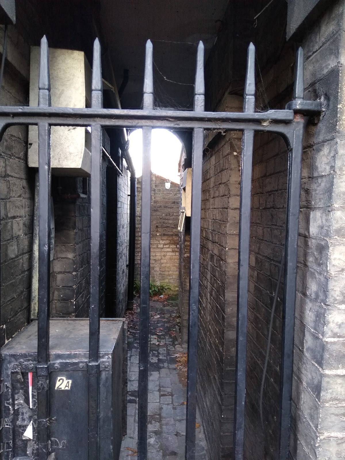
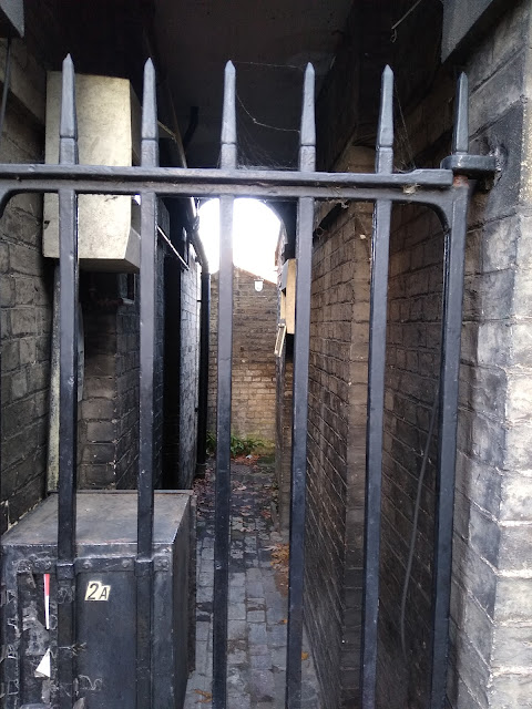
Victorian/Georgian facades continue for the remainder of Park Street only broken by the entrance to Parkside Community College, Melbourn Place and Clarendon Street. Most of the buildings seem to house offices of Solicitors or similar enterprises these days but mostly resemble buildings at least once used as houses. Along the very final stretch and into Emmanuel Road, the brick of the buildings is particularly stained as to be almost black, most likely because of 20th century bus pollution rather than having to do with being a century old. There is no view into the windows behind the dusty net curtains and things are nearly as obscure in shady doorways or down the dark side passages blocked by locked iron gates. These places are always apparently devoid of people and appear frozen in another time. In a sense they are, since they are on the edge of the conservation area which protects most of what occupies the space that somehow managed to avoid demolition in the 1980s and has since been preserved by the forces of gentrification.
Onto Emmanuel Road, No 1 is named, as shown on a relatively new looking plaque, 'Hamied House'. This is Christ's College student student accommodation. There is also a 'Hamied Hall' a bit further up and Hamied Lodge somewhere else in the near vicinity. All named after the chemist Dr Yusuf Hamied, an alumni and patron of Christ's College
The Unitarian Church building next door has been 'the home of liberal religion since 1904'. It's notice board promotes the living wage and gives details for the samaritans. The building is humble but magnificent. Gigs are occasionally held in the church. About a year ago here I enjoyed seeing Justin Hopper doing a reading from The Old Weird Albion, with temperamental backing from a laptop and projector. I was also glad to get to see the inside of the building, which was dark brown wood panelled and resembled a more austere version of a Sam Smiths Pub, providing the same feeling of escaping into a dark brown refuge of still somewhere-slightly-elswhereness, except with an alter (doubling as a stage) instead of a bar. Robyn Hitchcock made one of his irregular returns to Cambridge a few weeks later to play the venue.

The other side of Victoria Street, the next stretch of buildings were occupied variously by yet more serviced apartments, The King Slocombe School of Dance and the previously mentioned Hamied Hall. These facts are only advertised by discrete plaques, unnoticed by the casual passer by. I wondered who King Slocombe was. It turns out it was two people; Betty (King) and Edna (Slocombe), who founded the school in 1940. Located underneath the plaque are also two small plastic door bells, one black and one white as if they represented the yin and yan of Betty and Edna.
Only just beyond is a large white abandoned looking building, windows boarded up with Forestry Commission approved panels. In it's back yard, low level feral greenery had colonised much of the floor. Around the bottom of the house and the flat roofed outbuildings at the back what looked from a distance like a hybrid or dock leaves and unruly spinach was growing around the base of the house. It was frothing out from inside interspersed with a few taller things that were starting to creep up the walls. I had a brief foray into the space, surprised at finding a mini- edgelands scene at this location. I can;y say I'd ever noticed the house before which made it feel like it had only recently been imposed there. Apparently it was recently a dental practise, which may have explained the still pristine whiteness of the building, albeit now peppered with light brown 'cavities'. No doubt the liminal stage the building is at will be short lived and something to be savoured before the almost certain arrival of yet more serviced accommodation.

Next door is a posh interior designers called Angel and Blume. I don't know about the interior as I've never been in but I thought the exterior of the building looked pretty good. It could easily be mistaken to be still operating as a pub, albeit a more 21 century craft ale emporium on a Hoxton street corner than it's final pub incarnation as a Lacons house in 1971. It was known as The Golden Rose and a large ostentatious replica of said flower is bolted to the gold panel above the door. Somehow I'd never noticed this before. In alchemy, the Golden Rose apparently symbolised perfection, completion of a project and invocation of cosmic energy and past masters. The building was certainly built as a pub and also one of an age to have been built in the first period of Kite development. Buildings (particularly pubs) like this could only be produced by past masters. New buildings, pubs in particular (when rarely built) are usually sterile and temporary feeling. The Rose symbol (now noticed) seemed to be a reminder of what was possible. Past masters could, also I suppose, refer to passed piss artists whose ghosts are no doubt locked behind the purple ornate doors, ready to be invoked should the site ever be returned to it's original and correct use.

A few seconds later having crossed Elm Street, I joined the horde of shoppers heading towards the Grafton along the path that bifurcates New Square. Now a pleasant green space, pre-Grafton New Square was concreted over and used as a car park with a pedestrian footbridge going across.
I blended in with the crowd and pretended that my pilgrimage was the same as theirs, a journey towards retail 'therepy'. When feelings of boredom and frustration soon came over me it was obvious I had pretended too well. On reaching the Eden chapel the other side of New Square, I came to, and with relief remembered I was not here to shop. The Chapel is another institution shifted by the development. The original was swallowed into the Grafton Centre. The facade is still there but now barely recognisable in its most recent incarnation as Gail's Bakery. On incorporation it originally housed 'The Trolly Stop' which later became 'Footlights'. This was nothing to do with the University comedy revue but a Mexican restaurant-come-cocktail bar.

I walked along the opposite side of the pedestrianised road, underneath the Christmas banner indicating I was now entering the 'The Grafton Quarter'. The sanitising practise of re-branding areas of cities as 'quarters' is something that's I've only noticed in Cambridge fairly recently. Indeed, the Grafton Quarter was the only one I could think of when I saw the banner. I had no idea where or if the other three quarters existed. It felt like the banner marked the latest attempt in the erosion of the spirit of place of the old Kite.
I passed the block of shops that houses Argos and Little Waitrose The plaque attached to the corner of the building at Eden Street Backway indicates the block was built in 1957 by Jesus College and named after it's master and benefactor, John Repton. I recalled my last attempt to visit the excellent Bengal Indian Restaurant which was located at the other end of the original building on the same site, only to find the whole block had been demolished. There's no mention of this on the plaque and although it's obvious by looking that the current building is dated from the 2000's, I felt like this was yet another deliberate move to cover up the pre-Grafton environment.
I carried on towards the mouth of The Grafton Centre, past the former Laurie and Maconnels building, now occupied by a Wilco. The original facade is maintained, and sticks out in stark contrast to the surrounding buildings and pedestrianised Fitzroy Street which are all very much post-Kite in feel, if not necessarily in age.
As I approached 'The Grafton' I could see the front entrance now entirely made of glass. The structure resembled a rhomboid giant greenhouse. Inside I could make out what looked like fluorescent tube lights in various colours hanging from the ceiling at different angles like light sabres from Star Wars. The purpose of these was never revealed.
As I entered I crossed the threshold from Fitzroy Street, into what used to be a continuation of Fitzroy Street before the Grafton Centre was built over it. The route of the main thoroughfare within the Grafton follows the same route. In a similar manner of a road built over a lost river, the thoroughfare had been built over a lost road, but attempted to replicate it in a virtual reality sort of way. The name 'Fitzroy' is mostly associated with 'Fitzrovia' in London, the area named after the Fitzroy Tavern and associated with boozy bohemian types from the past. Fitzrovia was up until the end of the 19th Century an estate of the Dukes of Grafton, ancestors of the first Duke of Grafton, Henry Fitzroy. Fitzroy meaning 'bastard', Henry was an illegitimate son of Charles II and presumably the Tavern was named after him. The third Duke of Grafton, Augustus, was an English Prime Minister in the 1700s. He had studied at Cambridge and later became the Chancellor of the University, at the same time as being Prime Minister. Fitzroy Street and Grafton Street (a surviving street in the Kite), and ultimatlely the Grafton Centre were all named after him. Thus a connection between the Grafton and Fitzrovia, though somewhat tenuous, exists

Donning headphones to protect myself from piped music and any tannoy announcements, I entered and merged with the hordes. I soon was forced to adopt the pace of 'the retail shuffle'; the act of walking at much reduced but varied speed with occasional sudden stops accompanied by vacant staring, either ahead, into shop units or at a mobile device. It was easy to see where George Romeo got his inspiration for Dawn of The Dead. Just inside an electronic blueprint mapped out which shops and other facilities occupied each 'unit'. I wondered at the energy efficiency of an electronic map as opposed to a printed one. Then recalled that the high rate of change of unit occupier probably made the e-version the better choice in this respect. I observed the 'light sabres' overhead and considered that they would probably make more sense after dark.

I can't say I noticed what was new upon first entrance, only what had disappeared over the years. The Reject Shop had long gone. So was the electronic sign that used to have a scrolling message in red text: 'Welcome to the Grafton Centre...' , displayed in a similar manner to Cefax where you had to stand and wait if you wanted the whole of the message, normally having arrived at the equivalent of page 3 out of 6. More recently the side arcade (not really an arcade but I can't think of the correct nomenclature) called Eden Hall had closed to be redeveloped. This, along with Footlights, occupied the aforementioned Eden Chapel and had a small number of independent outlets which, along with the adjacent toilets, were in my mind had always been the most useful bit of the Grafton Centre. The entrance to Eden Hall had been blocked off and as far as I could tell was still in the process of 'being reconfigured to attract new leisure and retail operators'. I'm glad the architects Corpstorphine Wright also differentiate between retail and leisure. But what the end result will be remains to be seen. I had heard some time ago the names Pizza Hut and McDonalds being banded around but hopefully that's just a rumour. It would be nice to think a bit more imagination might be employed.
A sign a bit further up was advertising 'Food Social'. This referred to an area I had yet to reach where various food outlets ply their wears. The names were not familiar to me: Chi, Burger Priest, Duck Truck. The post hipster sounding names tuned out to be located in the area around the cinema that used to contain Burger King and similar establishments but now contained post-hipster food trucks. It's easy to be cynical about these things, but encouragingly it seems evening events with music will be held with local beer available, so this did sound like a marked improvement.
Something called 'The Campus' was occupying a shop unit further along. Looking in from across the way I couldn't work out what this was. Post walk, I discovered it is a 'community hub' where you can 'work, study and relax'. There's a book exchange and what look like comfy seats and places to charge electronic devices. It hadn't occurred to me that the Grafton would feature something like this and I assumed it was some sort of language school. Another surprisingly positive sounding development.
Opposite was what I took to be the managers/staff office. The modern equivalent of where the security pronouncements used to emanate. I saw no security men today and heard no announcements. This initially felt like a good thing, but then I realised that they have been made redundant by silent CCTV and other robotic means of monitoring which you can neither see or hear so can't run away from.

Past the lifts, no longer Great Glass elevators but inconspicuous steel doors in a grey wall, I passed the Ping Pong Parlour, another unit not being used for retail but apparently where people could play table tennis for free. Whether this and The Campus are temporary arrangements, just to fill units which the owners are having trouble letting, or whether a permanent feature remains to be seen. But I started to feel a bit more optimistic that maybe the changes afoot in the Grafton were for the better. Dwelling on this was short lived, since the inevitable urge to pee had been creeping up for some time and was now feeling more urgent.Since I hadn't been able to avail myself of the old Eden Hall facilities and not realising there were some new ones through a doorway I'd already past without seeing, I headed to those located upstairs next to the 'food social'. Expectations of relief were short lived as I found an attendant pulling a canvas barrier across the entrance. Apparently there was no water so the loos had to be closed. This could have been more of a disaster but the distance to alternative facilities would have been too much for some. I didn't know they existed and shuffled off, having to use mind over matter to suppress the urge which faded after a while.
I had a wander round the 'food social' area, which took my mid off things. Above/in front of the old BHS I observed the view. The feature that my eyes were drawn to the most was the roof, a glass apex which again resembled a giant greenhouse. The amount of natural light was welcome and I developed the urge to be the other side of the glass. The 'insideness' of the Grafton was becoming oppressive despite this obvious attempt to alleviate it by the architects.

The urge to escape lead me up the stairs and onto the roof of the East car park, where I also hoped I might find a discrete corner to pee. Emerging through the door into the outside, I was immediately transferred into a different landscape. Barely anyone had parked on the top floor and in contrast to the inside it was devoid of people. Views of the City on all sides were incredible, in an ordinary sense. I located various landmarks, and saw others I couldn't recognise. The place was familiar but seen through a lens of unfamiliar perspective it took some time to get my bearings, and even then they were not total. Christ's Church was the nearest landmark. From this angle, it looked like a mini-Kings College Chapel. The spotless white car in the foreground was from this perspective about the same size as the church. The juxtaposition of something earthy from the old Kite (the Church)
and the new sterile car, which would probably be replaced by it's owner within three years on a PCP deal, was stark. The view beyond the Grafton was of roofs that mostly pre-dated it, reinforcing the feel of it as a fortress or castle.
I wandered around the deserted car park roof for a while. The low sun produced a sheen on the damp floor, making it resemble a grey ice rink. Various posts protruded up from the ground adding to the alien and liminal atmosphere. The sky was a vast panorama with bizarre and dramatic cloud formations. All was in stark contrast to what was below. Having emerged into this environment I felt like the character from THX1138 when he sees the outdoors and the sun rise for the first time, having escaped an underground existence in a sterile white environment.
A close encounter with a broadcasting and monitoring post reigned in my sense of freedom while increasing the feeling of liminality. Air vents, pipes and extractor fans dominated the flat expense a level below adding to the landscape of vertical periphery.

I wandered around in this environment apparently unnoticed (other than maybe on CCTV) for some time. I could I suppose have been mistaken for someone coming or going from their car. I felt anonymous even though I ought to have been fairly conspicuous since I had no conventional purpose to be here. After about 10 minutes I looked down towards the back of Burleigh Street. The former Boat Race can be seen to the far left, obscuring WT's and the smoking huddle outside. In the centre are the tradesman's entrances to various shops that face out onto the street. One of these, second or third along, used to belong to a double glazing firm called 'Allied Windows' where I had two stints in the mid 1990s cold calling people who mostly did not want double glazing and were less than pleased to hear from me. My task was to convince them they were interested in hearing about our 'special offers' and have a greasy salesman turn up later in the week to convince them further. Judging my the lack of take up of such a poor quality offer, this must have been at the fag end of the double glazing cold calling 'boom'. In earlier years people were probably more easily convinced that reps were 'in their area' and that a bargain was to be had. Once word got round that they were going to get two or three hours of hard sell and the 'special offers' were nothing of the sort, people were rightly more sceptical. The job was mind numbing, monotonously ringing people from a ripped out page of a two year old phone book. But I suppose helped me develop a thick skin being on the receiving end of a certain amount of well deserved verbal abuse. You could smoke (and on Fridays drink) on the job which boosted morale slightly. Most staff were students like me who only lasted a matter of weeks or months. The only other workers were two women in their 50s or 60s who seemed to be long term employees. They were still there when I returned to do a my second stint nearly a year after the first. They smoked the most out of anyone, which was not surprising.

I left the car park by a different exit, no quite sure where I would eventually emerge and resigned to not finding somewhere it was safe to pee. I made my was down the stairs, soon to be confronted by a door where there was no thororougfare and 'no entry to the store'. The store in question was Debenhams. This didn't help navigation much, since Debenhams was the largest and most complex 'store' with the most entry/exit points.
Not fancying the invitation to 'push bar to open' on what was presumably an emergency exit I carried on down the stairwell to be faced by another door which was 'sonic alarmed'. I continued my decent, not encountering a single other person.
With some relief, I eventually came out of a door into daylight, albeit into some sort of side exit which didn't look like one the public was supposed to use. I found myself in a sort of dark enclave where I could see the outside world waiting through an open metal gate in front of me. Behind was a brown wooden door, presumably locked, with a letterbox shaped aperture about two thirds of the way up and one of those plastic butchers curtains hanging at the side. Not unlike something from a scene in the Texas Chainsaw Massacre, this sight hastened my departure.

I was glad to be back 'on the outside' and wandered along East Road onto which I had been ejected from the back end of The Grafton. I headed via Burleigh Street into the surviving area of Victorian Streets where the garden of Eden once stood until reached the Elm Tree pub. Here, after finally relieving myself, I sat for a while with a half pint for a short period on contemplation. From this location, in one of a trio of three pubs located at the confluence of Prospect Row and Eden Street, I felt closer to the genius loci of the old Kite. I recalled the recent memory of the window display of the corner shop over the road, now a hairdressers. This had been made up of several stacks of Andrex toilet paper which never seemed to alter and could well have been there since before the days of colour television. The three pubs felt like guardians protecting the remaining Victorian Kite from further development. But the main reason they are still here is that they are protected by being part of a conservation area and one which has been gentrified, tow things that usually go together. Both seem to have protected this part of the Kite from the demolition and development. It seemed paradoxical, if unsurprising, that the part of the Kite that has survived, at least in it's Victorian physical form, is not one that continued to provide an area lived and worked in by any working class 'town' people. At the same time it is the part that was lost to the Grafton Centre that attracts these people back to an area that in a former age they might have feasibly have been able to live and work in. Now they are mostly sucked in from peripheral areas, often remote and some distance away, to shop or go to work. Whether the latest 'renovations' to The Grafton are an attempt to appeal more to a local middle class crowd and will result in another push out to the periphery for the 'town' remains to be seen. I resolved not to leave my next visit so long, hopefully before it eventually (as it surely will) becomes largely serviced accommodation.