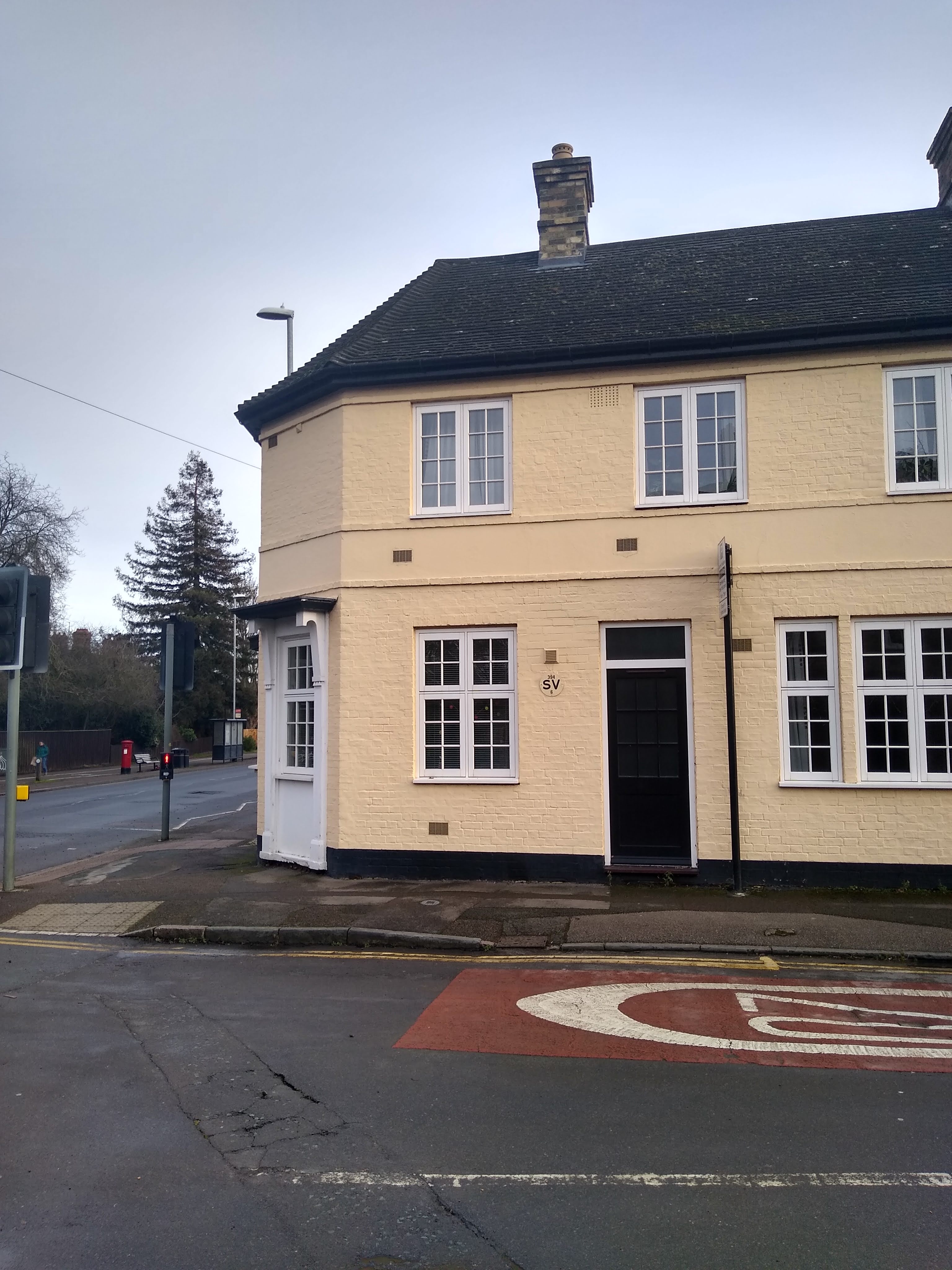
I arrived at the crossroads coming from the direction of town. The village of Fulbourn lie straight ahead beyond the Big Tesco's and the old Victorian asylum. To the right was Queen Edith's Way, a reference to Edith Swan-neck, the hand fast wife of Harold II and landowner of the Manor of Hinton prior to the battle of Hastings. To the left, Cherry Hinton High Street, leading into the village I grew up in. I say village, it was was technically a suburb by then. But although it was being gradually engulfed into Cambridge it still felt a bit cut off. A little bit 'out of town'.

I took the left turn, fancying a wander along the high street. The Cherry Hinton sign marking the entrance to the 'village' dates from 1991, an attempt to reclaim a village-like feel at a time when 'Chinton' (as it is affectionately know by many) was expanding. The 'village' had been incorporated as part of Cambridge in the 1950s for administrative purposes, but managed to maintain the feel of somewhere a bit out on a limb and 'other' after officially becoming part of the City. The sign, which has a heraldic four panelled shield depicting things symbolic of Chinton, backed by a cherry tree, marks the crossing point into 'the village'. To my eyes it resembled a sort of masked foliate head with a Mrs Thatcher hairdo. This seemed fitting of a place that I associated with the 1970s era of children's television programmes more often than not hosted by folk-singing hippie types like Derek Griffith's and Toni Arthur, but also with the subsequent era of Two Tone music, unemployment and Thatcher selling off council houses. A retrospective marriage of the strange and the stark.

On the corner near the sign, the grass slopes down to The Giant's Grave. This is probably called after the folkloric giants Gog and Magog who also give their name to the chalk hills just beyond Cherry Hinton. An alternative explanation is the unusually tall skeletons unearthed from an Iron Age burial site on nearby Lime Kiln Hill.
At The Giant's Grave a spring rises where the chalk hills of Gog Magog end. The spring flows into a sort of large oval pond with an island in the middle, before flowing left and becoming the Cherry Hinton Brook. I followed the path around the pond, recalling that there was a bench the other side to sit on, hidden by the trees from the street above. A good spot to rest and take in the slightly 'other' atmosphere that exists here, particularly when devoid of other people. But the bench had been removed and the chance of respite denied. It was too damp to sit on the grass.

A fence running along the far side marks the boundary with a private partially overgrown green space, which I always assumed was an under-used garden belonging to a large house behind it. Clearly someone, or something, had decided that it was an affront that this piece of land was not available for use by the people of the Manor of Hinton and breached the fence, using some considerable force. Maybe the giants had risen from the grave in anger. Or maybe it was the work of giant reanimated skeletons, click-clacking their way through the ripped fence in pursuit of their prey. Like a scene from Jason and The Argonauts passing through the normally still environment. Though the blue plastic protective 'fingers' added to the spikes suggested more human and health and safety conscious intruders.
An alternative name given to the area around the spring is Robin Hood's Dip. In folklore, Robin Hood is the name given to a sprite associated with wells and springs. One explanation of this name is that it was used to frighten away children, to keep them away from the possibility of drowning. It's also been suggested that the figures of Robin Hood and the Giant are really part of the same folk memory of an earlier deity revered at the spring.
Springs and holy wells are by some considered magical places. There is certainly something a bit off-kilter about the Giants Grave. Possibly explained by the layers of folk memory associated with it, or my own vague memories of it as a child (I was never frightened away by the sprite when I brought my home made action man boat here to play with). Or maybe simply by the fact that such a space continues to be allowed to exist and is in stark contrast to the 'village' beyond it. If you can ignore the modern connotations of the traffic noise from overhead it feels like a place moving through time much slower that it's surroundings, where layers of history are thinner and the ancient origins of 'Chinton' are revealed.
At the point the brook heads away, starting it's journey towards The River Cam via The Snakey Path and Coldham's Common, a hideous and imposing modern block of flats has made an appearance. Between it and the brook there are some unusual stone/concrete or possibly wooden hemispheres resembling giant fungi. The purpose of these remains unclear an no doubt will be even less so to future visitors to the spring, who may assign some magical significance to them or might just observe how the objects would make cutting the grass that bit more awkward.
Across the road from the Giant's Grave is the Robin Hood Pub, which used to be The Robin Hood and Little John. Locals aways just called it the Robin Hood so Little John, sensing he was not needed, presumably left the scene formally at some point. The pub is named thus I'm guessing because of Robin Hood's Dip, but the pub's iconography has always referred to the Sherwood Forest dwelling archer Robin Hood rather than the water sprite version.
On the side of the pub is a semi-hexagonal protrusion which used to be the pub lounge. I remember it being more glass fronted when I was growing up offering views of the people drinking inside, sat in a semi-circle around the edges. The glass has been replaced by a faux farrow and ball dull grey, which on a grey day gives a slightly sinister and depressing feel.

The current pub sign, which is an imposing edifice fronting the car park, shows Robin of Sherwood with his bow. It also has the ubiquitous Greene King motif, being under the control of East Anglia's dominant regional brewer and pub company. The Greene King iconography was found in all social clubs I was taken too as a child on beer mats, bottle tops and the metal trays used to transport a round from bar to table. At the time I didn't really know who or what the Greene King was, and thought of it/him as some sort of mythical medieval figure. The iconography has changed from something vaguely bizarre to a more corporate pub-model-number-nine style these days. Associated more with property capitalism and the ubiquitous Greene King IPA ('ditch' as one of my friends calls it) than with the strange East Anglian figure of the Greene King, who appeared on metal ashtrays and lurked in the back of my imagination as child.

In the car park is an ancient looking stone with what looks like the impression of a large footprint sunk into it's centre. I've read various explanations for its origin or purpose: a glacial erratic, a Celtic 'kingship' stone used for the equivalent of crowning a king or for a good luck ritual by Roman soldiers before and after a long march. I've also read that water collecting in such stones has been thought to have healing properties. In modern Cherry Hinton, however, the current use of the stone is as a handy comestible for used fag ends, a couple of which drifted sluggishly around in the shallow water with the odd leaf as I stood and observed the stone for a couple of minutes. Presumably this rendered any healing properties the water might have had null and void.

Away from the crossroads, the village's intersection with the landscape of the Gog Magog hills and the folk memories contained within it are soon forgotten. Probably a minutes walk from the Giant's Grave I was confronted by a giant billboard advertising nothing other than a wirery white brick void. The building accommodating this used to be a Co-op, where my Dad was the manager. This was during the era of my action man boat. There was a post office inside, which is still there, the shop bit now an Asian grocers. The white void billboard served as a sort of portal into the village proper. A less official but more authentic welcome to the current Cherry Hinton than the village sign passed earlier.

Just beyond this is one of the more welcome developments of recent times. The former Unicorn pub, which closed several years back, has been through various guises since. Now it's an Indian restaurant with a lunchtime buffet. Even so, it's a pity and somewhat baffling that, once extracted from the hands of Greene King, the Unicorn wasn't reborn as an excellent free house, given the lack of decent pubs in the 'village'.

Next door, separated by a small road linking the High Street and Mill End Road, is the second and final still functioning pub in Cherry Hinton. The Red Lion is another Greene King establishment, completing their monopoly of the village hostelries. The current pub sign depicts a sort of red haired Aslan. This overlooks a row of four mini red lion statues crouching over the flower beds in a manner suggesting they are straining in order to enrich the soil. These mini red lions reminded me of the Red Lion Statue, formerly of Lion Yard, now encased in perspex at the University Rugby club. It's as if his offspring have escaped to the fringes of the city, away from the University and the gentrification found more towards the centre of town.
Cherry Hinton certainly feels like it has so far escaped any significant trappings of gentrifcation, despite the growth of the village towards Fulbourn in the last 25 years and it's edge of Cambridge location. Maybe the newer residents are less inclined towards craft beer, artisan bread and coffee shops than those moving into other parts of town. Or maybe the newer Chinton estates are lived in in the manner of dormitory towns, the residents never setting foot in the high street to avail themselves of its amenities.
That might help account for the decrease in the number of pubs at the same time as a population increase, while the level of other services in the high street has not grown to accommodate the new influx and in many respects less is on offer than it was quarter of a century ago. Apart from less pubs, there is no longer a butchers, greengrocers or cobblers. But there are now two Chinese takeaways, two Indian restaurants and 2 charity shops which were things previously lacking. Swings and roundabouts I suppose.


I speculated on this as I gazed into the large back garden of the Red Lion. The pub seems at least to have started having live music and in recent years has hosted events by local mod collective 'The Alley Club', the name of an original mod club in Cambridge in the '60s. Mods are something I first encountered in Cherry Hinton. During the mod revival of the early 80s, kids in parkas were often seen hanging around the chip shop on the high street or at the legendary British Legion Hall disco. Older ones had scooters. I was never a mod, and while now I can see the appeal, at the time I remember being a bit put out when my mates seemed to switch from Two-Tone to Mod. I stopped going to the British Legion disco, and instead, started listening to punk after renting 'The Great Rock and Roll Swindle' from Roger's Hardware, which housed Chinton's premier and only video library at the time.
In the Red Lion garden, like a ghost from my pre-teen 'youth', was a board depicting Two-Tone iconography. The black and white 'rude boy' with the shades, suit, loafers and hands in his pocket. The Red Lion seems to have become the locus of what remains of mod/two tone energy in the 'village, at least when sporadic events take place put on by people who are very likely veterans of the British Legion disco era Cherry Hinton 'scene'.
Not long after this walk I noticed The Specials are due to play in Cambridge soon. Possibly a more mellow prospect than when they played in a tent on Midsummer Common in Cambridge in 1980 amid skinhead violence. The singer, Terry Hall, apparently tried to calm the crowd down by telling them they 'looked stupid standing about in a tent'. It didn't work and he was arrested for his efforts. This became the stuff of legend for the heberts frequenting the British Legion disco and too young to go to 'proper' gigs in town.

Across the High Street is Cherry Hinton Rec, something of a focal point of the 'village'. Although it was empty when I arrived. 'Recs' seem to be relics of a past where a communal green space was automatically factored into the development of a place. Nothing fancy, just a big green square or oblong with one or two paths and maybe some swings, a slide and a roundabout. Possibly some goalposts and a pavilion. Cherry Hinton Rec still has all these things and is pretty much the same as it was in the era of Peter Powell kites and balsa wood gliders.
Of course, dog shit has always been a problem on recs which inevitably are places shared between children and dog walkers. Special bins to put it in and the practice of dog owners carrying plastic bags to collect it are relatively recent inventions. When I used to go to the Rec there were no such facilities and people didn't think picking up their dog's shit was something they should do. The odd unpleasant incident was almost accepted as inevitable if you were a playing child in the 70s and 80s. At the same time, there were frightening posters about rabies being displayed in the doctors waiting room, featuring fearsome dobermans frothing at the mouth like Zoltan, Hound of Dracula. The notice on the bin I encountered on the Rec seemed to encapsulate a similar level of dog based paranoia and fear. It featured a public information poster showing a slightly demented looking child with a flea ridden looking dog sat behind an array of sinister looking veterinary products. The headline 'When did you last worm your dog?' implying some sort of terrible epidemic could be just around the corner as a result of non-compliance. The green lichen, if indeed that's what it was, giving the impression it may already be too late.

I didn't let this put me off having a walk round the Rec, which was pleasantly dog shit free. I followed the path that circumnavigates it, past The Tom Smith Memorial Pavilion, home of Cherry Hinton FC and the Cherry Hinton Lions football teams.
Just beyond the renewed pavilion, the revamped children's play area and a BMX/skateboarding facility that is a relatively recent addition, the green opens out. I walked the path around the edge of the 'field' and as it veered left I noticed the sound of playing children. This got louder as the path drew parallel to Colville School. The children appeared to be wearing costumes, the bright colours exaggerated by the dull grey sky. It was as if they were performing some sort of Avant-Garde linear play as they filed chaotically along the side of the school building. Shortly after witnessing the spectacle, I heard the teacher's whistle blow, an attempt to gather the heard and restore order.
After passing by the small wood at the back of the Rec and then the rear entrance/exit passage that connects the Rec to a post-war housing estate, I came to a corner with a bench. I considered stopping for a sit down but the arrival of a couple of dog walkers made me feel a bit self conscious about doing so. I suddenly felt less 'invisible'. I had no dog. I wasn't a jogger or someone taking their kids out to play. I wasn't carrying out some form of work. I had no visible reason to be there and was conscious that this might mark me as someone to be regarded as suspicious, or at best eccentric. 'I just fancied a walk around the Rec' or 'I'm carrying out a psychogeographical excursion of Chinton' would, I doubt, be convincing explanations to anyone that questioned my presence.
When to dog walkers had past I had a look the other side of the fence. Housing had replaced what used to be a caravan site/mobile home park. When I was a kid, we regarded the caravan site as a bit of a mystery. I knew no one who lived there and wasn't sure if it was for permanent residence or if it was some sort of holiday camp. The favoured speculation of its use was as a nudist camp, but try as we might, we never saw any evidence of Health and Efficiency types living the other side of the fence. It always seemed to be deserted.
I continued on my way and looked across the green back in the direction of the school. There was no evidence of the children I'd seen there earlier and all was silent. The school from this distance reminded me of the old Ipswich Airport terminal building is seen on my recent excursion to the Suffolk Town. In turn, the old terminal building had reminded me of a school, possibly as a result of recollections of Colville School as seen from the Rec years ago.

I headed towards the exit and back onto the High Street. Just before I reached the gate I stopped to look at the noticeboard advertising community events. The annual Cherry Hinton festival, a one day annual event which takes place on the Rec, had been and gone in September. But the notice was still there to tell me what I'd missed. This year the theme had been 'Time Travellers'. I suppose I was indulging in a form of time travel myself by lurking around the 'village' I grew up in. But like a rubbish Dr Who, I had arrived about two months too late for the key event. On offer at the festival had been a 'journey through space' in a planetarium and the chance to 'experience weightlessness (like an astronaut) in the gyroscope'. A much more cosmic offering than the early Cherry Hinton festivals I remembered where some of the highlights were throwing sponges at scouts in the stocks and BMX displays. There was also a parade where various floats made up on the back of lorries by various organisations drifted down the high street and onto the Rec before the main event. One of these organisations was the keep fit class my mum belonged to, who also gave a demonstration in the 'arena' on the Rec. I didn't rate them as much as the BMXers. Sorry mum...
The sponsors of the festival this year other than the council, were local car/aerospace firm Marshall, the IT company ARM who's main Cambridge office is the building on nearby Fulbourn Road that used to belong to 1980s computer firm Acorn, and construction company Anderson. The latter are currently 'consulting' with residents about the possibility of a new 'country park' on old cement works/rubbish dump land that links Cherry Hinton with the City. More of that later.
The final item on the agenda for the festival was to 'Go Prehistoric' and meet the dinosaurs'. A similar opportunity seemed to be regularly available at the 'Ol' Boys Club' as advertised by an adjacent poster confirming meetings of this organisation are held Village Leisure Centre every Monday afternoon from 2-4. Activities, designed 'by the men for themselves' include cards and board games as well as slightly more physical pursuits, including walking football. I've never been much of a footballer but a walking version sounded like something even I might be able to cope with. I noticed to qualify as an 'Ol Boy' you have to be fifty, which doesn't seem that 'Ol' to me and an age I'm only a very few years off. I have no connections to any Old Boys clubs that might happen in the University, Rotary Club or Freemasons but I reckon my connections to Chinton might get me in as an 'Ol Boy' when the time comes if I fancy a game of walking football and a chin wag with some fellow ageing Chintonites.
Having left the Rec I passed a house that used to be the cobblers. Once supplier of the 'blakeys' used to make the loafers worn by the mods of Chinton more hard wearing and audiable. I can't remember it closing but now it's a residential bungalow. Next door to this is Chequers Close, named after the pub that once stood here. The pub building I remember was the 'second' Chequers built in the 50s. It was two storey building but in my memory it had a sort of 'flat roofed pub' quality about it. The facade at the front featured a chequered pattern in the concrete. The photo
here pre-dates me but it's pretty much how I remember it looking. It closed before I was old enough to frequent pubs, but before it did went through a period as a sports pub and then a jungle theme pub. I can't find anything on the Internet about either of these incarnations or the reason for the pub closing. I have a vague memory that it had a bit of a bad reputation. But this might just be from recollection of one evening when, from the back of my parents car, I witnessed a large mob of teenagers outside the pub involved in some sort of fracas as we drove past. I think the jungle theme pub was short lived and may have contributed to it's downfall. Maybe the pub was an early casualty of the 'run it down and sell it for housing' mentality of many pub companies.
A little further along is a thatched cottage, which I always assumed dates from a time when Cherry Hinton was truly a village. It stands out on the high street as an artifact from an earlier period (of which I know virtually nothing). It was one of two greengrocers when I was growing up but is now residential. Round the back of it is a light industrial area where a plastics engineering firm is quietly located, .

Next to the cottage is the starkly contrasting building containing the Cherry Hinton Library and the flats above it. Several libraries in Cambridgeshire have closed or been threatened with closure so it was good to the the facility still operational in its 50s/60s-ish building. The flats above were always something of a mystery to me. A passage leads from the high street underneath the flats and round the back into Coville road. This was as close as I got to knowing anything about the rest of the layout of the building or anyone who lived in it. I never knew anyone who lived in the flats and never heard much about them. Just prior to my walk, a man living in one of the flats had been arrested after a protracted siege involving a large police presence. Details as reported in the Cambridge News were up to their usually vague standards with a repetitive commentary that could easily have been condensed into one paragraph. Details were scant and no conclusion about the reasons for the event were revealed other than the man was arrested and was being taken to hospital to be checked out. The residents none the wiser as to why they could not access their flats or why armed police and the dog section were out in force other than the police saying it was a 'domestic incident'. Whether their was more to it and the police couldn't or wouldn't say, or whether the vagueness is down to the shoddy reporting of the Cambridge News, it's impossible to tell.
Oddly, I never closely associated the library underneath with the flats. They were largely invisible when I used to frequent it when growing up. The library was the only place in the village where any culture, in the form of books and music, could be discovered and for free (well, apart from the nominal charge on borrowing cassette tapes). When I got too old for the children's section, I usually honed in on the Science Fiction and Horror sections. Pan books of horror and novels by people like James Herbert and Michael Moorcock kept me going back for more. Along with the New English Library books I 'borrowed' from my Dad this provided, in retrospect, what many would probably regard as an unhealthy literary diet for a young man. The library also housed several books about film and music, as well as the aforementioned cassette tapes where things that seemed quite 'out there' from the viewpoint of a pre-teen in Chinton could be found among the usual dross. The Batcave compilation and the Anti-Nowhere League were two of the things I found there not long after my 'defection' from Two Tone to punk.

Across Colville Road from the library is a 50s brown building housing shops on the ground floor and flats above. The bakery, now under the name Dorrington's, is still in there. This always used to feature a large poster in the window for a film showing at one of the cinemas in town. It was also the place to sign up to join the cubs. I signed up to join when I was of the right age (about 8 I think) but changed my mind when I found out you had to swear allegiance to God and the Queen. I didn't feel I could commit to that and I didn't want to wear the uniform. There was no sign of cinema or cubs in Dorrington's which had since been modernised but not poncified. Old school cakes like Viennese whirls were still available at reasonable prices and the coffee was good.
At the other end of the row of the block used to be 'Stops-Shops' newsagent, now a hairdressers. I can't recall how long ago it shut, but presumably the demand for sweets, fags and newspapers could no longer sustain two newsagents. In the end Pledge's, over the road, crushed the competition and is still there, albeit smaller and under a different name. As far as I'm aware it's former name was nothing to do with the furniture polish spray that was popular around the same time.
The entrance to the flats in the 'Dorrington's' building was marked by the first graffiti tag I'd noticed thus far. 'Poxy' was one I hadn't seen in town and I assumed must be local to Chinton. 'Nigel' had been conspicuous in its absence.
On the corner of the building is a cycle repair shop. Prior to an 'interegnum' during which the shop housed a butcher, it was also a bike shop. John Hart's used to supply cow horn and chopper handlebars to local herberts who used them to customise secondhand bikes picked up through the classifieds in the back of the Town Crier or Cambridge Evening News. Groups of pre-teen kids cycled around the village on these contraptions like a cross between a low grade de-motorised motorcycle gang and a more raucous version of 'Red Hand Gang'. The world of cycling has changed. Now it's all hipster fixed wheelers, commuter Bromptons, crap mountain bikes and sit-up-and-begs. The latter depicted on the shop notice.
I didn't see any examples of these on my walk, only a couple of abandoned Mobikes and Ofo Bikes which stood out as symbols of a sort of failed vision of cycling utopia. A digital age Green Bike Scheme rife for the same sort of abuse. The Green Bike scheme that was tried in Cambridge in the 1990s lasted about two days before most of the bikes disappeared. Indeed, I never saw any attached to the dropping off point installed outside Dorrington's at the time. The Yellow and Orange Ofo and Mo bikes have endured longer. Maybe the GPS tracking and mobile apps used and the money collected makes them more viable. The green bikes had no security at all and were free. Despite new technology and improved security, their successors are being stolen or vandalised on a seemingly grand scale, but maybe that's factored into the business model. The Green bikes which were supposed to provide free transport to the people of Cambridge and work to homeless people fixing up and repairing them were a noble idea from the analogue age but one doomed to failure. The new yellow and orange incarnations superficially share a similar vision, but are the product of a digital and business driven age. The main differences are that they are not free (unless you steal one) and they have digital technology which presumably facilitates data harvesting. I'm glad I've got my own wholly analogue, non-hipster old man's basket bike.

Across the road is a Tesco. In a previous life it was a Budgens. My first job involved sweeping up and emptying bins there after school. I don't recall any sieges or much in the way drama of during my tenure. Indeed, the management seemed somewhat unkeen and inept when it came to catching shoplifters. When my Dad started at the Co-op, the manager at Budgens called to warn him about local character Cowboy Joe, who they had been trying to catch for sometime without success when he came in the shop and stole booze. At the time of the call, my Dad had Cowboy Joe waiting in his office for the police to arrive, having just nabbed him leaving the shop with a bottle under his coat. The Budgens manager was somewhat put out. Cowboy Joe, so called for his 'western' looking appearance and because he carried a large Bowie knife around (you could buy them out of the back of Grattan's catalogue at the time), lived across the road from us in a flat with his girlfriend. Following being nicked due to my Dad's intervention, by way of apology he knocked on our door and gave my dad a tin of Colt 45, an American drink which I think was a Special Brew equivalent for English people who imagined they lived in Texas. It remained in the cupboard undrunk for years before being chucked out.

The other side of the passage that runs alongside Tesco's to Desmond Avenue is The Cherry House, which does Chinese food and fish and chips. This has been there for years now, but when it first opened it seemed like considerable progress. Previously it had been Geoff's Place or possibly Plaice, I can't remember. I do remember it as one of the worst chip shops in Cambridge, with the possible exception of the one run by Geoff's dad on East Road (long demolished to make way for Anglia Ruskin student accommodation). Geoff's Place was a magnet for the local youth who liked to hang about outside, showing off their 50cc mopeds and trying to look hard. As a long haired youth I would often get abuse from these people when I rode past on my bike. I wasn't the only one. A big bloke, a friend's dad, who lived near us and who was not impartial to a few or more in The Red Lion, ended up in the Cambridge Evening News after confronting the chip shop crowd. He'd received some verbal from them, probably on his way home from the 'Lion, so came back with a baseball bat to put the wind up them. He explained to the 'News, 'There were a lot of them and I'm not as young as I used to be'.

I've already forgotten what is immediately next to Cherry House where the aforementioned Rogers Hardware used to be. Rogers Hardware sold the sort of things you'd expect a hardware shop to have and later expanded into Rogers Hardware 2 a few doors along. When he added the video library that was the main draw and probably funded the second shop. Apart from The Great Rock n Roll Swindle' and large horror and martial arts sections, I was always drawn to the dodgy Italian dubbed Mad Max and Conan rip off films. He stocked plenty of these. Via the wonders of Youtube and daily motion , many of them are available again. It's no longer necessary to carry home a video cassette in an over sized box to put into a top loading Ferguson Video Star. 'Classics' like Ator The Fighting Eagle or Exterminators of the year 3000 are available almost instantly via a smart phone app, allowing nostalgic guilty pleasure to the middle aged. One of the things the Internet does best.
A few doors along, near to where Rogers Hardware 2 used to be, a charity shop was having a Black Friday sale. This reminded me to check out Black Friday death count later. This facility provides an admittedly morbid tally of deaths and injuries reported each year as a result of the ridiculous frenzy people get themselves into to obtain 'bargain' electrical goods. Most of the events described take place in the US where the 'tradition' of Black Friday comes from. It's somehow connected to Thanksgiving, which itself is a harvest festival but with days off work and a big dinner. In the UK, harvest festival is much more limited. It only happens in Schools and Churches and involves people contributing vegetables or tinned food for the harvest festival display followed by a few hymns. What the connection is between harvest festivals and mindlessly queueing for hours before getting into a fight over a big telly is difficult to say. Luckily in the UK, Black Friday violence seems to have wained after the first time it appeared here a few years back when ludicrous scenes of rugby scrum style shopping took place and a few people were hospitalised. There was certainly no pushing and shoving today at the charity shop, which had about two customers when I went in. I didn't find any 'bargains'.

At the end of the row of shops is Love Lane, a footpath leading towards Mill End Road. It used to be considerably more overgrown and narrow with a dirt path rather than a proper surfaced one. Given the name, I always assumed it was a place where couples disappeared for a bit of 'privacy'. But since the path had been opened out and made much more visible from the high street, this no longer seemed much of an option.

I walked along the path to Mill End Road, and back up Desmond Avenue and through the passage between Tesco's and The Cherry House. At the back of Tesco's the upper floor windows had been boarded up. Of the four, three were dirty grey, the fourth painted dirty white with the warning 'Danger! apparently hastily scrawled on it. It looked like the upper floor might have recently suffered a fire, but I don't recall anyone mentioning it and can find no trace of one being reported. The shop, like the library, was subject to a siege just over a year ago. This one involved police with riot shields and a lone fifteen year old robber who staged a hold up. I haven't been able to ascertain the reason for the dilapidated state of the upper floor.

Past the front of Tesco's is a set back parade of shops known as Rectory Terrace. The name, I think, comes from Rectory Manor which was one of four manors in Cherry Hinton and presumably the land here used to be part of it but my less than intensive research so far has been unable to confirm this. The shops unsurprisingly have changed over the years. But a relic from my childhood, the hairdresser's 'Trim Sett' still looked open on the day of my walk. The only other survivor apart from the bookies is Martin's newsagent which is a truncated reincarnation of Pledges, with half the unit lost to a Domino's pizza. The area in front of the shops had been given a makeover at some point. This seems to have had the effect of enhancing the sort of '60s council estate feel that was already there, albeit with attempts at exotic long grass shrubbery in-between the new but old looking pebble dash effect beige concrete. It's as if the area has been sent back in time to 1960s Harlow via Southend sea front and returned as a miniature amalgamation of both places giving it a sort of Soviet Essex feel.

Just beyond the shops I saw a notice advertising an event by The Friends of Cherry Hinton Hall. The 'Hall is a park just beyond Giants Grave which was once part of Hinton Manor before the enclosures. It's home to Cambridge Folk Festival and the grand Victorian house that was once the nursery I attended and is now some sort of international private school. The notice promised an evening with Cambridge City Council Officer Anthony French and the chance to raise 'questions and concerns'. I've not heard of any plans affecting The 'Hall as part of the Cambridge Local Plan or anything else, so hopefully any concerns are minor.
Across the road, on the corner of Fishers Lane which leads to the road containing the house I grew up in. On the corner , next to the Baptist Church is a white end of terrace house. There's nothing particularly remarkable about it to look at, not these days anyway. But in the past, according to memory, a large metal or ceramic black widow spider was placed about halfway up the front wall. I recall vividly the Spider and the witchy connotations it gave the house, the inhabitants of which I never caught a glimpse of. I'm ninety-nine percent sure the spider existed, but have no way of verifying this. The Internet is silent.


I crossed the railway line which bifurcates Cherry Hinton at pretty much the same point where the boundary between Mill End (the area I'd just passed through) and Church End used to be before they joined to form Cherry Hinton many moons ago. The area around Church End was apparently at one time a sort of marshy quagmire where occasionally Cambridge university students got lost when they ventured what must have seemed a long way from Reality Checkpoint.
Just past the railway crossing is The Green Hut, a Chinton institution now seemingly derelict and unused. This is next to Cherry Hinton Infants school and at one time occupied land belonging to an earlier version on the school. It served as the parish hall between 1902 to 1985 and during that time was used by scouts and playgroups as well as for wedding receptions and other functions. The parish hall was relocated to a purpose built attachment to St Andrew's Church in 1985, and a purpose built village centre was opened in 1989 near the library, by Princess Diana apparently but I have no recollection of the spectacle. I don't recall ever entering The Green Hut, which may help explain why such a superficially mundane structure should seem so bizarre but not why it seems so significant. It's no doubt unnoticed by many passers by or taken for granted. But it seems to quietly emanate a sort of static hum as if it were a depository of memory. It has an intangible importance, only accentuated by it's fall into dilapidation. I've not been able to find out what plans lie in store for it but if it disappears a key locus of the 'village' will be lost.

A closer look revealed what looked like a miniature doorway. Next to this the mysterious 'M' symbol, which notably features on the iron footbridge on Coldhams Common as spotted on a previous walk. A link between two Cambridge artifacts established, or an existing one subtly noted, by the tag. Maybe there are others in the series. I'll keep my eye out.
I took a diversion down the side of the Green Hut, along the footpath that leads to a 1970s vintage council estate and which used to form part of my walk to school. The Cherry Hinton Community Junior School is the other side of the estate, on the way to Fulbourn. The estate itself was fascinating to me, its layout of random passages, car parks and small green spaces between flats and houses seemed labyrinthine. It was a larger version of the small estate we lived on the other side of the railway, the houses and flats the same design but with more opportunity to explore and get lost.

I didn't go deep into the estate on this occasion, but skirted round the back of the school field and past a children's playground which used to feature a climbing frame shaped like a helicopter and a small hill with a concrete 'ramp' going up the side of a slide, the latter providing a popular and slightly dangerous facility for BMXers. These had long been replaced by more health and safety conscious facilities.
Past the playground I carried on into Tenby Close, drawn by a sudden memory of a windowless old house that had always appeared unoccupied, at least where it backed into the Close. As kids we tried patiently to make a gap in the wall by scraping away the mortar between the bricks. We gave up long before this endeavour showed any sign of us ever being able to access the house. The mystery of what (or who) dwelt inside was never solved. Unsurprisingly, the house now is very much occupied and has windows where before there the mysterious blank wall had captured our imaginations. A planning document online refers to the building as 'The Barn, Tenby Close'. The proposal was to turn it into two dwellings, modest two bedroom affairs. I can't find any information about the previous life of 'The Barn', my Google search just returning a plethora of estate agents adverts. I imagine it was part of a farm, possibly connected with the vicarage whose grounds probably extended that far at one time. Like the Green Hut, The Barn feels like a significant locus of vague memory. Despite its conversion, it still stands out in its setting among the '70s council dwellings as something from another time.

Out onto Fulbourn Old Drift, I headed back into the high street. The old version house which I remembered as being just set back from the corner seemed to have been demolished and turned into a series of smaller houses. A planning application online seems to confirm this. It also says the old vicarage house dated from the 1960s or 70s. My memory is of something more 1860s or 70s. Either there was a typo in the application or more likely, my memory is as unreliable as it is vague.
I remember there being church fetes held in the vicarage garden but failed to notice what is there now. I was intent on getting to Langdale Close for a view of the Barn from the other side. Langdale Close is built on what was presumably once the farm containing The Barn. A small two storey block of flats from the 70s or 80s (at a guess), face the Barn which sits in the corner, across a green and partially obscured by a large hedge. The flats seem like a secluded brutalist estate. A place it is easy to forget exists, and like the library flats I never knew anyone who dwelt there.


I emerged from the hidden corner of Langdale Close and headed back towards the railway crossing. On my left I passes the unusual low rise Infants School building. A place I remember being inhabited by stern dinner ladies and teachers that were either also stern and old or young and of the hippy Playschool presenter type. The bizarre angular roofs of the building were jutting above the orangy/brown leaves of the dense copper beach hedge which hides the lower half of the building from the street. The rooves still radiated an atmosphere of Izal Medicated toilet paper, sun warmed pre-Thatcher era free school milk and giant papiermache Jabberwocky murals. I was temporarily mentally drawn back inside to a place and time where weekly country dancing and an annual May Queen and maypole dance celebrations took place, alongside more Christainy traditions like hymn singing and nativity plays. Neither made much sense to me at the time. Looking back I'm not sure if the school was being progressive in mixing these things, if the headmistress was a sort of Lord Summer Isle type begrudgingly going along with the nativity to keep her job or if the folk of Chinton demanded their ancient traditions be kept alive. It was all in keeping with the retrospectively strange 70s culture that permeated at the time, particularly in children's television and public information films. At the time it seemed normal and mundane.

Across the road is the site of the former Five Bells pub, demolished not long after an apparently drug related altercation in the car park resulted in a man's death back in 2009. The houses that replaced it date from 2012. This was the fifth and final pub along the High Street when coming from the direction of the Giants Grave. The building I remember was the modern 60s version, which had apparently replaced an original incarnation. St Andrew's Church at the far north of the village used to have five bells in its tower until a sixth was added in 1952. This may account for the pub's name, or may be a coincidence. There was until more recently another Five Bells in Cambridge located in Newmarket Road, in a similar type of building mode. As far as I know the pubs had no other connections other than name, the vintage of the buildings and that they have been demolished.
I continued back towards the railway line and turned off just before it into Railway Street, to head home via The Tins. The Church and other parts of the Northern bit of Chinton, I thought, could wait for another day and would justify a separate excursion.
Railway Street, as it's name suggests, runs alongside the railway and turns into a dirt road about halfway down where it runs behind people's back gardens. Before this there are a few houses and a Plymouth Brethren Hall which is inconspicuously set back from the road. The dirt road and allotment like back gardens used to (and still do) give the street an air of
somewhere more rural than the rest of Cherry Hinton. This perception was
enhanced undoubtedly when once I was given an egg by one of the
residents who kept chickens, a neighbour of one of my friends. Railway Street was the place three of us set of from my friends mum's house house to our first day at secondary school. Solidarity in the face of what might lie ahead after having listened to too much to rumour of heads flushed down the loo and too much watching of Grange Hill shaping our perceptions as to what 'big school' would be like.
I took the left turn before the back gardens, which leads past a few more houses and onto the beginnings of The Tins. The Tins is a path which leads out of Cherry Hinton, a sort of twin of the Snaky Path that runs the other side of the railway line. Both end up in roughly the same place but are different propositions. The Tins initially runs along the front of the terrace of houses which the back gardens belong to. I couldn't remember which of these house my friend lived in. I also never recall previously noticing the solitary old iron post, presumably a stink pipe from the Victorian era. Just further along on the other side is a 1930s vintage electricity building featuring the obligatory 'danger of death' yellow signs. I'd never noticed this before either. Now both objects stood out as things that belonged to The Tins and marked it's starting place.

I crossed Orchard Estate, a street, not an orchard or an estate although maybe it used to be, where the main section of the Tins begins. This section of the path runs along a housing estate on one side and an empty fenced off expanse on the other. The name the Tins comes from the corrugated iron fences that run along the path for much of this section. I recall it being more 'tinny' with a longer expanse of corrugated iron fence but the memory is vague. The path also used to be much narrower and not lit up at night. Adolescent drunk journeys back from town by foot or bike usually involved a foray along the Tins or The Snaky Path which were both equally dark and creepy short(er) cuts used to avoid taking the main roads. The tins at least did not have a brook to fall into, just rusty fences to fall into instead. It was rare to encounter a fellow traveller late at night along these routes but it was always a relief to come out the other end without incident.
Now the Tins has been widened at this section, has an added cycle lane and is lit up at night. There is still a significant amount of corrugated iron fencing, which starts where a newer housing state begins and the earlier one, which clusters around Wolsey Way and is obscured from the path by wooden fencing, ends. Wolsey Way seems to still be in the territory of Poxy, but this was the last observation I made of the tag, possibly marking a boundary of Cherry Hinton. I don't know if Wolsey Way officially does sit in Cherry Hinton. I've always felt it to be in a sort of peripheral zone off Coldhams Lane, across the road from the former site of The Rosemary Branch Pub. The pub had it's location near to a slaughter house (also now gone) and light industrial and office buildings one one side and the airfield on the other. The notion of a place like Cherry Hinton having 'Edgelands' might seem a bit fanciful, but this zone, including the Tins did and still does feel a lot like that. It's a zone marking the transition from Cherry Hinton to Cambridge proper and is a sort of 'neither' place in between.

This is, and has been for a while, a zone in transition. The vast expanse on the other side of the path is land that was previously occupied by
The Norman Cement Works and used as quarries, with the cement factory/works building being further along. The cement works closed in 1987 and it's iconic chimney was demolished a year later. Apparently crowds flocked to witness the spectacle. The part of the formerly quarried land opposite the rusty fence bearing the legend 'Dasisy' is covered in low rise edgeland 'vegatation'. This is the wrong periphery of Cherry Hinton for Robert Macfarlane, who is known more for excursions into the landscape of the Gog Magogs. But I was reminded of a talk he gave a little while back in which he described 'Bastard Countryside'. McFarlne had written a forward for a book of the same name by Robin Friend, a photographer who had been documenting the strange mix of beauty and ugliness to be found where urban meets rural. The phrase originates from Victor Hugo's 'Les Miserables', and appears a precursor to the recent fascination with 'edgelands', and to some extent Richard Mabey's 'Unofficial Countryside'. Macfarlane's talk expanded on these themes with reference to the area around the Gog Magogs. He mentioned that the area contained a popular dogging spot. This fact has been frequently and eagerly reported by the Cambridge News in recent times, and much earlier in a publication a boy at school liberated from his dad to show his fellow classmates entitled 'Love In The Open Air'. Macfarlane also mentioned the trend of plastic bags of dogshit tied to trees as the other significant horror of the local 'bastard countryside'. He labelled these objects 'Farages'. I'm unaware of The Tins being known for dogging, but a 'Farage' was blotting the view of an otherwise idyllic edglands scene of 'unofficial countryside'. A combination not as impressive perhaps as the tree growing through a pylon in Friend's book, but nonetheless an expression of the bastard countryside on the Chinton periphery.

The housing estate sitting behind the corrugated iron has replaced an old scrap yard. On the end corner, the location of the last house in the terrace was for years the site of a dilapidated double decker bus, the scrapyard's prime exhibit. The windowless upper deck used to loom above the fence where the first floor windows of the house now stare across the vegetated landscape opposite.
Not far from the former site of the bus was an abandoned bike, a child's version of a shopper bike reminiscent of something that would have been sold in John Hart's bike shop in the late 70s or early 80s. A portent from the recent past marking changing times on the Chinton periphery. The abandoned bike was still there a few weeks later when I cycled this way. The latest changes have yet to manifest.

As mentioned earlier, Cherry Hinton Festival sponsors Anderson Group, have for some time been floating the idea of creating a country park and other leisure facilities as part of the development of the area. This has been rumbling on for a while. An idea emerged a few years back to turn the two lakes on the site, created when two of the old quarries became disused, into a sort of seaside with a beach and boating activities. The area around the lakes, on the south side of The Tins, is known variously as East Cambridge Lakes, 'the Chalk Lakes', 'Romsey Lakes', or the maybe more prophetic (or wishful thinking by some) 'Romsey Beach'. Since the cement works closed and the lakes were created , access to the area has been restricted to members of a local angling club. But it has been used for several illegal raves over this period, the revellers making use of the swimming facilities provided by the lakes. These feature steep sides and I've heard below the surfaces lurks a plethora of rusting and jagged equipment left behind from the Norman works.
The whole area including the lakes, the former quarry/ landfill site the other side of the Tins and the Territorial Army site (formerly the Saxon cement works, which preceded the Norman works) is marked for development as part of the Local Plan. The area is deignated as an 'area of major change' and has been coldly re branded 'The Land South of Coldhams Lane'. Anderson own 60 percent of the land, other bits are owned by the council and Peterhouse College. Anderson are pushing the idea of the country park as some sort of trade off for planning permission to build houses on the parcels of land they own on the site. The idea being it can be paid for out of some of the money generated from the house sales. There have been a series of events run by consultants working for Anderson where local people could have their say. The blurb for the latest event suggested the views of residents were paramount in 'helping shape the vision' for the site. Whether the developers are genuine, or whether their efforts at community engagement are a facade masking a nonsultation and allowing a box to be ticked for planning application purposes will probably never be fully revealed. There is certainly some opposition by people concerned about the impact on the wildlife that has colonised the edgelands that emerged in the aftermath of the Norman Works. Others, inevitably, are worried about traffic and car parking. Then there are the anglers, like my Dad. It's clear Anderson were ever prepared to leave the land as it is. My Dad suggested this at one of the early 'consulation' events and it was clear they were not keen on the idea. The latest
community planning weekend took place over the same weekend I did this walk, but I was in the vicinity far too early for the afternoon start time. This consisted of two 'consultation' days to get views and ideas from the public on the Friday and Sunday, along with open access to the lakes on the Sunday. The following Tuesday an evening event was held to showcase the 'master plan' which would form the basis of Anderson's planning application for the area.
The official website has not been updated since the event and I've not
been able to find out from anywhere else what was reported back at the Tuesday session. But at this stage it would be surprising if the
development of the area does not begin soon along the lines shown on Anderson's
website, and at pace. Nearby across
the other side of Coldhams Lane, 'The Land North of Cherry Hinton' is
another area marked for change as part of the East Area Action Plan,
with housing, a school and new roads planned, incorporating part of
Marshall's airfield. Together these developments will potentially remove
any 'periphery' here between Cherry Hinton and Cambridge. For the time
being though, the land around the lakes remains fenced off with a
pelthora of signs of the 'Private, Keep Out' attached at various
intervals.

Around about the location of the former cement factory is a building called 'The Cambridgeshire' which houses the David Lloyd Gym and was the location for Anderson's community planning weekend. I'm not sure what else is in the building, which has a sort of Blakes 7 quality about it due to the strange semi-circular window and roof above the entrance. This is located in approximatly where a circular vat used for cement mixing once stood. There were always stories that someones dad had been killed having fallen into the vat and was mixed into the cement, the skeleton broken up and bones hidden beneath the surface of the long since dried out mixture.

Opposite the Cambridgeshire is a car park and some business units housing a cash and carry among other things. I don't know if the existing development of the Cambridgshire, Business Units and the Holiday Inn pre-date Anderson's ownership of the land, but they have only been here for a few years and still feel new to me. Next door to these on the North side of the Tins is another formerly quarry, the one used for landfill for several years after the Norman Works closed. I was tempted to go up the chalky desire path to get a better view (and possibly access) to the site but once again, my footwer of choice, Jason Roamers, made this an impossible endeavour. The path was wet and too slippery for anythhing other than proper walking boots.

Past the Holdday Inn, which sits just past the Cambridhsire building, the Tins narrows again before a sharp upward turn onto the railway bridge, an impressive piece of liminal architecture. The green painted metal was suplemented with graffiti, including a plea to 'paint the world'.
The fence designed to stop falling/jumping was adorned with a single padlock. Presumably a lovelock. There have been numerous examples of bridges covered in 'lovelocks' across the world, but the idea doen't seem to have caught on much in 'The Land South of Coldhams Lane'.
The view from the bridge of the railway line heading back to Cherry Hinton and beyond coupled with a bit of pointy grey fence is definately edgelands. Definately 'bastard countryside'. But unlikely by many people to be considered romantic, other than the liminally inclined.
Along the final stretch of The Tins, the frequency and variety of Private Property signs increased, particularly on the side with the fence separating the path from the Romsey Lakes/Beach.


Behind the fence on the other side of the path is an assault course on land occupied by the Territorial Army, which used to be the Saxon works. The other side of the assault course is another fishing lake and former quarry. Two warning signs stood side by side warning of the danger of deep water. Bifocal public information. I've never ever seen anyone use the assualt course and I'm not sure the TA even still use the site. Thoughts of the Krypton Factor and Gordon Burns always spring to mind when I pass here. I always thought it was a bit unfair that the contestents on the show deemed less fit and able to cope with the assault course got a head start, while in the mental agility round the least clever people never got any sort of concession. I last spotted Gordon Burns on 'Look North West' a few years ago when I was staying in a hotel in Manchester. His calm and friendly Krypton Factor host manner appeared to have been replaced by disinterest and slight anger as he introduced the admitedly mundane events going on in the Manchester Region that day . Maybe the cause of this change in personalitywas his 'demontion' into presenting regional television news. Or maybe resurgent guilt at the inequal treatment of countless past contestents who found the mental agility round to be their achillies heal.

The odd structures of the assault course coupled with the stillness and complete lack of human activity gave it an atmosphere reminicent of John Petwee era Dr Who or a place that might be discovered by people displaced following some sort of catasprohe in a 70s TV drama.
Back the other side of the path, the private keep out signs gave way to bits of streetart/graffitti. One featured a picture of a bloke who might have been Jack Nicholson, but could equally have been Del Boy, coupled with the the words 'Follow Your Dreams' in a script style indicating a level of sarcasm rather than optimism was being conveyed.
A little further along an electcity box had been arted up to feature a pained human face underneath the word 'Cruel'. Possibly a pop at the proposed development and it's effect on the wildlife currently inhabiting 'The Land South of Coldhams Lane'. The agonised face an anthromorphised concentration of the suffering to come.
At the end of The Tins the foot/cycle crosses a small bridge. The current bridge, which replaced the previous old rickerty and narrow wooden one, was constructed by Concrete and Timber Services Limited of Huddersfield. Memories of Huddersfield and the World Congress Psychogeography a couple of months earlier were still fresh(ish). The bridge, as well as being the physical crossing to Burnside and beyond to Mill Road and Romsey, also felt like a connection back to Huddersfield.
 |
| The Huddersfield Connection |
Burnside leads one way onto Mill Road along a short stretch of housing each side. The other direction follows the brook on one side with houses along the other leading up to the allotments and Snaky Path. The street always felt a little cut off from Mill Road and Romsey, and from Cherry Hinton. With the development of The Land South of Cherry Hinton, what's left of this atmosphere is unlikely to remain. I considered my walk done at the site of the black and white post next to the road sign. The Burnside Post. I drifted back towards Mill Road, leaving behind the transitional 'Land South of Coldhams Lane' and Chinton for now.