Smoke and Mirrors (aka Crab and Bee aka) describe the town of Royston in 'The Pattern' thus:
'Royston is a place from which the power has been removed.A hollow left behind when the roof was pulled. There are many signs of the hooded crow but no hooded crows'.
Re-reading that section of The Pattern prompted a long belated trip to the town of Royston and a visit to the Royston Cave.
The Cave and Royston generally have been lurking in the back of my mind for some time. I've never properly been to Royston, only briefly passed through it or visited the Royston Heath as a child, memories of which are vague and involve Peter Powell kites, balsa wood gliders and my grandad. The town is only about 15 minutes away from Cambridge by train. I wasn't really sure why I'd never been.
The first notable point after leaving the station and heading in the direction of the town centre along The Old North Road was the small museum. The exhibits that seemed most significant were a taxidermy hooded crow and the model of the Priory Cinema. In fact, I can't swear it was a model, it may have just been a photograph. The memory of most of the exhibits in the museum faded soon after leaving, so it's likely I've misremembered.
The cinema opened in the early 1930s and featured typical brown brick of the time but with unusual octagonal features in the design. It was demolished in 2002 to make way for housing, but seems to remain as nearly as important in the memory of the town as the hooded crow.
The hooded crow was once a common visitor to Hertfordshire and in particular Royston, to the extent that it is often referred to a the 'Royston Crow'. The name was also given to local cavalier supporters who brawled with visiting Roundheads in the Cromwellian era. It has for years also been the name given to the local paper.
Old North Road/Kneesworth Street or Ermine Street, met the crossroads with the Icknield Way soon after. Both the Cave and the Royce Stone sit at the conjunction of the two ancient routes. I spotted The Cave Shop, which sits adjacent to the Cave entrance. But since our visit to the cave was not due for a couple of hours, we continued over the crossroads. I had intended to stop and investigate the Royce Stone, but the presence of an ogre-like man standing next to it like a guard dissuaded me. He had an energy drink in one hand and a fag in the other, and was and using the depression on the stone as an ashtray. The stone is said to be the original base of Roisia's Cross, named after the Lady Roisia who may have erected the cross or repaired an already existing one, at a time when the town had yet to be established in the 10th century. The town, which subsequently grew up around the crossroads, is said to be named after her. Roisia's Town was later truncated to Royston, the stone became the Royce Stone.
During a brief and incoherent wander through the town, in which we took in in the Priory Gardens and some side alleys off the main shopping street, we encountered more a modern but no less curious and completely unexplained stonework. Then we headed to Therfield Heath.
Therfield Heath is the place I knew as Royston Heath as a child. Now it is a nature reserve , a Special Site of Scientific Interest on part of a large chalk escarpment. No kite flying was evident. To the West, the nature reserve gave way to a golf course featuring prehistoric long barrows. Further in the distance I could clearly see the Sandy Heath Transmitter, looming up from the neighbouring county of Bedfordshire. The Icknield Way was signposted, cutting across the Health and heading south to Baldock and Letchworth, north-west, out of the town and passing through the Greenwich Meridian before bypassing Cambridge, on to Newmarket and beyond. As I sat taking in the view, among a profusion of wild flowers and bees, something flew over me. A hooded crow. Or was it? Crab and Bee say there are none and the Kent Ornithological Society say that the last sighting in Royston was in 1985. The image is still clear in my mind, but may well have been a projection of my geographic imagination brought about by the earlier visit to the museum and the still present spectre of the crow throughout the town.
Our appointment at the Cave meant we didn't have too long to linger. On the way back through the town, we diverted through Angel Pavement, a 60s pedestrian shopping precinct which both stood out and blended in with the older buildings in the town centre to form an atmosphere typical of London commuter belt Hertfordshire towns, including neighbours like Letchworth or Hoddesdon. Royston seemed unusually quiet. It was Saturday, early afternoon but felt more akin to a Wednesday morning such was the lack of people. Coming from Cambridge,where town on Saturday is best avoided due to the overwhelming volume of tourists and shoppers, this was a minor revelation.
Angel Pavement featured a newly opened independent bookshop, the only one in Royston and something that is a rarity generally. We diverted in to have a look. They had what looked like an interesting topography section. But before I'd had a good look, I was distracted by a display of books in the centre of the shop being 'manned' by a posh sounding lady. The books were all by Jeffrey Archer and I realised that he had been invited to come and sign books to mark the opening of the shop. I remembered Archer coming to talk at an assembly at my school many years ago where he had made much of the virtues of honesty and hard work. I remember not being very convinced at the time. Subsequent events and revelations about Archer, which ended in his imprisonment for perjury, seemed to bear out my scepticism. We left the shop before he had a chance to arrive.
Archer was not from Royston, but is most usually associated with Grantchester, just on the edge of Cambridge, where he still lives with Mary Archer in the Old Vicarage. The TV programme Grantchester, set in a fictionalised version of the village sometime in the 1950s, has no connection to Archer, although central to the programme is criminal activity and a vicarage. The crimes in the TV series were usually murders, not perjury, lying or cheating. The day we arrived in Royston, Archer had chosen to come from Grantchester, the fictional vintage murder hotspot, to Royston, to open a bookshop.
Royston does have a more recent and much less sanitised, if less frequent, history of murder than the fictional 'Grantchester'. The non-fictional murder of Helen Bailey, a children's book author from Royston happened in 2016. Had she still been alive, she would have probably been a far more suitable candidate to open a bookshop in Royston. She was murdered by her fiance Ian Stewart, who hid her body and that of her dog in a septic tank at her house. It emerged the Stuart had in the past played bowls at the same club as my Dad. My Dad said he always thought there was something 'a bit odd' about him. Stewart was later also convicted of killing his previous wife back in 2010.
I was with these black thoughts and the image of the grinning face of Jeffrey Archer stubbornly refusing to shift from my minds eye, that we headed to the Cave. After a short wait loitering in the passage next door with others who had booked the tour, we were welcomed in by the guide. After a short decent we were in the chamber, which had been cut out of chalk and was festooned with carvings of unknown age and origin, as well as 17th century graffiti. The Cave was discovered in the 17th century when some works above accidently revealed the opening, but thought to date from at least the 1300's.
Several figures were depicted in the carvings. One was said to be by some St. Christopher, patron Saint of Travel,
probably the nearest thing the Christians can offer to a psychogeographic
figure. Others think the carving represents Hermes, The Greek God of travel and
messenger to the Gods. In modern times, that name is more associated with
disgruntled gig economy workers who throw parcels over fences to express
their distain at 21st Century labour market conditions.
Explanations and theories about who the figures in the carvings were supposed to be or what they represented are many and varied. The same is true of the cave itself. The guide explained that nothing had ever been proven, so people were free to believe in whichever theory they liked. There are various theories suggesting the cave may have been a prison, hermitage, hiding place for religious dissenters, site of pagan worship or possibly most popular, that it was connected to the Knights Templar. The guide clearly had met people with all sorts of theories and beliefs that visited, some more out-there than others. Midsummer day was only a few days before we visited, when the number of Earth Mystery types and dowsers visiting the caves increases. The Cave is thought to be at an intersection of the The Mary and Michael Ley Lines, which in turn are said to lead in different directions to nearby sites associated with the Templars, who some say were skilled at the art of dowsing.
Another feature of the cave was that it had apparently had a wooden platform on all sides, octagonal in shape. I was reminded of the octagonal features of the Priory Cinema and wondered if there was some sort of connection.
I can't say I felt anything unusual in the Cave, although it was without doubt an unusual and unique place. I did enjoy the much welcome cool air found underground, and the chamber provided a refuge from the heat we had escaped from outside. In a previous era it may have offered refuge from other uncomfortable or dangerous situations. But can't say I felt any weird energy or had any moments of revelation.
But when we emerged a man was standing in the alley outside. He had came out of the Cave before the tour had finished and looked a bit shaken. We enquired if he had felt claustrophobic. The chamber was fairly small, particularly when filled to capacity by hit people on the tour. He said no. He had though apparently felt some kind of bad energy present in The Cave, and had had to get out.
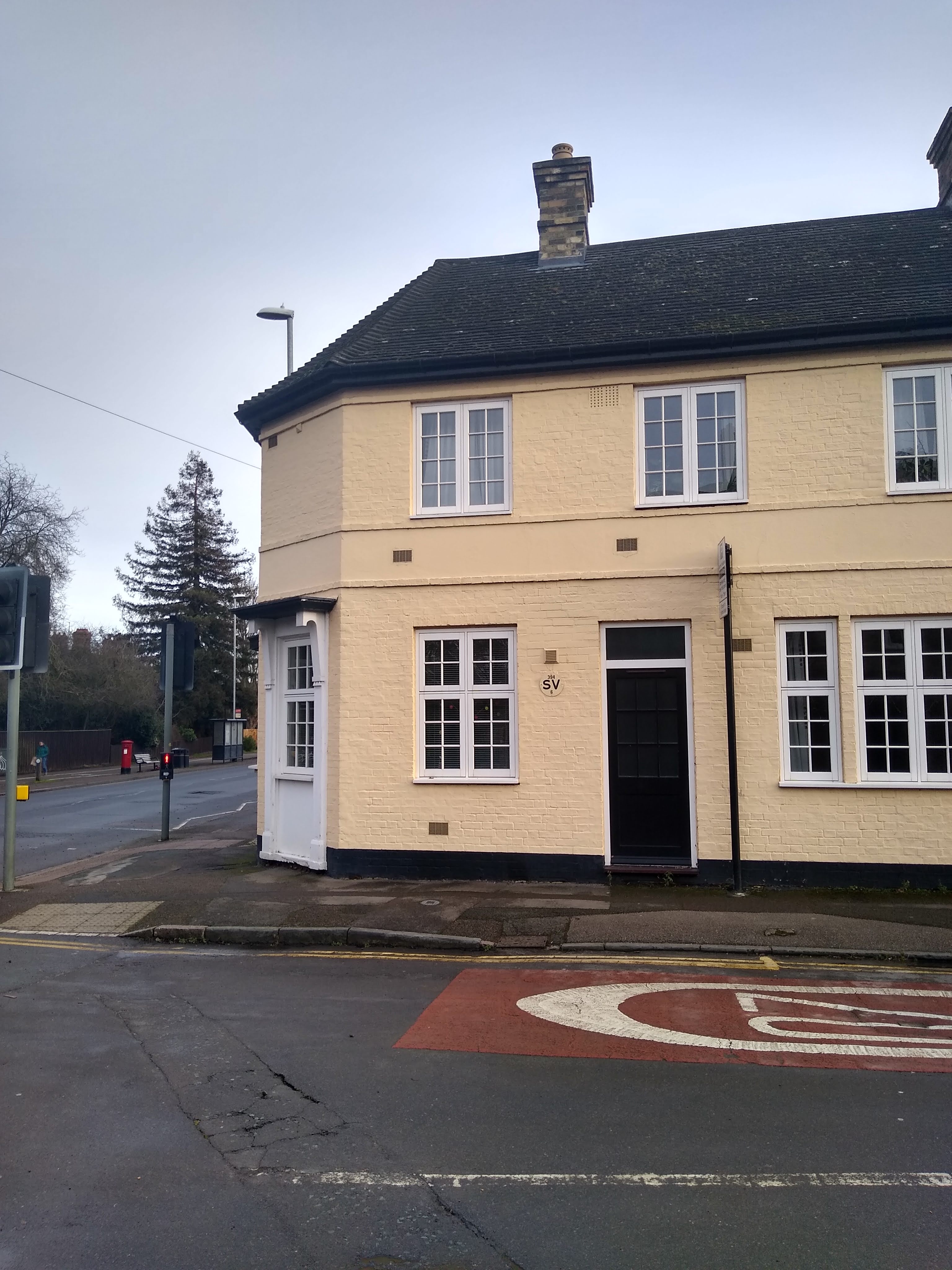
We had a brief look in the Royston Cave Shop next door. It was full of the sort of paraphernalia to be found in New Age type shops of the sort that I imagine proliferate in Glastonbury. I had a look at the books, some of which were concerned with the Cave and the Knights Templar. Others were not Royston centric, but included quite a bit of Erich Von Daniken inspired ancient aliens type volumes as well as the typical new age sort of stuff. After leaving the Cave Shop we crossed the road and passed above the original entrance to the cave, marked by a sort of manhole cover immediately outside of Bet Fred, where two punters had come out for a fag break.The contrast between the scenes above and below ground were stark. Back on the surface, the intrigue of the Cave was quickly replaced by the dull and ordinary scene of a betting shop exterior. The boundary between old and new Royston was a thin one, between the road surface and the chamber of the Cave
One thing I didn't see in the Cave Shop shop or hear anything about on the tour was the assertion that Royston sits at the heart of the 13th sign of the British Zodiac. I stumbled across a short paper explaining this on the internet after I got home. First I was stuck by the impressive green and purple cartographic image, which had at its centre High Cross, where Watling Street and Fosse Way intersect near Leicester. Royston is depicted directly South East, apparently at the heart of Ophiuchus, the constellation marking the 13th Sign. The sign apparently 'signifies a new cycle of time and initiation at a higher evolutionary level than before'. The paper manages to bring together the Round Table, King Arthur and the Grail, The Knights Templar, the aforementioned Michael and Mary Ley Lines and Roisia's Cross, with the Royston Cave at the centre of all this. It goes on to suggest that Royston was the place of origin for the Hot Cross bun custom and ties this back to St. George, The Red Cross (Roisias Cross) and the Cave as a place of rebirth.
I first assumed the paper had been deposited online as a prank and assumed it was something that had been written in the spirit of the London Psychogeographical Association, Luther Blissett or the Church of The Subgenius. But a further look at the Francis Bacon Research Institute website made me doubt my initial assumptions and it seemed to be an entirely serious organisation. I was though still sceptical about the hot cross buns and it turned out rightly so as they were invented by Brother Thomas Rocliffe in St Albans Abbey, at least according to other bits of the internet. St Albans is still in Hertfordshire and not that far away from Royston, so I guess they were not too far off the mark. Although St Alban's appears peripheral to the 13th sign of the zodiac at best.
Before we departed the crossroads, I noticed that there was now no ogre guarding the Royce Stone, so I went for closer look. It was set on a fairly recent looking stone platform, with an engraving encircling it that gave a brief explanation of the object. That it was situated in an otherwise unremarkable setting, a street science typical of any nearby Hertfordshire commuter town, enhanced the significance of the object. The stone, which if the stories of Roisia's Cross are true, predates the town and was a catalyst for its development around the crossroads at the intersection of ancient tracks, (possibly) the Ley Lines and to the West the Greenwich Meridian.
Adding a further layer of intrigue was the appearance of 'Nigel' on a bin next to the stone. The tag is (as far as I know) native to Cambridge. Nigel's appearance in Royston mirrored Archers and our own. A day away in the peripheral zone of Royston, an escape to a sort of non-place away where one could dissapear temporarily. It was clearer now why Smoke and Mirrors described the town as having had the power removed. The townscape surrounding the cave felt like a place that was less alive than it might once have been. A place where much passes through but little stays. I had read that the original Meridian Marker in the west of the town had been stolen in 2007 and had to be replaced. The nearby Meridian school closed down following conversion into an academy and subsequent merger with two other schools. The town appeared to be in a state of downsizing to the point of being somewhere mostly used just to pass through, as it was before it properly existed. I surmised that the departure of the Royston Crow in 1985 had probably heralded a reversion whereby the town became peripheral in every sense to the crossroads at its centre. The cross roads once again becoming became the only focal point, a place of passing through, channelling travellers in and out without encouraging them to stop. Ironically, the resulting subdued atmosphere of the town was something I had enjoyed, it had made a nice change. We had come with the purpose of not just passing through, which felt like a disruption of what the town really wanted us to do. Although we did not feel unwelcome, but not really welcome. Just left alone. A day in the town was like the equivalent of a lengthy sit on a park bench in the middle of a long walk. A welcome and peaceful respite from the horrors of the modern world in a place neither salubrious or horrific, but one semi-sonambulant. Somewhere in between things.
Footnote:
The Royston Cave website contains much information about the Cave and the various theories connected to it.
Lockdown three has brought back almost identical
restrictions to the first lockdown in March last year. The message on leaving
the house for exercise, similar to before, is to ‘stay local’. ‘Local’ is not
clearly defined in statute but in the guidance somewhere it talks about staying
within your town, village or the part of the City you live in. Any clarity this
might have provided was muddied when Boris Johnson was seen cycling seven miles
from Downing Street in the Olympic Park. It was not made clear if he actually
cycled there or if he was driven or if it mattered either way. Stratford and
Westminster are not usually considered the same part of London, but Boris was
deemed not to have broken any rules. Meanwhile, in the same week two women from
Ashby-De-La-Zouch were found to have breached the regulations and fined after driving
5 miles from where they lived, to go for a walk at a (possibly) local beauty
spot. They had brought coffee which they were told was not allowed because it
was classed as a ‘picnic’. I’m not sure if their crime was the driving to the beauty
spot, the coffee or because they were judged, League of Gentlemen style, as
‘not local’ to the location.
During the weeks leading up to and through Christmas I had
been feeling an increasing sense of lethargy and dis-interestedness, which was
magnified by the onset of Lockdown three. In a belated start to the New Year, I
decided that I needed a new method to get out and walk within the permitted
boundaries of ‘local’.
A rummage in the map draw and I ‘rediscovered’ a 1980
Ordinance Survey map of Cambridge, from the same series as the Ipswich Town Map that I used as the basis for a walk a while ago. The only other map
in the series as far as I know is of Southampton, a place definitely not local and I don’t (yet)
have the map anyway. The covers of all three maps in the series feature
‘posterised’ images of local landmarks on their front covers. The Cambridge one has a closeup angular view
of Kings College chapel, apparently from the perspective of somebody laying on
the grass outside and seeing the building through the prism of 1970s special
effects from Beat Club or Top of The Pops.
The scale of the map
is ideal for my purposes. Each grid square covers a large enough area to contain
sufficient things of interest but one small enough to be do-able easily in an
afternoon or morning. All are within reasonable walking or cycling distance
from where I live, at least at the weekend when work won’t get in the way. The plan
is to select a grid square using random number generators before setting out. A
more local but similar idea to the Barnett’s Map project that I started around
this time last year but was swiftly halted due to Covid, using the idea of a
‘catapult’ to randomly determine the vicinity of the walk.
Whilst Cambridge is technically a City, I reckon since it is
smaller than some towns, let alone any major city, anywhere within its boundary
can be considered local to me. The 1980s map will be used as a guide,
identifying points of interest that may or may not still exist within the grid
square boundary of the walk. New points of interest or possibly disinterest
that have appeared since the point in time of the map will certainly be
encountered given the level of development and change in the intervening years
in parts of the City. The walking, in order to qualify as permitted exercise
and not attract attention of the police or others, will have to involve minimal
stopping or prolonged loitering at any point of interest. How regular, in both timing and content
these walks turn out to be is not predetermined.
Preamble
The random number generator for the first walk selected map
square D4. This covers an area bifurcated by Barton Road, with part the suburb
of ‘Newnham Croft’ on the South side and part of the University dominated area
around Grange Road to the North. The whole area is within the council ward of
Newnham, the term also used for the immediate surrounding area in the local
vernacular.
The suburb of Newnham Croft is one of the most well-off
parts of a well-off but particularly un-equal city. I always think of it as Cambridge’s equivalent of
Hampstead or Highgate. As well as being well off, it is also a conservation
area. I wasn’t sure if the streets within my map square strictly as part of
Newnham Croft, being a bit cut off from the main residential area located in
the adjacent square, or if they were simply part of ‘Newnham’. Maybe this would
become apparent.
Amble
I began at the corner of Barton Road and Kings Road outside
a building that used to be the Hat and Feathers Pub until about 2010. It is not
easily recognisable as a former pub, having been completely striped of any
external paraphernalia hinting at its former life. I only recall visiting it
once, as a teenager, when a friend living around the corner on Selwyn Road had
a party. We were ordered to contribute to the swear box several times soon
after our arrival. Other than that, I remember very little about the pub.
Still, any pub lost to flats, even one with puritanical views on the use of
language, is to be mourned and I stood for a few seconds to pay my respects
Across the street, a laminated advert for a mattress sale
was attached to a telegraph pole. These are currently prolific throughout
Cambridge. They seem to have superseded a previous epidemic of similar notices
offering outdoor benches of the type normally found in pub gardens. Maybe these
items have become excess due to a downturn in sales of mattresses to hotels and
benches to pubs during Covid and there is cheap surplus stock to be had. I
imagined a dodgy bloke in a lock-up full of these items, waiting for his mobile
to ring after a morning stapling notices to posts around town, a low-level
disaster capitalist spawned by Corona Virus.
I turned into Selwyn Road, a street I was only vaguely
familiar with from the previously mentioned party and couple of other visits to
the same friend’s house around the same time. The street was devoid of people.
There seemed to be a clear divide between sides of the road, one made up of
modest sized terraced houses but ones which were in keeping with the general
ambience found in the main bit if Newnham Croft. The houses on other side of
the road by contrast, while not exactly resembling the one depicted in the ‘22
Shit Street’ ceramic ornament Viz used to sell, were much less in keeping with a
middle-class conservation area. It more resembled part of a decent post war
council estate. A taxi was parked in one drive, and on another house the front
door window was boarded up with plywood. The front gardens were lived in, not
twee. The contrast between both sides of the street was subtle, but marked and
an indicator of a more sensible era when council housing was widespread enough even
to appear in posher parts of town.
At the end of the street, I turned into Grantchester Road.
This, by no surprise, eventually takes you to the village of Grantchester,
famous for the poet Rupert Brooke and less impressively, Jeffrey Archer. Rupert
Brooke had a pub named after him in the village and is also
associated with the tea orchard which is a big tourist draw. Archer, by
contrast, is conspicuous in his absence in any tourist narrative the village
uses to attract visitors. I recalled him coming to my secondary school and giving
a talk where he extolled the virtue of hard work and competition. The reception
he got from the assembled was polite but lukewarm. Any visitors are much more
likely to associate the village with Brooke or Robson Green from the ITV drama series
‘Grantchester’ than Archer. Grantchester, the television program, is set in a
fictionalised version of the village during the 1950s and partially at least filmed
locally. The programme is a formula ITV drama and not of huge interest, other
than to spot the difference between real and non-real local references and
locations. The village was at least two map squares away from where I was at
this point, possibly off the map. It would almost certainly be full of lockdown
walkers and joggers, so I was glad I had not been randomly catapulted there
today.
I passed the Rugby Stadium, home of the Cambridge Rugby
Union Football Club and the University Rugby League club. This was a place I couldn’t ever
recall seeing before, although I have cycled this route at least once. That was
in the dark after a couple of pints at the Blue Ball in Grantchester, so maybe
I didn’t notice it. It is mostly field after all. The ground is called Volac Park due to a
sponsoring deal with Volac, a company based in Royston, Herts and who are
‘world leaders in dairy nutrition’ according to their website. Previously the
club was named after Wests Renault Garage a formerly well-established local
business across town on Newmarket Road, since gone to make way for the ‘Anglia
House’ student flats development.
On the other side of the road were a couple of University
College Sports Grounds. The one belonging to Pembroke College had an impressive brown flat roofed modernist building,
presumably the changing rooms and clubhouse. The land being private it was not
accessible and I could only view from a distance.
I took a left turned off Grantchester road into ‘The Baulk’
permissive byway, just in time to avoid the point where the narrow, unmarked and in places windy road
reached the national speed limit. The Baulk, by contrast, had a far more
agreeable 5mph limit, presumably for tractors and people using it to get to the
‘Cocks and Hens’ tennis club for which there was also a sign here. The name seemed
fitting for a location in a terrible 1970s ‘sex comedy, starring Robin Askwith
rather than the University imbued edgelands of the 21st century city. After I looked at the
map, it made more sense. Nearby, at least in 1980, were some Poultry Houses
located behind the rugby club. The Baulk, meanwhile, is a historic footpath
linking Grantchester and Barton, and also according to the sign, Coton and Maddingley.
A path I had previously unaware of until today.
The sign for the Baulk featured the logo for something called’
QTSQ Quarter to Six Quadrant’, which sounded like the name of a mysterious
University drinking club. On return google confirmed this referred to the area
of Cambridge bordered by a straight line from Maddingley Road South to Grantchester
and another from the same point running East to Coton, thus resembling the hands on a clock at a quarter to six. South Cambridgeshire District Council has designated this area a ‘Major
Green Infrastructure Target Area’.The name QTSQ has also been adopted by a local
association who have their own vision for the area and want to preserve it.
They and have managed to get South Cambridgeshire District council to consider this
vision as a material planning consideration. Their other activities include an
oil club (the domestic fuel type), as well as promoting walks and local pubs in
the area. This corner of the Cambridge edge is one hitherto largely untouched
by major development unlike most other parts. If any local area is likely to be
spared to sort of development seen elsewhere, it’s here. It will be interesting
to see how things pan out over the next few years in this area – or ‘Quadrant’.
The path took a 45 degree turn to follow the edge of the ‘Cocks
and Hens’ Tennis club, at a point marked by a second world war pillbox. Not something I had expected to find, but I suppose this was a sort of edgeland, albeit one without the usual connotations of abandoned industry and dilapidation. This was more the edgeland of Cambridge University.
The track within the private grounds of the tennis club was dry
and would have been easily walkable. The public track parallel to it, which ran
alongside a brook, made me rebuke myself for coming out in footwear only really
suitable for urban walking. I’d assumed I wouldn’t encounter the sort of muddy
paths I’d inadvertently found myself on the day before across the saturated
Stourbridge Common, but would be walking in an area where it was easy to stay
on the dry land of asphalt and concrete. I was wrong! The path in front of me was something
of a quagmire, but I managed to negotiate it in my unsuitable slip-on DM type
boots by sticking to the relatively grassy bit near the brook, managing not to
slip and fall in.
Safely on the other side, opposite the beer barrels stacked at
the back of the Rugby Stadium, I noticed a gate led to a model railway. This was on the 1980
map, but somewhere I had never known existed and I had wondered if it would
have disappeared. This is the home of the Cambridge Model Engineering Society
who open the railway for public visits once a month (usually). Through the gate I could see what
looked like a level crossing and a few other bits of railway paraphernalia but
had I not known it was there, I could easily have missed it due to the prolific
number of trees in the site. Further up another gate bore a notice confirming
Covid-19 had curtailed public visits, in front of a muddy path that led
somewhere but without the notice, again, there was no obvious sign of a model
railway, with the place easily resembling a farm with chicken sheds as shown on
the 1980 map.
As I approached the end of the section of path, with a small
but impressive allotment site on one side and Fulbrooke Road on the other, I
realised I hadn’t seen a single person along the Baulk. This place virgin
territory for me, which in a city you have lived all your life Is always produces
a mixture of mild euphoria and dreamlike unreality, particularly in places that
are devoid of other people and out of the way of things. I felt this most
keenly at the confluence of the path with Fulbrooke Road, The Allotments and
the entrance to Kings College and Selwyn College Sports Ground (private property).
Everything seemed to pause momentarily.
This was not just a metaphorical pause, though. I stopped to
consult the map and saw two points of interest, things I’d never previously
heard of or seen. ‘Stone Bridge’ was shown on the other side of the playing
field where what looked like a continuation of the path met Barton Road. Before
that, to the left of this path was what appeared to be a large lake, but which
was not named or marked otherwise. This was located on land between houses on
Fulbrooke Road and Barton Road. I considered going into the sports ground but
could see no apparent pathway following the brook as shown on the map. Besides,
the notice clearly stated the land was private, so regardless of the gate being
wide open, I decided going in was a bad idea, path or no path. I was attempting
to stick to the rules and didn’t want any unwanted attention from neighbours or
the police.
Instead, I diverted down Fulbrooke Road, where also marking
the confluence of paths was an impressive stinkpipe. This contributed to the sort
of unchanged and just off the edge of town but not quite village atmosphere of
the deserted street, which was very agreeable.
Back on Barton Road I headed towards the location of the
Stone Bridge, on the 1980 map. One of the unnecessarily large houses that line the road, and at this point back onto the lake, had a large arched stained-glass window, above which a
stone was engraved with ‘2000AD’. Maybe the part of the building above the
garage was devoted to some sort of dystopian comic book judgement based religion, that made
offerings to whatever dwelt in the lake to appease the deity.
It soon became apparent there was no access to the lake from any point on Barton Road either and I
gave up hope of seeing it. On return, from what I could gather, it is on
private land and indeed not accessible to the public. It is known as Bolton’s
Pit after George Bolton, who used to quarry bricks there in the 19th
century the quarry later becoming the lake. I did manage to view it via a video
on an estate agent’s website, as part of the sales pitch for ‘The Lake House’,
a new house on Barton Road with the lake at the end, or possibly in, its back
garden. Apologies for the ‘estate agency-ness of the video which I have included purely for illustrative and educational purposes.
Stone Bridge was marked on the map at the point of the sign marking the city limit. It occurred to me that what I thought
was a path on the map following the brook through the sports field was in fact
the line of the city boundary. I could see just beyond the sign a layby which
normally accommodates resting truckers and a burger van, but it was devoid of
either. I crossed the road to where a brook emerged. I couldn’t work out if
this was the same brook I had been walking along and if this had crossed under
the road, or if this was different one. The map was vague on this and looking at the
current OS map didn’t help either. There was no sign of a stone bridge either
side of the road. But the emerging brook was wider, fuller and flowing much
more rapidly here as it turned through a pronounced meander. From the map, I identified
this as part of the Bin Brook, a watercourse I had heard of and seen on maps
but which had otherwise remained off my radar previously.
A short distance along the brook I reached ‘Gough Way
Culvert’ which took the brook underground beneath the Gough Way Estate. Another
channel went off at right angles and later investigation revealed this as a
relief channel for the Bin Brook. I followed the course of the brook via a
passage into Gough Way Estate, which was another part of Cambridge I had no memory
of ever visiting or even being aware of. Most of the
houses were built between the mid-1960s and mid-1970s. Houses on the estate
suffered flooding in 1978 and again in 2001 and despite the culvert and relief
channel there are concerns that the area is still at risk from this happening
again. Today, this seemed more than possible.
I brief and uneventful walk among the typical suburban
60s/70s middle class houses soon led to another passage following the direction
of the brook. A notice said the footpath was private and would close at 4.30. I
can’t recall if there was a gate. Maybe this closure just happened on trust. I
decided to take the path since 4.30 was two hours away and despite the sign it didn’t
really look private.
I soon emerged at a small recreation ground surrounded by
houses on three sides. On the left side the Bin Brook had re-emerged and the footpath
followed its course. A handful of young people were on the rec and I soon
passed a trio of elderly(ish) women with small dogs, who said hello and didn’t appear
to regard me as suspicious. That, in my mind, validated my right to walk the
path. The path and brook separated the estate on one side and Corpus Christi
College Sports Ground on the other, the latter hidden behind trees but clear on
the 1980 map.
I noticed the path featured lights in the floor which are
sometimes found on cycle paths. The path seemed a bit narrow to accommodate cycling,
but a sign advising people to slow down in advance of a sharp blind bend suggested
the route was used to cycle into town. As I took the bend, I saw no cyclists.
My attention was momentarily diverted into the field which suddenly appeared on
the estate side of the path as the houses ran out. It looked at first glance
like a normal agricultural field but there were two people standing in the middle
having a chat among whatever was growing. They didn’t strike me as farmers and
I wondered if the field was connected with the West Cambridge site nearby which
is an amalgam of University linked science based institutions. Was
the field was used for conventional agriculture or some sort of experimentation?
Given the strangeness of the last year and the weird times we are living in, the second option felt like something
that now would probably be regarded as more normal and run of the mill than perhaps it ought to be . Of course,
they could have quietly been plotting to sell the land for housing, although
being in the Quarter to Six Quadrant this would have been a bit optimistic on their part.
I only encountered one other person along the remaining
section of the path. A jogger, who showed no sign of intending to deviate from a straight trajectory in the middle of the narrow path, presented an awkward social distancing challenge. I had to force myself into a hedge in order to try and move myself two metres away. While mildly irritating, the narrow path was never going to allow much leeway when meeting anybody coming the other way. I reflected that while not an ideal place to go for a run, anybody living 'local' who did not have access to the vast green spaces of the various University sports fields in the vicinity, had little choice but to make do with the limited space available in between them.
I emerged into Cranmere Road which I realised was out of the
map square. But there had been no other route given that much of the land this
side of Barton Road in square D4 was inaccessible University or College land. This
road led to Grange Road where I headed back into D4. Grange Road was at the
Eastern edge of the map square. Along it I passed a mixture of college and
University buildings, mostly residential. Nothing immediately struck me and the
lack of sideroads to explore and the beginning of aching legs indicated it was
time to depart square D4. I decided to turn back and exit the grid square to
the North where just beyond was the Cambridge University Rugby Union Club. I
briefly stood outside to look at and pay homage to the Red Lion statue, which was
unceremoniously half hidden behind a skip. After bidding farewell to the former Town Centre icon I walked home.